Loading AI tools
From Wikipedia, the free encyclopedia
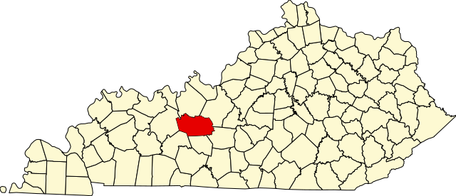
This is a list of the National Register of Historic Places listings in Grayson County, Kentucky.

This is intended to be a complete list of the properties and districts on the National Register of Historic Places in Grayson County, Kentucky, United States. The locations of National Register properties and districts for which the latitude and longitude coordinates are included below, may be seen in a map.[1]
There are 11 properties and districts listed on the National Register in the county.
This National Park Service list is complete through NPS recent listings posted November 8, 2024.[2]
| [3] | Name on the Register | Image | Date listed[4] | Location | City or town | Description |
|---|---|---|---|---|---|---|
| 1 | The Cedars |  |
May 17, 1976 (#76000889) |
East of Leitchfield on Kentucky Route 1214 37°28′28″N 86°15′26″W |
Leitchfield | |
| 2 | Court Square Historic District |  |
November 23, 1984 (#84000288) |
Court House Square between Walnut and Market Sts.; also 106 and 104 N. Main 37°28′48″N 86°17′38″W |
Leitchfield | Addresses on N. Main St. are a boundary increase |
| 3 | Crow Hollow Petroglyphs (15GY65) | September 8, 1989 (#89001188) |
Address Restricted |
Clarkson | ||
| 4 | Falls of Rough Historic District |  |
January 31, 1978 (#78001305) |
Kentucky Route 110 37°35′21″N 86°33′07″W |
Falls of Rough | Extends into Breckinridge County |
| 5 | Grayson Springs |  |
December 6, 1978 (#78001334) |
South of Clarkson 37°27′37″N 86°13′29″W |
Clarkson | |
| 6 | Hunter House |  |
May 16, 1985 (#85001055) |
118 W. Walnut St. 37°28′53″N 86°17′42″W |
Leitchfield | |
| 7 | St. Augustine Catholic Church |  |
April 7, 1989 (#89000259) |
Kentucky Route 88 37°27′02″N 86°13′57″W |
Grayson Springs | |
| 8 | Saltsman Branch Petroglyphs (15GY66) | September 8, 1989 (#89001189) |
Address Restricted |
Moutardier | ||
| 9 | Saltsman Branch Shelter Petroglyphs (15GY67) | September 8, 1989 (#89001190) |
Address Restricted |
Moutardier | ||
| 10 | Jack Thomas House |  |
April 21, 1976 (#76000890) |
108 E. Main St. 37°28′47″N 86°17′32″W |
Leitchfield | |
| 11 | Walnut Grove School | February 2, 1988 (#87002516) |
Walnut Grove Rd. 37°26′38″N 86°30′18″W |
Caneyville |
Seamless Wikipedia browsing. On steroids.
Every time you click a link to Wikipedia, Wiktionary or Wikiquote in your browser's search results, it will show the modern Wikiwand interface.
Wikiwand extension is a five stars, simple, with minimum permission required to keep your browsing private, safe and transparent.