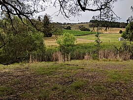
Nanima
Town in New South Wales, Australia From Wikipedia, the free encyclopedia
Nanima is a locality in the Yass Valley Council area, New South Wales, Australia.[2][3] It lies on both sides of the Murrumbateman Road between Murrumbateman and Gundaroo, about 37 km north of Canberra. At the 2021 census, it had a population of 252.[1]
| Nanima New South Wales | |||||||||||||||
|---|---|---|---|---|---|---|---|---|---|---|---|---|---|---|---|
 | |||||||||||||||
| Coordinates | 35°00′32″S 149°07′46″E | ||||||||||||||
| Population | 252 (2021 census)[1] | ||||||||||||||
| Postcode(s) | 2582 | ||||||||||||||
| Location |
| ||||||||||||||
| LGA(s) | Yass Valley Council | ||||||||||||||
| Region | Southern Tablelands | ||||||||||||||
| County | Murray | ||||||||||||||
| Parish | Toual, Bedulluck | ||||||||||||||
| State electorate(s) | Goulburn | ||||||||||||||
| Federal division(s) | Hume | ||||||||||||||
| |||||||||||||||
Nanima is also a civil parish of Murray County. It is located northwest of the current locality of Nanima in the Murrumbateman area, although there is also a Murrumbateman parish that lies further north.[4][5]
References
Wikiwand in your browser!
Seamless Wikipedia browsing. On steroids.
Every time you click a link to Wikipedia, Wiktionary or Wikiquote in your browser's search results, it will show the modern Wikiwand interface.
Wikiwand extension is a five stars, simple, with minimum permission required to keep your browsing private, safe and transparent.

