
Lichtenstein, Baden-Württemberg
German municipality / From Wikipedia, the free encyclopedia
Dear Wikiwand AI, let's keep it short by simply answering these key questions:
Can you list the top facts and stats about Lichtenstein (Württemberg)?
Summarize this article for a 10 year old
SHOW ALL QUESTIONS
For the country, see Liechtenstein.
Lichtenstein is a municipality in the Tübingen administrative region in Baden-Württemberg, Germany. It lies at the foot of the Swabian Jura (plateau).
Quick Facts Country, State ...
Lichtenstein | |
|---|---|
,_Albsteig,_Blick_auf_Lichtenstein_-_panoramio.jpg) Lichtenstein from the east | |
 Coat of arms | |
Location of Lichtenstein within Reutlingen district 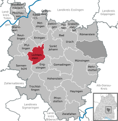 | |
 Lichtenstein  Lichtenstein | |
| Coordinates: 48°25′37″N 09°15′13″E | |
| Country | Germany |
| State | Baden-Württemberg |
| Admin. region | Tübingen |
| District | Reutlingen |
| Subdivisions | 4 Ortsteile |
| Area | |
| • Total | 34.24 km2 (13.22 sq mi) |
| Elevation | 507 m (1,663 ft) |
| Population (2022-12-31)[1] | |
| • Total | 9,312 |
| • Density | 270/km2 (700/sq mi) |
| Time zone | UTC+01:00 (CET) |
| • Summer (DST) | UTC+02:00 (CEST) |
| Postal codes | 72805 |
| Dialling codes | 07129 |
| Vehicle registration | RT |
| Website | www |
Close