Kingstown
Capital and chief port of Saint Vincent and the Grenadines From Wikipedia, the free encyclopedia
Kingstown /ˈkɪŋsˌtaʊn/ is the capital and largest city of Saint Vincent and the Grenadines. The city, located on the main island of Saint Vincent, has the main port and the biggest commercial center of the islands. With a population of 12,909 (2012),[3] Kingstown is the most populous settlement in the country. It is the island's agricultural industry centre and a port of entry for tourists. The city lies within the parish of Saint George in the south-west corner of Saint Vincent.[4]
Kingstown | |
|---|---|
|
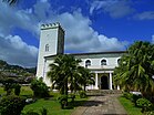
Top:Aerial view of Kingstown; Middle: Carnegie Old Public Library, Fort Charlotte; Bottom: St. George's Cathedral, Saint Vincent and the Grenadines Botanic Gardens | |
| Nickname: City Of Arches[1] | |
| Coordinates: 13°09′28″N 061°13′30″W[2] | |
| Country | Saint Vincent and the Grenadines |
| Island | Saint Vincent |
| Parish | Saint George |
| Founded | 1722 |
| Constituencies |
|
| Government | |
| • MPs | |
| Population (2012)[3] | |
• Total | 12,909 |
| Time zone | UTC-04:00 (AST) |
| Area code | 784 |
| Climate | Aw |
History

The modern capital, Kingstown, was founded by French settlers shortly after 1722, although Saint Vincent was under British rule for 196 years before its independence.[5]
The botanical garden, conceived in 1765, is one of the oldest in the Western hemisphere. William Bligh, made famous from the Mutiny on the Bounty, brought seed of the breadfruit tree here for planting, c. 1793.[6]
Geography
Summarize
Perspective
Topography
The town is surrounded by steep hills.[7]
Climate
| Climate data for Kingstown(temperature,precipitation,humidity 1991~2021/sunshine hours 1999~2019) | |||||||||||||
|---|---|---|---|---|---|---|---|---|---|---|---|---|---|
| Month | Jan | Feb | Mar | Apr | May | Jun | Jul | Aug | Sep | Oct | Nov | Dec | Year |
| Mean daily maximum °C (°F) | 25.7 (78.3) |
25.7 (78.3) |
26.1 (79.0) |
26.7 (80.1) |
27.3 (81.1) |
27.3 (81.1) |
27.2 (81.0) |
27.4 (81.3) |
27.7 (81.9) |
27.4 (81.3) |
26.9 (80.4) |
26.3 (79.3) |
26.8 (80.3) |
| Daily mean °C (°F) | 24.8 (76.6) |
24.7 (76.5) |
25.0 (77.0) |
25.6 (78.1) |
26.2 (79.2) |
26.2 (79.2) |
26.1 (79.0) |
26.4 (79.5) |
26.7 (80.1) |
26.5 (79.7) |
26.0 (78.8) |
25.5 (77.9) |
25.8 (78.5) |
| Mean daily minimum °C (°F) | 23.9 (75.0) |
23.7 (74.7) |
24.0 (75.2) |
24.6 (76.3) |
25.2 (77.4) |
25.3 (77.5) |
25.1 (77.2) |
25.3 (77.5) |
25.6 (78.1) |
25.4 (77.7) |
25.0 (77.0) |
24.6 (76.3) |
24.8 (76.7) |
| Average rainfall mm (inches) | 49 (1.9) |
32 (1.3) |
34 (1.3) |
45 (1.8) |
62 (2.4) |
105 (4.1) |
132 (5.2) |
155 (6.1) |
152 (6.0) |
162 (6.4) |
147 (5.8) |
67 (2.6) |
1,142 (44.9) |
| Average rainy days | 11 | 9 | 8 | 8 | 11 | 14 | 17 | 18 | 15 | 17 | 16 | 12 | 156 |
| Average relative humidity (%) | 76 | 74 | 74 | 76 | 77 | 78 | 80 | 81 | 80 | 80 | 80 | 77 | 78 |
| Mean daily sunshine hours | 8.8 | 9.0 | 9.2 | 9.4 | 9.5 | 9.4 | 9.3 | 9.1 | 9.0 | 8.5 | 8.5 | 8.7 | 9.0 |
| Source: "Climate Data". Retrieved 22 January 2024. | |||||||||||||
Education
Secondary education is provided by the Thomas Saunders Secondary School at Richmond Hill.
Transportation
The city is served by Argyle International Airport, which has commercial passenger services to the United States, Canada and to the United Kingdom.
Sights
- Saint Vincent and the Grenadines Botanic Gardens: Located on the northern outskirts of Kingstown are the Botanical Gardens. Kingstown is overlooked by Fort Charlotte on the north side of town. It is located 190 metres (620 ft) above sea level.[8]
- The St. George's Cathedral
- The Cruise Ship Berth
See also
References
External links
Wikiwand - on
Seamless Wikipedia browsing. On steroids.


