Loading AI tools
Howick, Quebec
Municipality in Quebec, Canada From Wikipedia, the free encyclopedia
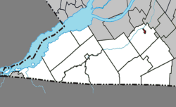
Howick is the third smallest municipality in the Canadian province of Quebec, located in Le Haut-Saint-Laurent Regional County Municipality. The population as of the 2021 Canadian census was 850. Situated along the English River in the heart of the Châteauguay Valley, it is approximately 50 minutes southwest of Montreal and 20 minutes north of the Canada–United States border.
Howick | |
|---|---|
 | |
 Location within Le Haut-Saint-Laurent RCM | |
| Coordinates: 45°11′N 73°51′W[1] | |
| Country | Canada |
| Province | Quebec |
| Region | Montérégie |
| RCM | Le Haut-Saint-Laurent |
| Constituted | October 29, 1915 |
| Government | |
| • Mayor | Richard Raithby |
| • Federal riding | Salaberry—Suroît |
| • Prov. riding | Huntingdon |
| Area | |
| • Total | 0.96 km2 (0.37 sq mi) |
| • Land | 0.96 km2 (0.37 sq mi) |
| Population (2021)[4] | |
| • Total | 850 |
| • Density | 885.0/km2 (2,292/sq mi) |
| • Pop (2016-21) | |
| • Dwellings | 366 |
| Time zone | UTC−5 (EST) |
| • Summer (DST) | UTC−4 (EDT) |
| Postal code(s) | |
| Area code(s) | 450 and 579 |
| Highways | |
| Website | www |
The following waterways pass through or are situated within the municipality's boundaries:[1]
Around 1804, George Ellice, son of Lord Alexander Ellice, built a mill on the west bank of the English River, that became a settlement bearing his name: George's Mill. Circa 1833, the place was known in English as Howick (named after either Charles Grey, 2nd Earl Grey, or his son Henry Grey, 3rd Earl Grey, both known as Viscount Howick), but known in French as Village de la Fourche (French for "Village of the Fork" in refence to the nearby confluence of the Châteauguay and English Rivers).[1][5]
On October 29, 1915, the Village Municipality of Howick was established when it split off from the Parish Municipality of Très-Saint-Sacrement.[6]
On May 15, 2010, the village municipality changed statutes to become a regular municipality.[1]
| 2021 | 2016 | 2011 | |
|---|---|---|---|
| Population | 850 (+9.3% from 2016) | 778 (+23.5% from 2011) | 630 (+4.4% from 2006) |
| Land area | 0.96 km2 (0.37 sq mi) | 0.97 km2 (0.37 sq mi) | 0.99 km2 (0.38 sq mi) |
| Population density | 885/km2 (2,290/sq mi) | 803.5/km2 (2,081/sq mi) | 634.2/km2 (1,643/sq mi) |
| Median age | 34.4 (M: 34.8, F: 34.0) | 37.1 (M: 34.9, F: 38.9) | 39.1 (M: 37.5, F: 40.2) |
| Private dwellings | 366 (total) 347 (occupied) | 352 (total) | 288 (total) |
| Median household income | $72,000 | $54,016 | $38,092 |
|
| ||||||||||||||||||||||||||||||||||||||||||||||||||||||||||||
| Source: Statistics Canada[12] | |||||||||||||||||||||||||||||||||||||||||||||||||||||||||||||
| Canada Census Mother Tongue - Howick, Quebec[12] | ||||||||||||||||||
|---|---|---|---|---|---|---|---|---|---|---|---|---|---|---|---|---|---|---|
| Census | Total | French |
English |
French & English |
Other | |||||||||||||
| Year | Responses | Count | Trend | Pop % | Count | Trend | Pop % | Count | Trend | Pop % | Count | Trend | Pop % | |||||
2016 |
780 |
525 | 67.3% | 225 | 28.8% | 20 | 2.6% | 10 | 1.3% | |||||||||
2011 |
630 |
395 | 62.7% | 205 | 32.5% | 20 | 3.2% | 10 | 1.6% | |||||||||
2006 |
600 |
435 | 72.5% | 155 | 25.8% | 0 | 0.0% | 10 | 1.7% | |||||||||
2001 |
580 |
315 | 54.3% | 240 | 41.4% | 10 | 1.7% | 15 | 2.6% | |||||||||
1996 |
615 |
370 | n/a | 60.2% | 225 | n/a | 36.6% | 20 | n/a | 3.3% | 0 | n/a | 0.0% | |||||
List of former mayors:[6]
The CIT du Haut-Saint-Laurent provides commuter and local bus services.
Seamless Wikipedia browsing. On steroids.
Every time you click a link to Wikipedia, Wiktionary or Wikiquote in your browser's search results, it will show the modern Wikiwand interface.
Wikiwand extension is a five stars, simple, with minimum permission required to keep your browsing private, safe and transparent.