Halkapınar, Konya
District and municipality in Konya, Turkey From Wikipedia, the free encyclopedia
District and municipality in Konya, Turkey From Wikipedia, the free encyclopedia
Seamless Wikipedia browsing. On steroids.
Every time you click a link to Wikipedia, Wiktionary or Wikiquote in your browser's search results, it will show the modern Wikiwand interface.
Wikiwand extension is a five stars, simple, with minimum permission required to keep your browsing private, safe and transparent.
Halkapınar is a municipality and district of Konya Province, Turkey.[2] Its area is 605 km2,[3] and its population is 3,909 (2022).[1]
Halkapınar | |
|---|---|
District and municipality | |
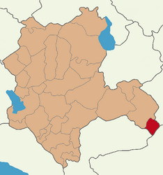
 Map showing Halkapınar District in Konya Province | |
| Coordinates: 37°26′06″N 34°11′19″E | |
| Country | Turkey |
| Province | Konya |
| Government | |
| • Mayor | Mehmet Vardar (BBP) |
| • Kaymakam | Enes Talha Ulusoy |
| Area | 605 km2 (234 sq mi) |
| Elevation | 1,160 m (3,810 ft) |
| Population (2022)[1] | 3,909 |
| • Density | 6.5/km2 (17/sq mi) |
| Time zone | UTC+3 (TRT) |
| Postal code | 42980 |
| Area code | 0332 |
There are 17 neighbourhoods in Halkapınar District:[4]