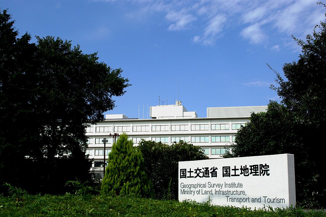
The Geospatial Information Authority of Japan (国土地理院, Kokudo Chiri-in), or GSI, is the national institution responsible for surveying and mapping the national land of Japan. The former name of the organization from 1949 until March 2010 was Geographical Survey Institute;[1] despite the rename, it retains the same initials. It is an extraordinary organ of the Ministry of Land, Infrastructure, Transport and Tourism. Its main offices are situated in Tsukuba City of Ibaraki Prefecture.
| 国土地理院 Kokudo Chiri-in | |
 Geospatial Information Authority of Japan logo | |
 Geospatial Information Authority of Japan Headquarters | |
| Agency overview | |
|---|---|
| Formed | June 2, 1869 |
| Preceding agency | |
| Jurisdiction | |
| Headquarters | Yubinbango 305-0811, Ibaraki Prefecture, Tsukuba City, Kitago No. 1, Japan |
| Employees | 671 civilian staff (2018) |
| Annual budget | 9,640,335 thousand yen |
| Agency executive |
|
| Parent agency | Ministry of Land, Infrastructure and Transport |
| Website | www |
It also runs a museum, situated in Tsukuba, the Science Museum of Map and Survey.
Earthquake Precursor Prediction Research
Stationary MT monitoring systems have been installed in Japan since April 1996, providing a continuous recording of MT signals at the Mizusawa Geodetic Observatory and the Esashi Station of the GSI. These stations measure fluctuations in the earth's electromagnetic field that correspond with seismic activity. The raw geophysical time-series data from these monitoring stations is freely available to the scientific community, enabling further study of the interaction between EM events and earthquake activity. The MT time series data from the GSIJ earthquake monitoring stations is available online at http://vldb.gsi.go.jp/sokuchi/geomag/menu_03/mt_data.html Archived 2016-10-13 at the Wayback Machine
The Authority is represented on the national Coordinating Committee for Earthquake Prediction.[2]
Japanese water height reference point

The Japanese water height reference point (日本水準原点, Nihon Suijun Genten) is installed in a small building in front of the National Diet Building in Nagatacho Chiyoda, Tokyo.[3] The building is called the Japanese water height reference point storehouse (日本水準原点庫, Nihon Suijun Genten Hyoko). Construction of the building started in August 1890 and it was completed on December 24, 1891. It serves as a reference point for elevations in Japan (vertical datum). The building cannot be entered, but there is a stone base with a description outside.
Elevations of Japan are determined with reference to the mean sea level of Tokyo Bay (elevation 0 m). This is called mean sea level of Tokyo Bay (東京湾平均海面, Tōkyō-wan heikin kaimen) or Tokyo Peil (TP for short, "Tokyo level"), where the word Peil comes from the Dutch language. The stone base monument of the datum has a crystal scale with a 0 which indicates 24.3900 m (80.020 ft) above the mean sea level of Tokyo Bay since October 21, 2011.[4]
Since it is difficult to refer to the altitude in Tokyo for remote islands, 37 islands have their own zero point.[5] The heights of Okinawa z. B. are measured from the middle water level of Nakagusuku Bay ( 中 城 湾 , Nakagususku-wan ) and that of Miyake from the Ako Bay.[6]
The GSI in fiction
The GSI featured in the novel Norwegian Wood by Haruki Murakami as the intended workplace of his roommate, "stormtrooper". At the time the novel was set, in the late sixties, the GSI was situated in Tokyo.
See also
- Japanese maps, the history of mapping in Japan.
- Japanese map symbols, the official symbols used by the GSI in maps.
- Global Map
References
External links
Wikiwand in your browser!
Seamless Wikipedia browsing. On steroids.
Every time you click a link to Wikipedia, Wiktionary or Wikiquote in your browser's search results, it will show the modern Wikiwand interface.
Wikiwand extension is a five stars, simple, with minimum permission required to keep your browsing private, safe and transparent.
