File:Villa_Clara_Province_location_map.png
From Wikipedia, the free encyclopedia
No higher resolution available.
Villa_Clara_Province_location_map.png (169 × 137 pixels, file size: 14 KB, MIME type: image/png)
| This is a file from the Wikimedia Commons. Information from its description page there is shown below. Commons is a freely licensed media file repository. You can help. |

|
This image could be re-created using vector graphics as an SVG file. This has several advantages; see Commons:Media for cleanup for more information. If an SVG form of this image is available, please upload it and afterwards replace this template with
{{vector version available|new image name}}.
It is recommended to name the SVG file “Villa Clara Province location map.svg”—then the template Vector version available (or Vva) does not need the new image name parameter. |
Summary
| DescriptionVilla Clara Province location map.png |
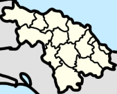
English: Location map of Villa Clara Province, Cuba |
| Date | |
| Source | Own work |
| Author | CubanoBoi |
Licensing
I, the copyright holder of this work, hereby publish it under the following license:
This file is licensed under the Creative Commons Attribution-Share Alike 4.0 International license.
- You are free:
- to share – to copy, distribute and transmit the work
- to remix – to adapt the work
- Under the following conditions:
- attribution – You must give appropriate credit, provide a link to the license, and indicate if changes were made. You may do so in any reasonable manner, but not in any way that suggests the licensor endorses you or your use.
- share alike – If you remix, transform, or build upon the material, you must distribute your contributions under the same or compatible license as the original.
Captions
Add a one-line explanation of what this file represents
Items portrayed in this file
depicts
9 April 2023
image/png
File history
Click on a date/time to view the file as it appeared at that time.
| Date/Time | Thumbnail | Dimensions | User | Comment | |
|---|---|---|---|---|---|
| current | 17:33, 9 April 2023 | | 169 × 137 (14 KB) | CubanoBoi | Uploaded own work with UploadWizard |
File usage
The following pages on the English Wikipedia use this file (pages on other projects are not listed):
- Aguada de Moya, Cuba
- Antón Díaz
- Bosque, Cuba
- Báez
- Calabazar de Sagua
- Camilo Cienfuegos, Villa Clara
- Canoa, Cuba
- Cayo Hueso, Encrucijada
- Constancia (Encrucijada)
- Corona (Santa Clara)
- Crucero Carmita
- El Purial (Camajuaní)
- El Salto del Hanabanilla
- El Santo (Cuba)
- Encrucijada Norte
- Escambray (Santa Clara)
- Esperanza (Ranchuelo)
- George Washington, Cuba
- Guajén, Cuba
- Güinía de Miranda
- Hanabanilla Dam
- Isabela de Sagua
- Jibacoa (Manicaragua)
- José María Pérez, Cuba
- La Luz, Cuba
- La Quinta, Cuba
- La Sierra (Encrucijada)
- Luis Arcos Bergnes, Cuba
- Manajanabo
- Mataguá
- Paso Real (Encrucijada)
- Piedra (Camajuaní)
- Raizúa
- Rincón (Camajuaní)
- Sagua la Chica
- San Antonio de las Vueltas
- Taguayabón
- Tuinicú (Encrucijada)
- Vega Alta, Cuba
- Vega Redonda (Cuba)
- Zulueta (Remedios)
Global file usage
The following other wikis use this file:
- Usage on tum.wikipedia.org
- Vega Alta, Cuba
- Canoa, Cuba
- La Luz, Cuba
- Luis Arcos Bergnes, Cuba
- Crucero Carmita
- Rincón (Camajuaní)
- Guajén, Cuba
- Aguada de Moya
- CCS Raúl Torres Acosta
- El Purial, Camajuaní
- La Quinta, Cuba
- Dolores (Caibarién)
- Guajabana (Caibarién)
- Rojas (Caibarién)
- Cambaito (Caibarién)
- Texico (Caibarién)
- Mujica (Caibarién)
- Refugio (Caibarién)
- El Santo (Encrucijada)
- Abel Santamaría (Encrucijada)
- Arroyo Naranjo (Encrucijada)
- Blanquita (Encrucijada)
- Arroyo Seco (Manicaragua)
- Boquerones (Manicaragua)