File:Upper_Pontnewydd_railway_station_(site),_Gwent_(geograph_4387629).jpg
From Wikipedia, the free encyclopedia
Size of this preview: 800 × 600 pixels. Other resolutions: 320 × 240 pixels | 640 × 480 pixels | 1,024 × 768 pixels | 1,280 × 960 pixels | 1,600 × 1,200 pixels.
Original file (1,600 × 1,200 pixels, file size: 408 KB, MIME type: image/jpeg)
| This is a file from the Wikimedia Commons. Information from its description page there is shown below. Commons is a freely licensed media file repository. You can help. |
Summary
| DescriptionUpper Pontnewydd railway station (site), Gwent (geograph 4387629).jpg |
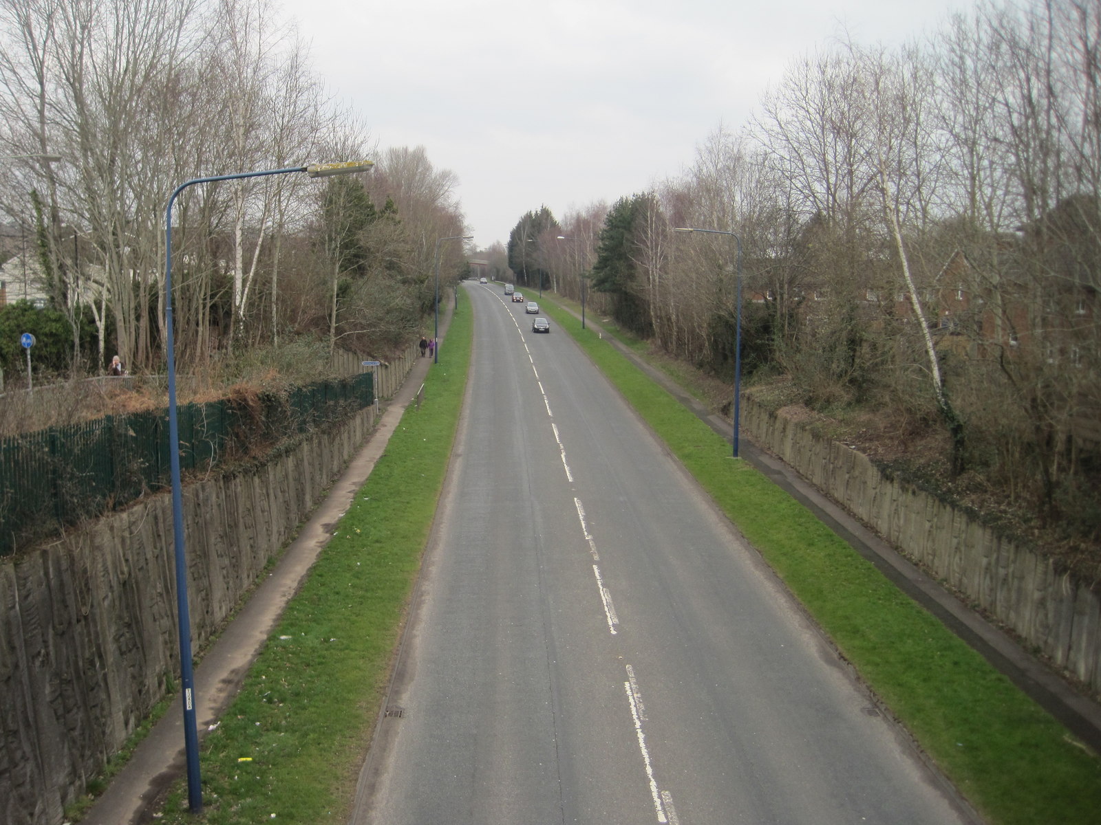
English: Upper Pontnewydd railway station (site), Gwent Opened in 1852 by the Monmouthshire Railway, later part of the Great Western Railway, on its line from Newport to Pontypool (Crane Street) and Blaenavon, this station closed to passengers in 1962 and completely in 1969. View north towards Pontrhydyrun and Pontypool. The site has been lost due to construction of the A4051 road. |
| Date | |
| Source | From geograph.org.uk |
| Author | Nigel Thompson |
| Permission (Reusing this file) |
Creative Commons Attribution Share-alike license 2.0 |
| Attribution (required by the license) InfoField | Nigel Thompson / Upper Pontnewydd railway station (site), Gwent / |
InfoField | Nigel Thompson / Upper Pontnewydd railway station (site), Gwent |
| Camera location | 51° 39′ 38.7″ N, 3° 01′ 27″ W | View this and other nearby images on: OpenStreetMap |
|---|
| Object location | 51° 39′ 40.3″ N, 3° 01′ 27″ W | View this and other nearby images on: OpenStreetMap |
|---|
Licensing

|
This image was taken from the Geograph project collection. See this photograph's page on the Geograph website for the photographer's contact details. The copyright on this image is owned by Nigel Thompson and is licensed for reuse under the Creative Commons Attribution-ShareAlike 2.0 license.
|
This file is licensed under the Creative Commons Attribution-Share Alike 2.0 Generic license.
Attribution: Nigel Thompson
- You are free:
- to share – to copy, distribute and transmit the work
- to remix – to adapt the work
- Under the following conditions:
- attribution – You must give appropriate credit, provide a link to the license, and indicate if changes were made. You may do so in any reasonable manner, but not in any way that suggests the licensor endorses you or your use.
- share alike – If you remix, transform, or build upon the material, you must distribute your contributions under the same or compatible license as the original.
Captions
Add a one-line explanation of what this file represents
Items portrayed in this file
depicts
14 March 2015
51°39'38.664"N, 3°1'27.293"W
51°39'40.28"N, 3°1'26.80"W
File history
Click on a date/time to view the file as it appeared at that time.
| Date/Time | Thumbnail | Dimensions | User | Comment | |
|---|---|---|---|---|---|
| current | 20:14, 2 January 2020 | | 1,600 × 1,200 (408 KB) | Lamberhurst | Transferred from geograph.co.uk using [https://tools.wmflabs.org/geograph2commons/ geograph2commons] |
File usage
The following pages on the English Wikipedia use this file (pages on other projects are not listed):
,_Gwent_(geograph_4387629).jpg)