File:Tulul_adh-Dhahab_ramparts.jpg
From Wikipedia, the free encyclopedia
Original file (1,360 × 2,048 pixels, file size: 887 KB, MIME type: image/jpeg)
| This is a file from the Wikimedia Commons. Information from its description page there is shown below. Commons is a freely licensed media file repository. You can help. |
Summary
| DescriptionTulul adh-Dhahab ramparts.jpg |
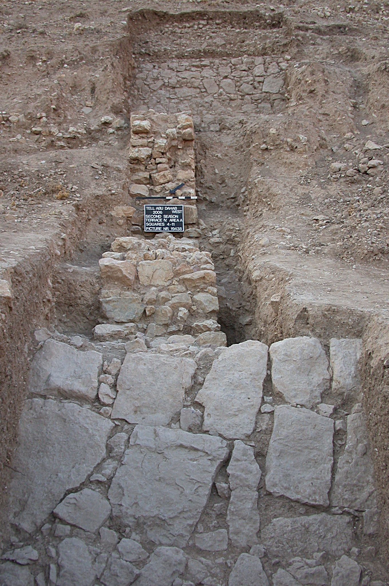
English: Tulul adh-Dhahab (Jordan): Ramparts on the northwestern flank of the western hill. The tell is heavily fortificated, the structure consists of a stone paved glacis and a casemate-like defence wall with numerous wall towers.
Deutsch: Tulul adh-Dhahab (Jordanien): Wehranlage an der Nordwestflanke des Westhügels. Der Tell ist massiv befestigt, die Anlage besteht aus einem steinbelegten Glacis mit aufgesetzter, kasemattenartiger Wehrmauer mit zahlreichen Türmen. |
||
| Date | |||
| Source | Given to Jorre by the author for publication on commons. | ||
| Author | E. Rehfeld | ||
| Permission (Reusing this file) |
|
| Camera location | 32° 11′ 16.48″ N, 35° 41′ 05.45″ E | View this and other nearby images on: OpenStreetMap |
|---|
| This is a retouched picture, which means that it has been digitally altered from its original version. Modifications: sharpened.
|
Licensing
- You are free:
- to share – to copy, distribute and transmit the work
- to remix – to adapt the work
- Under the following conditions:
- attribution – You must give appropriate credit, provide a link to the license, and indicate if changes were made. You may do so in any reasonable manner, but not in any way that suggests the licensor endorses you or your use.
- share alike – If you remix, transform, or build upon the material, you must distribute your contributions under the same or compatible license as the original.
| Public domainPublic domainfalsefalse |
| This work has been released into the public domain by its copyright holder, Emmanuel Rehfeld. This applies worldwide. In some countries this may not be legally possible; if so: Emmanuel Rehfeld grants anyone the right to use this work for any purpose, without any conditions, unless such conditions are required by law. Public domainPublic domainfalsefalse |
Captions
Items portrayed in this file
depicts
17 June 2008
32°11'16.476"N, 35°41'5.449"E
File history
Click on a date/time to view the file as it appeared at that time.
| Date/Time | Thumbnail | Dimensions | User | Comment | |
|---|---|---|---|---|---|
| current | 13:28, 17 June 2009 | | 1,360 × 2,048 (887 KB) | Jorre | {{Information |Description={{en|1=Tulul adh-Dhahab (Jordan): Ramparts on the northwestern flank of the western hill. The tell is heavily fortificated, the structure consists of a stone paved glacis and a casemate-like defence wall with numerous wall tower |
File usage
Global file usage
The following other wikis use this file:
- Usage on ar.wikipedia.org
- Usage on de.wikipedia.org
- Usage on he.wikipedia.org
- Usage on it.wikipedia.org
Metadata
This file contains additional information, probably added from the digital camera or scanner used to create or digitize it.
If the file has been modified from its original state, some details may not fully reflect the modified file.
| Camera manufacturer | NIKON |
|---|---|
| Camera model | E995 |
| Exposure time | 10/1,143 sec (0.0087489063867017) |
| F-number | f/3.3 |
| ISO speed rating | 100 |
| Date and time of data generation | 06:47, 17 August 2006 |
| Lens focal length | 8.2 mm |
| Horizontal resolution | 72 dpi |
| Vertical resolution | 72 dpi |
| Software used | GIMP 2.6.6 |
| File change date and time | 14:43, 17 June 2009 |
| Y and C positioning | Co-sited |
| Exposure Program | Normal program |
| Exif version | 2.1 |
| Date and time of digitizing | 06:47, 17 August 2006 |
| Meaning of each component |
|
| Image compression mode | 4 |
| Exposure bias | 0 |
| Maximum land aperture | 0 APEX (f/1) |
| Metering mode | Center weighted average |
| Light source | Unknown |
| Flash | Flash did not fire |
| Supported Flashpix version | 1 |
| Color space | sRGB |
| File source | Digital still camera |
| Scene type | A directly photographed image |