File:Tt-map.png
From Wikipedia, the free encyclopedia
Tt-map.png (324 × 350 pixels, file size: 4 KB, MIME type: image/png)
| This is a file from the Wikimedia Commons. Information from its description page there is shown below. Commons is a freely licensed media file repository. You can help. |
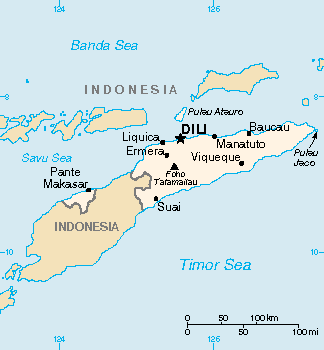
| DescriptionTt-map.png | Map of East Timor (wp-EN). | ||||
| Date |
Unknown date Unknown date |
||||
| Source | Original map in the CIA World Factbook (wp-EN). | ||||
| Author | CIA World Factbook | ||||
| Permission (Reusing this file) |
|
||||
| Other versions |
|

Captions
Items portrayed in this file
depicts
image/png
File history
Click on a date/time to view the file as it appeared at that time.
| Date/Time | Thumbnail | Dimensions | User | Comment | |
|---|---|---|---|---|---|
| current | 15:05, 13 March 2022 | | 324 × 350 (4 KB) | Lojwe | Cropped 2 % horizontally, 1 % vertically using CropTool with precise mode. |
| 19:59, 5 March 2005 |  | 330 × 355 (5 KB) | Alfio | CIA map of East Timor |
File usage
Global file usage
The following other wikis use this file:
- Usage on ckb.wikipedia.org
- Usage on en.wikinews.org
- Usage on fa.wikipedia.org
- Usage on gl.wikipedia.org
- Usage on he.wikipedia.org
- Usage on hu.wikipedia.org
- Usage on id.wikipedia.org
- Usage on it.wikipedia.org
- Usage on jv.wikipedia.org
- Usage on map-bms.wikipedia.org
- Usage on mzn.wikipedia.org
- Usage on pap.wikipedia.org
- Usage on sv.wikipedia.org
- Usage on tr.wiktionary.org
- Usage on udm.wikipedia.org
- Usage on vi.wikipedia.org
Metadata
This file contains additional information, probably added from the digital camera or scanner used to create or digitize it.
If the file has been modified from its original state, some details may not fully reflect the modified file.
| File change date and time | 15:03, 13 March 2022 |
|---|