File:Tasmania_in_Australia_map.png
From Wikipedia, the free encyclopedia
No higher resolution available.
Tasmania_in_Australia_map.png (200 × 186 pixels, file size: 11 KB, MIME type: image/png)
| This is a file from the Wikimedia Commons. Information from its description page there is shown below. Commons is a freely licensed media file repository. You can help. |
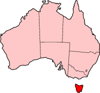
Localization of Tasmania in Australia

|
Permission is granted to copy, distribute and/or modify this document under the terms of the GNU Free Documentation License, Version 1.2 or any later version published by the Free Software Foundation; with no Invariant Sections, no Front-Cover Texts, and no Back-Cover Texts. A copy of the license is included in the section entitled GNU Free Documentation License.http://www.gnu.org/copyleft/fdl.htmlGFDLGNU Free Documentation Licensetruetrue |
| This file is licensed under the Creative Commons Attribution-Share Alike 3.0 Unported license. | ||
| ||
| This licensing tag was added to this file as part of the GFDL licensing update.http://creativecommons.org/licenses/by-sa/3.0/CC BY-SA 3.0Creative Commons Attribution-Share Alike 3.0truetrue |

|
File:Tasmania in Australia.svg is a vector version of this file. It should be used in place of this PNG file when not inferior.
File:Tasmania in Australia map.png → File:Tasmania in Australia.svg
For more information, see Help:SVG.
|
 |
History on English Wikipedia
- (delete all) (current) 23:20, 22 February 2004 Morwen (Talk | contribs | block) 200×186 11 KB
- (delete this) (revert) 08:45, 10 May 2003 Tim Starling (Talk | contribs | block) 200×181 4 KB Created by me based on Geoscience Australia data
Captions
Add a one-line explanation of what this file represents
Items portrayed in this file
depicts
File history
Click on a date/time to view the file as it appeared at that time.
| Date/Time | Thumbnail | Dimensions | User | Comment | |
|---|---|---|---|---|---|
| current | 15:08, 12 December 2004 | | 200 × 186 (11 KB) | Mschlindwein | Localization of Tasmania in Australia |
File usage
The following pages on the English Wikipedia use this file (pages on other projects are not listed):
- 2014 Tasmanian Legislative Council periodic election
- 2015 Tasmanian Legislative Council periodic election
- 2018 Hobart floods
- Agfest
- Anthony Fenn Kemp
- Ben Lomond bioregion
- Bulbine crassa
- Butlers Gorge Power Station
- Coat of arms of Tasmania
- Colonial Secretary of Tasmania
- Currie Lighthouse
- Cygnet Folk Festival
- Deal Island Lighthouse
- Electoral division of Westmorland
- Furneaux bioregion
- Goose Island Lighthouse
- Gormanston railway station, Tasmania
- Grecian (1824 ship)
- Hope and Anchor Tavern
- James Boag's Premium
- King bioregion
- Lea Tree
- List of highways in Tasmania
- Lune River, Tasmania
- Mona Foma
- Nieterana Power Station
- Office of the Tasmanian Economic Regulator
- Patterdale and Nile Farm
- Solicitor-General of Tasmania
- Tasdance
- Tasmania 40° South
- Tasmanian Central Highlands
- Tasmanian Conservation Trust
- Tasmanian Electoral Commission
- Tasmanian Freight Equalisation Scheme
- Tasmanian Government Personal Information Card
- Tasmanian Northern Midlands
- Tasmanian Northern Slopes
- Tasmanian South East
- Tasmanian Southern Ranges
- Tasmanian University Football Club
- Tasmanian West
- William Collins (colonist)
- Template:Tasmania-stub
Global file usage
The following other wikis use this file:
- Usage on hif.wikipedia.org
- Usage on hu.wikipedia.org
- Usage on id.wikipedia.org
- Usage on ja.wikipedia.org
- Usage on sw.wikipedia.org
- Usage on www.wikidata.org
Retrieved from "https://en.wikipedia.org/wiki/File:Tasmania_in_Australia_map.png"