File:TNMap-doton-Durhamville.png
From Wikipedia, the free encyclopedia
No higher resolution available.
TNMap-doton-Durhamville.png (250 × 63 pixels, file size: 16 KB, MIME type: image/png)
| This is a file from the Wikimedia Commons. Information from its description page there is shown below. Commons is a freely licensed media file repository. You can help. |
Summary

|
This file was moved to Wikimedia Commons from en.wikipedia using a bot script. All source information is still present. It requires review. Additionally, there may be errors in any or all of the information fields; information on this file should not be considered reliable and the file should not be used until it has been reviewed and any needed corrections have been made. Once the review has been completed, this template should be removed. For details about this file, see below. Check now! |
| DescriptionTNMap-doton-Durhamville.png |
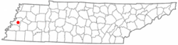
English: Adapted from Wikipedia's TN county maps by Seth Ilys
change file format to PNG |
| Date | 20 December 2008 (original upload date) |
| Source | Transferred from en.wikipedia to Commons by DoxTxob using CommonsHelper. |
| Author | DoxTxob at English Wikipedia |
Licensing

|
Permission is granted to copy, distribute and/or modify this document under the terms of the GNU Free Documentation License, Version 1.2 or any later version published by the Free Software Foundation; with no Invariant Sections, no Front-Cover Texts, and no Back-Cover Texts. A copy of the license is included in the section entitled GNU Free Documentation License.http://www.gnu.org/copyleft/fdl.htmlGFDLGNU Free Documentation Licensetruetrue |
| This file is licensed under the Creative Commons Attribution-Share Alike 3.0 Unported license. | ||
| ||
| This licensing tag was added to this file as part of the GFDL licensing update.http://creativecommons.org/licenses/by-sa/3.0/CC BY-SA 3.0Creative Commons Attribution-Share Alike 3.0truetrue |
Original upload log
The original description page was here. All following user names refer to en.wikipedia.
- 2008-12-20 04:31 DoxTxob 250×63× (16292 bytes) Upload new file with correct location deried from TN county maps by Seth Ilys Original under GNU FDL
- 2008-12-17 04:59 DoxTxob 300×75× (19086 bytes) change file format to PNG
Captions
Add a one-line explanation of what this file represents
Items portrayed in this file
depicts
20 December 2008
File history
Click on a date/time to view the file as it appeared at that time.
| Date/Time | Thumbnail | Dimensions | User | Comment | |
|---|---|---|---|---|---|
| current | 00:15, 18 June 2009 | 250 × 63 (16 KB) | File Upload Bot (Magnus Manske) | {{BotMoveToCommons|en.wikipedia|year={{subst:CURRENTYEAR}}|month={{subst:CURRENTMONTHNAME}}|day={{subst:CURRENTDAY}}}} {{Information |Description={{en|Adapted from Wikipedia's TN county maps by Seth Ilys change file format to PNG}} |Source=Transferred fr |
File usage
The following pages on the English Wikipedia use this file (pages on other projects are not listed):
Global file usage
The following other wikis use this file:
- Usage on azb.wikipedia.org
- Usage on fa.wikipedia.org
- Usage on www.wikidata.org
Retrieved from "https://en.wikipedia.org/wiki/File:TNMap-doton-Durhamville.png"