File:SanJuanBasinUSGS.jpg
From Wikipedia, the free encyclopedia
Size of this preview: 726 × 599 pixels. Other resolutions: 291 × 240 pixels | 582 × 480 pixels | 728 × 601 pixels.
Original file (728 × 601 pixels, file size: 160 KB, MIME type: image/jpeg)
| This is a file from the Wikimedia Commons. Information from its description page there is shown below. Commons is a freely licensed media file repository. You can help. |

|
This map image could be re-created using vector graphics as an SVG file. This has several advantages; see Commons:Media for cleanup for more information. If an SVG form of this image is available, please upload it and afterwards replace this template with
{{vector version available|new image name}}.
It is recommended to name the SVG file “SanJuanBasinUSGS.svg”—then the template Vector version available (or Vva) does not need the new image name parameter. |
 | This map image was uploaded in the JPEG format even though it consists of non-photographic data. This information could be stored more efficiently or accurately in the PNG or SVG format. If possible, please upload a PNG or SVG version of this image without compression artifacts, derived from a non-JPEG source (or with existing artifacts removed). After doing so, please tag the JPEG version with {{Superseded|NewImage.ext}} and remove this tag. This tag should not be applied to photographs or scans. If this image is a diagram or other image suitable for vectorisation, please tag this image with {{Convert to SVG}} instead of {{BadJPEG}}. If not suitable for vectorisation, use {{Convert to PNG}}. For more information, see {{BadJPEG}}. |  |
Summary
| DescriptionSanJuanBasinUSGS.jpg |
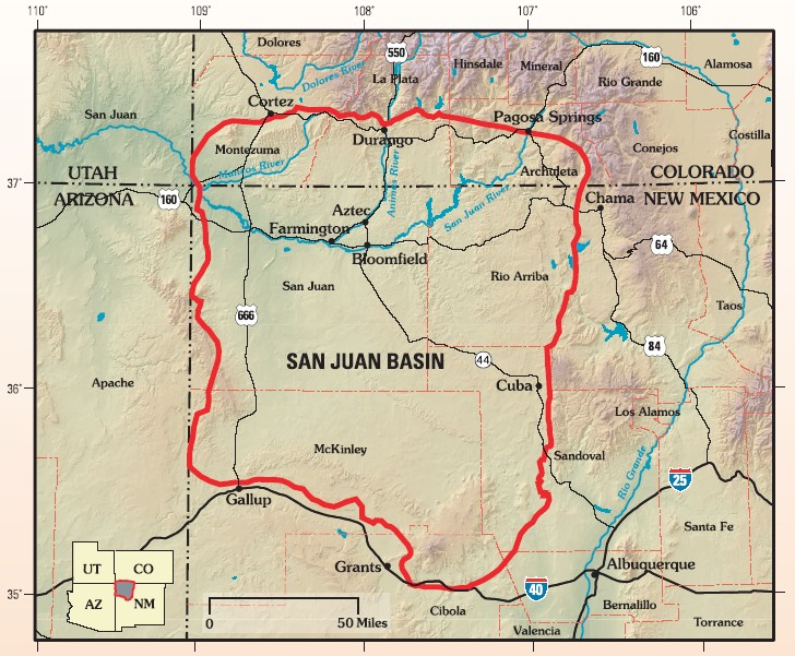
English: Map of San Juan Basin, Colorado-New Mexico, USA |
||||
| Date | |||||
| Source | Assessment of Undiscovered Oil and Gas Resources of the San Juan Basin Province of New Mexico and Colorado, 2002, USGS Fact Sheet FS-147-02 | ||||
| Author | US Geological Survey | ||||
| Permission (Reusing this file) |
|
Original upload log
The original description page was here. All following user names refer to en.wikipedia.
- 2008-03-05 16:44 Geologyguy 728×601× (163837 bytes) {{Information |Description=Map of San Juan Basin, Colorado-New Mexico, USA |Source=pubs.usgs.gov/fs/fs-147-02/FS-147-02.pdf |Date= |Location= |Author=US Geological Survey |Permission= |other_versions= }}
Captions
San Juan Basin Province of northwestern New Mexico and southwestern Colorado.
Items portrayed in this file
depicts
November 2002
image/jpeg
File history
Click on a date/time to view the file as it appeared at that time.
| Date/Time | Thumbnail | Dimensions | User | Comment | |
|---|---|---|---|---|---|
| current | 22:18, 19 January 2009 | | 728 × 601 (160 KB) | Urdangaray | {{Information |Description={{en|Map of San Juan Basin, Colorado-New Mexico, USA}} |Source=Transferred from [http://en.wikipedia.org en.wikipedia]<br/> (Original text : ''pubs.usgs.gov/fs/fs-147-02/FS-147-02.pdf'') |Date=2008-03-05 (original upload date) | |
File usage
The following pages on the English Wikipedia use this file (pages on other projects are not listed):
Global file usage
The following other wikis use this file:
- Usage on es.wikipedia.org
- Usage on it.wikipedia.org
- Usage on nl.wikipedia.org
Metadata
This file contains additional information, probably added from the digital camera or scanner used to create or digitize it.
If the file has been modified from its original state, some details may not fully reflect the modified file.
| _error | 0 |
|---|
Retrieved from "https://en.wikipedia.org/wiki/File:SanJuanBasinUSGS.jpg"