File:SA_in_Australia_map.png
From Wikipedia, the free encyclopedia
No higher resolution available.
SA_in_Australia_map.png (200 × 186 pixels, file size: 11 KB, MIME type: image/png)
| This is a file from the Wikimedia Commons. Information from its description page there is shown below. Commons is a freely licensed media file repository. You can help. |
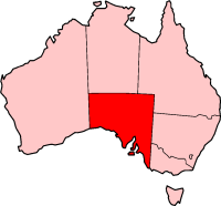
Variation on our usual theme. QuartierLatin1968 00:01, 22 May 2005 (UTC)

|
Permission is granted to copy, distribute and/or modify this document under the terms of the GNU Free Documentation License, Version 1.2 or any later version published by the Free Software Foundation; with no Invariant Sections, no Front-Cover Texts, and no Back-Cover Texts. A copy of the license is included in the section entitled GNU Free Documentation License.http://www.gnu.org/copyleft/fdl.htmlGFDLGNU Free Documentation Licensetruetrue |
| This file is licensed under the Creative Commons Attribution-Share Alike 3.0 Unported license. | ||
| ||
| This licensing tag was added to this file as part of the GFDL licensing update.http://creativecommons.org/licenses/by-sa/3.0/CC BY-SA 3.0Creative Commons Attribution-Share Alike 3.0truetrue |

|
File:South Australia in Australia.svg is a vector version of this file. It should be used in place of this PNG file when not inferior.
File:SA in Australia map.png → File:South Australia in Australia.svg
For more information, see Help:SVG.
|
 |
Captions
Add a one-line explanation of what this file represents
Items portrayed in this file
depicts
File history
Click on a date/time to view the file as it appeared at that time.
| Date/Time | Thumbnail | Dimensions | User | Comment | |
|---|---|---|---|---|---|
| current | 00:01, 22 May 2005 | | 200 × 186 (11 KB) | QuartierLatin1968 | Variation on our usual theme. ~~~~ {{GFDL}} Category:South Australia Category:Maps of Australia |
File usage
More than 100 pages use this file. The following list shows the first 100 pages that use this file only. A full list is available.
- Adelaide Hills Council
- Adelaide Plains
- Angaston, South Australia
- Australian south-east coast drainage division
- Balhannah
- Barossa Range
- Blyth, South Australia
- Bowmans, South Australia
- Bridgewater, South Australia
- Brinkworth, South Australia
- Cadell, South Australia
- Clarendon, South Australia
- Coonawarra, South Australia
- Crawford crater
- Dalhousie Springs
- Discovery Bay (Australia)
- District Council of Mount Barker
- District Council of Orroroo Carrieton
- District Council of Peterborough
- Dublin, South Australia
- Echunga
- Eden Valley, South Australia
- Emu Bay, South Australia
- English Island (South Australia)
- Evanston, South Australia
- Flaxman crater
- Flinders Ranges Council
- Forreston, South Australia
- Glendambo, South Australia
- Gluepot Reserve
- Hamilton, South Australia
- Heathfield, South Australia
- Hoyleton, South Australia
- Kenton Valley, South Australia
- Ki Ki, South Australia
- Kingston On Murray, South Australia
- Kingston SE
- Lake Cadibarrawirracanna
- Lake Dutton
- Lake Gregory (South Australia)
- Leasingham, South Australia
- Lenswood, South Australia
- List of highways in South Australia
- Littlehampton, South Australia
- Lower Hermitage
- Lyndoch, South Australia
- Maitland, South Australia
- Marion Bay, South Australia
- Mawson Trail
- McLaren Flat, South Australia
- Meadows, South Australia
- Mengler Hill
- Mid North
- Mindarie, South Australia
- Monash, South Australia
- Mount Barker (South Australia)
- Mount Chambers Gorge
- Mount Hopeless (South Australia)
- Mount Remarkable
- Murray Mallee
- Norton Summit, South Australia
- Oak Valley, South Australia
- Oakbank, South Australia
- Painted Desert (South Australia)
- Palmer, South Australia
- Paringa, South Australia
- Piccadilly, South Australia
- Port Germein, South Australia
- Port Vincent, South Australia
- Redhill, South Australia
- Roseworthy, South Australia
- Rowland Flat, South Australia
- SAFTAG
- Saddleworth, South Australia
- Second Valley, South Australia
- Skilly Hills
- South Australian gulf drainage division
- Spalding, South Australia
- St Mary Peak
- Stenhouse Bay, South Australia
- Strzelecki Track
- Summertown, South Australia
- Taldra, South Australia
- Taplan, South Australia
- Tarcowie, South Australia
- Tarlee, South Australia
- Templers, South Australia
- Thevenard, South Australia
- Thornlea, South Australia
- Totness, South Australia
- Two Wells, South Australia
- Verdun, South Australia
- Wellington, South Australia
- Wistow, South Australia
- Woodside, South Australia
- Wrattonbully
- Wudinna, South Australia
- Yallunda Flat, South Australia
- Younghusband, South Australia
- Younghusband Peninsula
View more links to this file.
Global file usage
The following other wikis use this file:
- Usage on am.wikipedia.org
- Usage on bar.wikipedia.org
- Usage on de.wikipedia.org
- Usage on en.wikivoyage.org
- Usage on hif.wikipedia.org
- Usage on hu.wikipedia.org
- Usage on ja.wikipedia.org
- Usage on kw.wikipedia.org
- Usage on ms.wikipedia.org
- Usage on simple.wikipedia.org
- Usage on www.wikidata.org
Retrieved from "https://en.wikipedia.org/wiki/File:SA_in_Australia_map.png"