File:Roman_britain_400.jpg
From Wikipedia, the free encyclopedia
Original file (880 × 1,152 pixels, file size: 306 KB, MIME type: image/jpeg)
| This is a file from the Wikimedia Commons. Information from its description page there is shown below. Commons is a freely licensed media file repository. You can help. |
Summary
| DescriptionRoman britain 400.jpg |
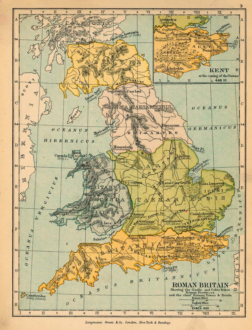
English: Map of Roman Britain in 400. |
|||||
| Date | ||||||
| Source |
|
|||||
| Author |
|
|||||
| Permission (Reusing this file) |
|
|||||
| Other versions |
|
|||||

Captions
Items portrayed in this file
depicts
1905
File history
Click on a date/time to view the file as it appeared at that time.
| Date/Time | Thumbnail | Dimensions | User | Comment | |
|---|---|---|---|---|---|
| current | 15:35, 3 December 2005 | | 880 × 1,152 (306 KB) | Migdejong | Map of the isle Great Brittain in the year 410. Image comes from the University of Texas at Austin: http://geography.about.com/gi/dynamic/offsite.htm?site=http://www.lib.utexas.edu/maps/historical/history%5Feurope.html Map is released into the publi |
File usage
Global file usage
The following other wikis use this file:
- Usage on da.wikipedia.org
- Usage on es.wikipedia.org
- Usage on et.wikipedia.org
- Usage on fr.wikipedia.org
- Usage on it.wikipedia.org
Metadata
This file contains additional information, probably added from the digital camera or scanner used to create or digitize it.
If the file has been modified from its original state, some details may not fully reflect the modified file.
| Orientation | Normal |
|---|---|
| Horizontal resolution | 300 dpi |
| Vertical resolution | 300 dpi |
| Software used | Adobe Photoshop 7.0 |
| File change date and time | 14:07, 25 September 2003 |
| Color space | Uncalibrated |