File:River_Tamar_map.png
From Wikipedia, the free encyclopedia
Size of this preview: 479 × 600 pixels. Other resolutions: 192 × 240 pixels | 383 × 480 pixels | 613 × 768 pixels | 818 × 1,024 pixels | 1,503 × 1,882 pixels.
Original file (1,503 × 1,882 pixels, file size: 2.08 MB, MIME type: image/png)
| This is a file from the Wikimedia Commons. Information from its description page there is shown below. Commons is a freely licensed media file repository. You can help. |
Summary
| DescriptionRiver Tamar map.png |
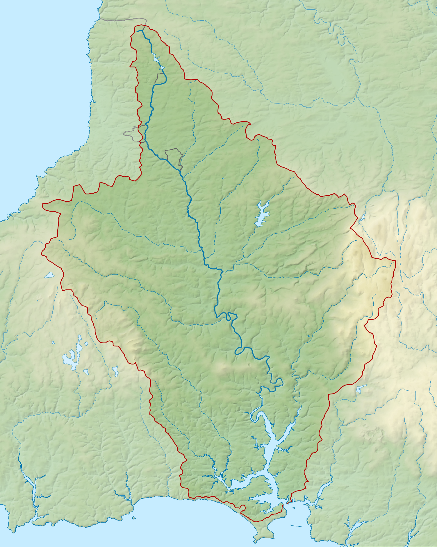
English: Map of the River Tamar and its catchment in Devon and Cornwall, UK. |
| Date | |
| Source |
|
| Author | Nilfanion, created using Ordnance Survey data |
| Permission (Reusing this file) |
This file is licensed under the Creative Commons Attribution-Share Alike 3.0 Unported license. Attribution: Contains Ordnance Survey data © Crown copyright and database right
|
Captions
Add a one-line explanation of what this file represents
Items portrayed in this file
depicts
21 February 2014
File history
Click on a date/time to view the file as it appeared at that time.
| Date/Time | Thumbnail | Dimensions | User | Comment | |
|---|---|---|---|---|---|
| current | 22:36, 21 February 2014 | | 1,503 × 1,882 (2.08 MB) | Nilfanion | == {{int:filedesc}} == {{Information |Description= {{en|Map of the River Tamar and its catchment in Devon and Cornwall, UK.}} |Source=Ordnance Survey [https://www.ordnancesurvey.co.uk/opendatadownload/products.html OpenData]. *Rel... |
File usage
The following pages on the English Wikipedia use this file (pages on other projects are not listed):
Global file usage
The following other wikis use this file:
- Usage on de.wikipedia.org
- Usage on es.wikipedia.org
- Usage on fa.wikipedia.org
- Usage on fi.wikipedia.org
- Usage on hu.wikipedia.org
- Usage on io.wikipedia.org
- Usage on nl.wikipedia.org
- Usage on www.wikidata.org
- Usage on zh.wikipedia.org
Metadata
This file contains additional information, probably added from the digital camera or scanner used to create or digitize it.
If the file has been modified from its original state, some details may not fully reflect the modified file.
| Horizontal resolution | 67.32 dpc |
|---|---|
| Vertical resolution | 67.32 dpc |
| File change date and time | 23:25, 13 February 2014 |
Retrieved from "https://en.wikipedia.org/wiki/File:River_Tamar_map.png"