File:River_Misbourne_in_Denham_Country_Park_-_geograph.org.uk_-_854924.jpg
From Wikipedia, the free encyclopedia
No higher resolution available.
River_Misbourne_in_Denham_Country_Park_-_geograph.org.uk_-_854924.jpg (640 × 480 pixels, file size: 152 KB, MIME type: image/jpeg)
| This is a file from the Wikimedia Commons. Information from its description page there is shown below. Commons is a freely licensed media file repository. You can help. |
Summary
| DescriptionRiver Misbourne in Denham Country Park - geograph.org.uk - 854924.jpg |
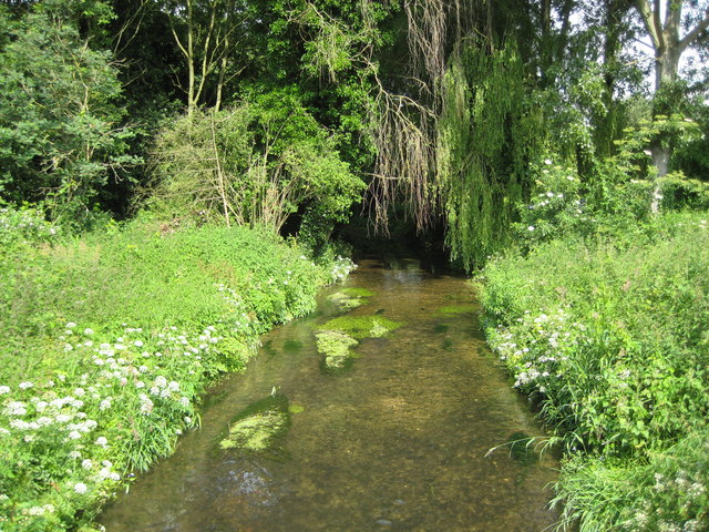
English: River Misbourne in Denham Country Park The Misbourne is a chalk stream that rises northwest of Great Missenden in SP8902 and runs for about 23 kilometres, as the crow flies, before ending where it joins the River Colne in TQ0585. Here, only about 1 kilometre upstream of the confluence with the Colne, it is still very shallow. This view was taken from the Denham Court Drive bridge. |
| Date | |
| Source | From geograph.org.uk |
| Author | Nigel Cox |
| Attribution (required by the license) InfoField | Nigel Cox / River Misbourne in Denham Country Park / |
InfoField | Nigel Cox / River Misbourne in Denham Country Park |
| Camera location | 51° 33′ 59″ N, 0° 29′ 20″ W | View this and other nearby images on: OpenStreetMap |
|---|
| Object location | 51° 33′ 59″ N, 0° 29′ 20″ W | View this and other nearby images on: OpenStreetMap |
|---|
Licensing

|
This image was taken from the Geograph project collection. See this photograph's page on the Geograph website for the photographer's contact details. The copyright on this image is owned by Nigel Cox and is licensed for reuse under the Creative Commons Attribution-ShareAlike 2.0 license.
|
This file is licensed under the Creative Commons Attribution-Share Alike 2.0 Generic license.
Attribution: Nigel Cox
- You are free:
- to share – to copy, distribute and transmit the work
- to remix – to adapt the work
- Under the following conditions:
- attribution – You must give appropriate credit, provide a link to the license, and indicate if changes were made. You may do so in any reasonable manner, but not in any way that suggests the licensor endorses you or your use.
- share alike – If you remix, transform, or build upon the material, you must distribute your contributions under the same or compatible license as the original.
Captions
Add a one-line explanation of what this file represents
Items portrayed in this file
depicts
some value
17 June 2008
51°33'58.7"N, 0°29'20.4"W
51°33'58.7"N, 0°29'20.4"W
File history
Click on a date/time to view the file as it appeared at that time.
| Date/Time | Thumbnail | Dimensions | User | Comment | |
|---|---|---|---|---|---|
| current | 03:08, 21 February 2011 | | 640 × 480 (152 KB) | GeographBot | == {{int:filedesc}} == {{Information |description={{en|1=River Misbourne in Denham Country Park The Misbourne is a chalk stream that rises northwest of Great Missenden in SP8902 and runs for about 23 kilometres, as the crow flies, before ending where |
File usage
The following pages on the English Wikipedia use this file (pages on other projects are not listed):
Global file usage
The following other wikis use this file:
- Usage on ceb.wikipedia.org
- Usage on uz.wikipedia.org
- Usage on www.wikidata.org
Metadata
This file contains additional information, probably added from the digital camera or scanner used to create or digitize it.
If the file has been modified from its original state, some details may not fully reflect the modified file.
| _error | 0 |
|---|