File:RepublicanRiver1947.jpg
From Wikipedia, the free encyclopedia
Size of this preview: 800 × 442 pixels. Other resolutions: 320 × 177 pixels | 640 × 354 pixels | 1,024 × 566 pixels | 1,280 × 707 pixels | 2,560 × 1,415 pixels | 4,039 × 2,232 pixels.
Original file (4,039 × 2,232 pixels, file size: 700 KB, MIME type: image/jpeg)
| This is a file from the Wikimedia Commons. Information from its description page there is shown below. Commons is a freely licensed media file repository. You can help. |
Summary
| DescriptionRepublicanRiver1947.jpg |
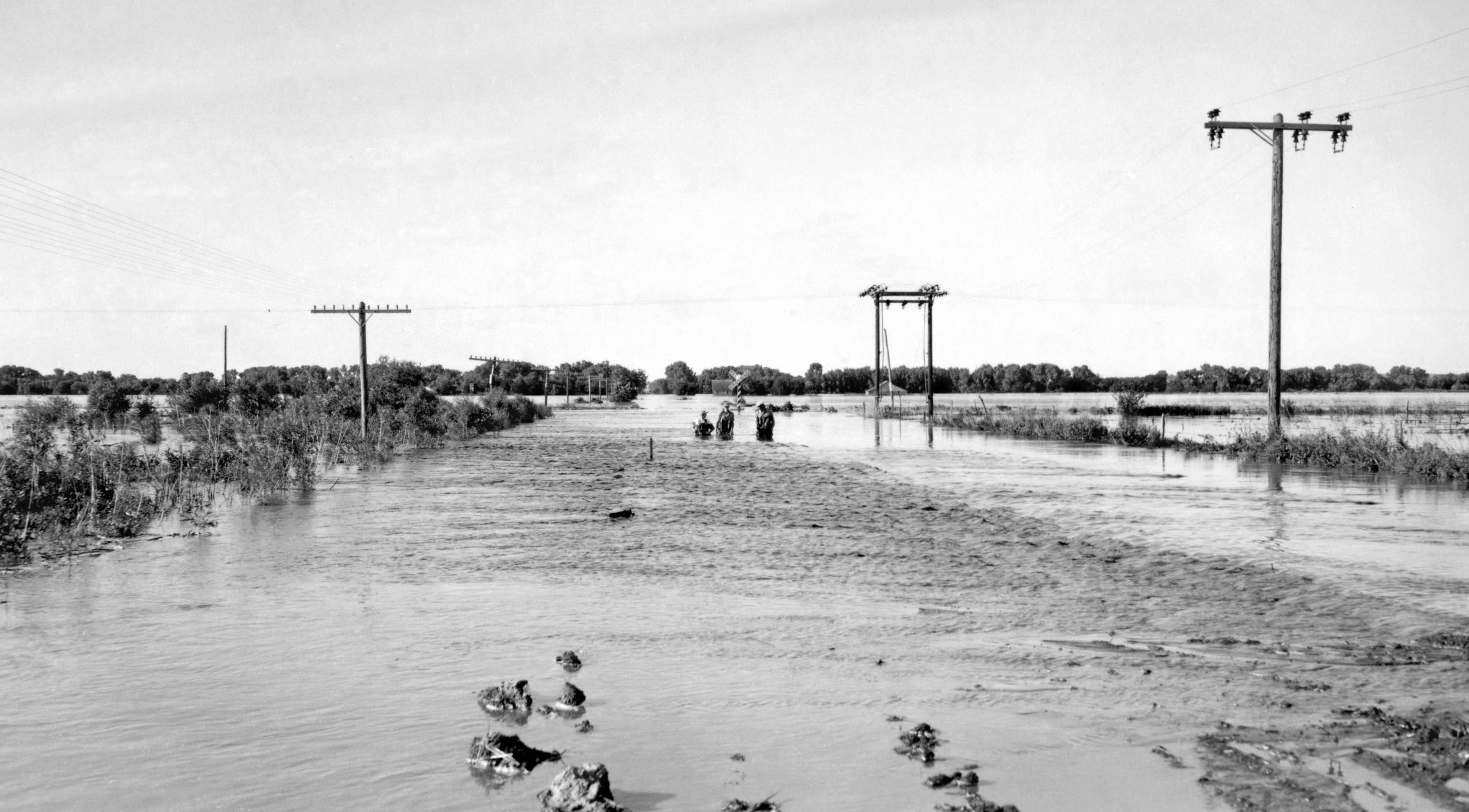
English: June 24, 1947 flood of the Republican River on the border of Jewell County, Kansas and Republic County, Kansas near Hardy, Nebraska and Webber, Kansas, just south of Nebraska NE-8 on Kansas 1 Rd/CR-1 bridge over the Republican River. The normal flood stage for the river is at the tree line in the foreground. |
| Date | Taken on 24 June 1947 |
| Source | USGS Surface Water Photo Gallery, item 18 09 |
| Author | J.G. Connor (submitted to USGS by Steve Blanchard, OSW) |
Licensing
| Public domainPublic domainfalsefalse |
This image is in the public domain in the United States because it only contains materials that originally came from the United States Geological Survey, an agency of the United States Department of the Interior. For more information, see the official USGS copyright policy.
Bahasa Indonesia ∙ català ∙ čeština ∙ Deutsch ∙ eesti ∙ English ∙ español ∙ français ∙ galego ∙ italiano ∙ Nederlands ∙ português ∙ polski ∙ sicilianu ∙ suomi ∙ Tiếng Việt ∙ Türkçe ∙ български ∙ македонски ∙ русский ∙ മലയാളം ∙ 한국어 ∙ 日本語 ∙ 中文 ∙ 中文(简体) ∙ 中文(繁體) ∙ العربية ∙ فارسی ∙ +/− |
Original upload log
The original description page was here. All following user names refer to en.wikipedia.
- 2008-09-04 00:03 Suntag 4176×2384× (607863 bytes)
Captions
Add a one-line explanation of what this file represents
Items portrayed in this file
depicts
24 June 1947
File history
Click on a date/time to view the file as it appeared at that time.
| Date/Time | Thumbnail | Dimensions | User | Comment | |
|---|---|---|---|---|---|
| current | 22:21, 26 September 2013 | | 4,039 × 2,232 (700 KB) | Centpacrr | Rotate 2.5º CCW & crop; adjust gamma; "flyspeck" and otherwise cleanup image |
| 19:15, 31 December 2008 |  | 4,176 × 2,384 (594 KB) | Urdangaray | {{Information |Description={{en|June 24, 1947 flood of the en:Republican River on the border of en:Jewell County, Kansas and en:Republic County, Kansas near en:Hardy, Nebraska and en:Webber, Kansas, just south of Nebraska NE-8 on |
File usage
The following pages on the English Wikipedia use this file (pages on other projects are not listed):
Global file usage
The following other wikis use this file:
- Usage on arz.wikipedia.org
- Usage on ceb.wikipedia.org
- Usage on chy.wikipedia.org
- Usage on de.wikipedia.org
- Usage on es.wikipedia.org
- Usage on fr.wikipedia.org
- Usage on incubator.wikimedia.org
- Usage on ja.wikipedia.org
- Usage on simple.wikipedia.org
- Usage on www.wikidata.org
Metadata
This file contains additional information, probably added from the digital camera or scanner used to create or digitize it.
If the file has been modified from its original state, some details may not fully reflect the modified file.
| Width | 4,176 px |
|---|---|
| Height | 2,384 px |
| Bits per component |
|
| Pixel composition | RGB |
| Orientation | Normal |
| Number of components | 3 |
| Horizontal resolution | 800 dpi |
| Vertical resolution | 800 dpi |
| Software used | Adobe Photoshop CS5 Macintosh |
| File change date and time | 18:19, 26 September 2013 |
| Exif version | 2.21 |
| Color space | Uncalibrated |
| Date and time of digitizing | 13:14, 26 September 2013 |
| Date metadata was last modified | 14:19, 26 September 2013 |
| Unique ID of original document | xmp.did:0180117407206811B1A4D4FAEB33425F |
Retrieved from "https://en.wikipedia.org/wiki/File:RepublicanRiver1947.jpg"