File:Prague-East_District_2007_names_PH_CZ.png
From Wikipedia, the free encyclopedia
Size of this preview: 596 × 600 pixels. Other resolutions: 238 × 240 pixels | 477 × 480 pixels | 954 × 960 pixels.
Original file (954 × 960 pixels, file size: 169 KB, MIME type: image/png)
| This is a file from the Wikimedia Commons. Information from its description page there is shown below. Commons is a freely licensed media file repository. You can help. |
Summary
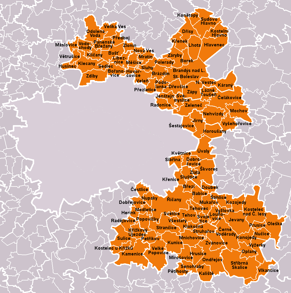
| DescriptionPrague-East District 2007 names PH CZ.png |
Čeština: Obce okresu Praha-východ dle stavu k 1. lednu 2007 (110 obcí). Bílé linie o různé tloušťce představují hranice obcí, správních obvodů, okresů a krajů.
English: Municipalities of Prague-East District as of January 1, 2007 (110 municipalities in total). White lines of variable thickness show boundaries of municipalities, administrative areas, districts and regions. |
| Date | |
| Source | Own work based on File:Prague-East_District_2007_PH_CZ.png |
| Author | User:Miaow Miaow |
| Permission (Reusing this file) |
PD-self |
| Other versions |
|


Licensing
| Public domainPublic domainfalsefalse |
| I, the copyright holder of this work, release this work into the public domain. This applies worldwide. In some countries this may not be legally possible; if so: I grant anyone the right to use this work for any purpose, without any conditions, unless such conditions are required by law. |
Captions
Add a one-line explanation of what this file represents
Items portrayed in this file
depicts
May 2010
File history
Click on a date/time to view the file as it appeared at that time.
| Date/Time | Thumbnail | Dimensions | User | Comment | |
|---|---|---|---|---|---|
| current | 20:03, 5 May 2010 | | 954 × 960 (169 KB) | Miaow Miaow | {{Information |Description={{cs|Obce '''okresu Praha-východ''' dle stavu k 1. lednu 2007 (110 obcí). Bílé linie o různé tloušťce představují hranice obcí, správních obvodů, okresů a krajů.}} {{en|Municipalities |
File usage
The following pages on the English Wikipedia use this file (pages on other projects are not listed):
Global file usage
The following other wikis use this file:
- Usage on azb.wikipedia.org
- Usage on bg.wikipedia.org
- Usage on ceb.wikipedia.org
- Usage on cs.wikipedia.org
- Usage on de.wikipedia.org
- Usage on eo.wikipedia.org
- Usage on es.wikipedia.org
- Usage on fa.wikipedia.org
- Usage on frr.wikipedia.org
- Usage on hu.wikipedia.org
- Usage on it.wikipedia.org
- Usage on ka.wikipedia.org
- Usage on ko.wikipedia.org
- Usage on ms.wikipedia.org
- Usage on nl.wikipedia.org
- Usage on pl.wikipedia.org
- Usage on pnb.wikipedia.org
- Usage on ru.wikipedia.org
- Usage on sk.wikipedia.org
- Usage on sv.wikipedia.org
- Usage on uk.wikipedia.org
- Usage on war.wikipedia.org
- Usage on xmf.wikipedia.org
- Usage on zh.wikipedia.org