File:Nevşehir_districts.png
From Wikipedia, the free encyclopedia
Size of this preview: 787 × 599 pixels. Other resolutions: 315 × 240 pixels | 630 × 480 pixels | 1,011 × 770 pixels.
Original file (1,011 × 770 pixels, file size: 28 KB, MIME type: image/png)
| This is a file from the Wikimedia Commons. Information from its description page there is shown below. Commons is a freely licensed media file repository. You can help. |
Summary
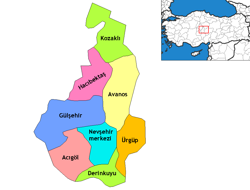
| DescriptionNevşehir districts.png | Map of the districts of Nevşehir province in Turkey. Created by Rarelibra 16:38, 4 December 2006 (UTC) for public domain use, using MapInfo Professional v8.5 and various mapping resources. Edited by One Homo Sapiens Corrected text where İ,Ş,ı,ğ,or ş occurs in name. Source: [statoids-com]. Increased font size and enhanced color differences among adjacent districts. |
| Date | 15 April 2007 (original upload date) |
| Source | No machine-readable source provided. Own work assumed (based on copyright claims). |
| Author | No machine-readable author provided. Denizz~commonswiki assumed (based on copyright claims). |
Licensing
| Public domainPublic domainfalsefalse |
| I, the copyright holder of this work, release this work into the public domain. This applies worldwide. In some countries this may not be legally possible; if so: I grant anyone the right to use this work for any purpose, without any conditions, unless such conditions are required by law. |
derivative works
Derivative works of this file:
- Nevsehir districts Acigol.png
- Nevsehir districts Gulsehir.png
- Nevsehir districts Hacibektas.png
- Nevsehir districts Kozakli.png
Captions
Add a one-line explanation of what this file represents
Nevşehir haritası
Items portrayed in this file
depicts
15 April 2007
image/png
29,045 byte
770 pixel
1,011 pixel
d47b6fda5696b9753adecb4ade690ca062869f0c
File history
Click on a date/time to view the file as it appeared at that time.
| Date/Time | Thumbnail | Dimensions | User | Comment | |
|---|---|---|---|---|---|
| current | 23:40, 16 October 2009 | | 1,011 × 770 (28 KB) | ZooFari | Trimmed off border |
| 01:46, 29 December 2008 |  | 1,056 × 816 (29 KB) | One Homo Sapiens | Corrected text where İ,Ş,ı,ğ,or ş occurs in name. Source: [statoids-com]. Increased font size and enhanced color differences among adjacent districts. | |
| 21:42, 15 April 2007 |  | 1,056 × 816 (28 KB) | Denizz~commonswiki | == Summary == Map of the districts of Nevşehir province in Turkey. Created by Rarelibra 16:38, 4 December 2006 (UTC) for public domain use, using MapInfo Professional v8.5 and various mapping resources. == Licensing == {{PD-self}} |
File usage
The following pages on the English Wikipedia use this file (pages on other projects are not listed):
Global file usage
The following other wikis use this file:
- Usage on ar.wikipedia.org
- Usage on ast.wikipedia.org
- Usage on av.wikipedia.org
- Usage on az.wikipedia.org
- Usage on be.wikipedia.org
- Usage on ca.wikipedia.org
- Usage on ceb.wikipedia.org
- Usage on cs.wikipedia.org
- Usage on de.wikipedia.org
- Usage on diq.wikipedia.org
- Usage on en.wiktionary.org
- Usage on eo.wikipedia.org
- Usage on es.wikipedia.org
- Usage on eu.wikipedia.org
- Usage on fa.wikipedia.org
- Usage on fi.wikipedia.org
- Usage on fr.wikipedia.org
View more global usage of this file.
Retrieved from "https://en.wikipedia.org/wiki/File:Nevşehir_districts.png"