File:Nerr0315_-_Flickr_-_NOAA_Photo_Library.jpg
From Wikipedia, the free encyclopedia
Size of this preview: 800 × 528 pixels. Other resolutions: 320 × 211 pixels | 640 × 422 pixels | 1,024 × 676 pixels | 1,280 × 845 pixels | 1,788 × 1,180 pixels.
Original file (1,788 × 1,180 pixels, file size: 1.46 MB, MIME type: image/jpeg)
| This is a file from the Wikimedia Commons. Information from its description page there is shown below. Commons is a freely licensed media file repository. You can help. |
Summary
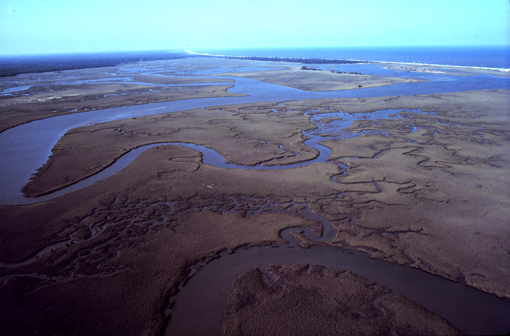
| DescriptionNerr0315 - Flickr - NOAA Photo Library.jpg | North Inlet - Winyah Bay National Estuarine Research Reserve. Aerial view of meandering tidal creeks and extensive pristine marshes in North Inlet Estuary. Vicinity of Georgetown, South Carolina. |
| Date | |
| Source | nerr0315 |
| Author | NOAA Photo Library |
Licensing
This file is licensed under the Creative Commons Attribution 2.0 Generic license.
- You are free:
- to share – to copy, distribute and transmit the work
- to remix – to adapt the work
- Under the following conditions:
- attribution – You must give appropriate credit, provide a link to the license, and indicate if changes were made. You may do so in any reasonable manner, but not in any way that suggests the licensor endorses you or your use.
| This image was originally posted to Flickr by NOAA Photo Library at https://www.flickr.com/photos/51647007@N08/5122950553. It was reviewed on 3 January 2013 by FlickreviewR and was confirmed to be licensed under the terms of the cc-by-2.0. |
3 January 2013
| Public domainPublic domainfalsefalse |
This image is in the public domain because it contains materials that originally came from the U.S. National Oceanic and Atmospheric Administration, taken or made as part of an employee's official duties.
العربية ∙ čeština ∙ Deutsch ∙ Zazaki ∙ English ∙ español ∙ eesti ∙ suomi ∙ français ∙ hrvatski ∙ magyar ∙ italiano ∙ 日本語 ∙ 한국어 ∙ македонски ∙ മലയാളം ∙ Plattdüütsch ∙ Nederlands ∙ polski ∙ português ∙ română ∙ русский ∙ sicilianu ∙ slovenščina ∙ Türkçe ∙ Tiếng Việt ∙ 简体中文 ∙ 繁體中文 ∙ +/− |
Captions
Add a one-line explanation of what this file represents
Items portrayed in this file
depicts
some value
28 October 2010
File history
Click on a date/time to view the file as it appeared at that time.
| Date/Time | Thumbnail | Dimensions | User | Comment | |
|---|---|---|---|---|---|
| current | 05:55, 8 January 2012 | | 1,788 × 1,180 (1.46 MB) | Kobac | {{Information |Description=North Inlet - Winyah Bay National Estuarine Research Reserve. Aerial view of meandering tidal creeks and extensive pristine marshes in North Inlet Estuary. Vicinity of Georgetown, South Carolina. |Source=[http://www.flickr.com/p |
File usage
The following pages on the English Wikipedia use this file (pages on other projects are not listed):
Global file usage
The following other wikis use this file:
- Usage on ceb.wikipedia.org
- Usage on www.wikidata.org
Metadata
This file contains additional information, probably added from the digital camera or scanner used to create or digitize it.
If the file has been modified from its original state, some details may not fully reflect the modified file.
| Credit/Provider | National Oceanic and Atmospheric Administration (NOAA), U.S. Department of Commerce. |
|---|---|
| Copyright holder |
|
| Exif version | 2.21 |
| Image width | 1,788 px |
| Image height | 1,180 px |
| Color space | Uncalibrated |
| Width | 1,788 px |
| Height | 1,180 px |
| Pixel composition | RGB |
| Number of components | 3 |
| Horizontal resolution | 72 dpi |
| Vertical resolution | 72 dpi |
| Bits per component |
|
| Date metadata was last modified | 07:02, 28 October 2010 |
| IIM version | 2 |