File:NSSL_Project_Vortex_-_Mobile_Radar_No.1_SE_of_Shamrock,_Texas.jpg
From Wikipedia, the free encyclopedia
Size of this preview: 800 × 519 pixels. Other resolutions: 320 × 208 pixels | 640 × 415 pixels | 1,024 × 664 pixels | 1,280 × 830 pixels | 1,832 × 1,188 pixels.
Original file (1,832 × 1,188 pixels, file size: 1.1 MB, MIME type: image/jpeg)
| This is a file from the Wikimedia Commons. Information from its description page there is shown below. Commons is a freely licensed media file repository. You can help. |
Summary
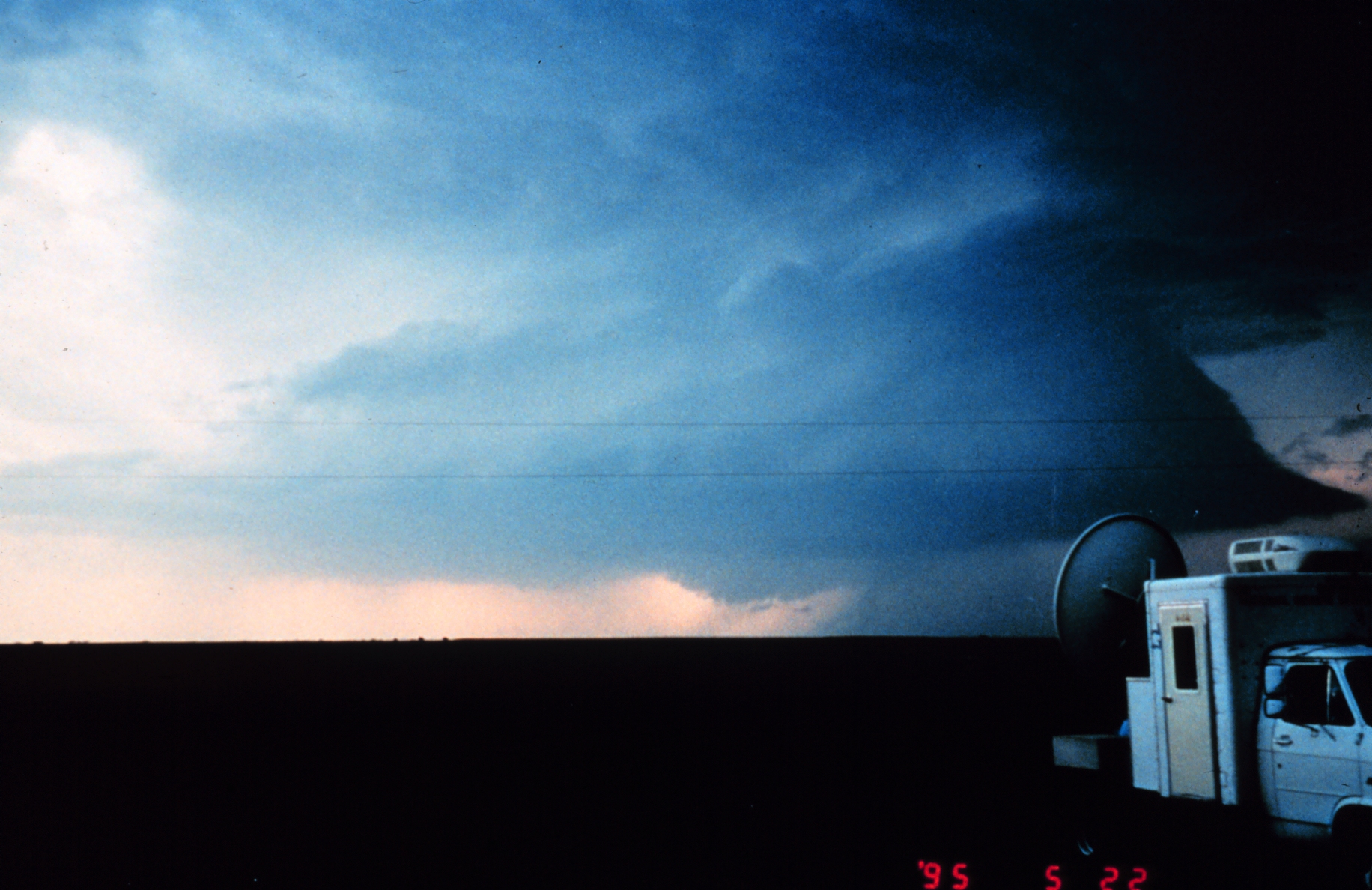
| DescriptionNSSL Project Vortex - Mobile Radar No.1 SE of Shamrock, Texas.jpg |
English: A mobile Doppler radar station (Doppler radar on wheels/DOW) southeast of Shamrock, Texas used in the first VORTEX project by the National Severe Storms Laboratory to study tornadoes. |
| Date | |
| Source | http://www.photolib.noaa.gov/htmls/nssl0156.htm |
| Author | NOAA Photo Library, NOAA Central Library; OAR/ERL/National Severe Storms Laboratory (NSSL) |
| Other versions | File:Tonado chasse NSSL.png - assembled with File:Project Vortex- filming a potentially tornadogenic storm.jpg |
Licensing
| Public domainPublic domainfalsefalse |
This image is in the public domain because it contains materials that originally came from the U.S. National Oceanic and Atmospheric Administration, taken or made as part of an employee's official duties.
العربية ∙ čeština ∙ Deutsch ∙ Zazaki ∙ English ∙ español ∙ eesti ∙ suomi ∙ français ∙ hrvatski ∙ magyar ∙ italiano ∙ 日本語 ∙ 한국어 ∙ македонски ∙ മലയാളം ∙ Plattdüütsch ∙ Nederlands ∙ polski ∙ português ∙ română ∙ русский ∙ sicilianu ∙ slovenščina ∙ Türkçe ∙ Tiếng Việt ∙ 简体中文 ∙ 繁體中文 ∙ +/− |
Captions
Add a one-line explanation of what this file represents
Items portrayed in this file
depicts
22 May 1995
File history
Click on a date/time to view the file as it appeared at that time.
| Date/Time | Thumbnail | Dimensions | User | Comment | |
|---|---|---|---|---|---|
| current | 01:34, 12 February 2012 | | 1,832 × 1,188 (1.1 MB) | OjdvQ9fNJWl |
File usage
No pages on the English Wikipedia use this file (pages on other projects are not listed).