File:Messenia.jpg
From Wikipedia, the free encyclopedia
Messenia.jpg (409 × 414 pixels, file size: 154 KB, MIME type: image/jpeg)
| This is a file from the Wikimedia Commons. Information from its description page there is shown below. Commons is a freely licensed media file repository. You can help. |
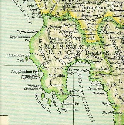
Map of Messenia, cropped from old public domain map of Greece, from the Perry-Castañeda Library Map Collection, The Historical Atlas by William R. Shepherd (1911) south, cropped from "Greece - Reference Map of Ancient Greece, Southern Part"" (825K) - https://maps.lib.utexas.edu/maps/historical/history_europe.html
| This image is a copy or a derivative work of ancient_greece_so_1926.jpg, from the map collection of the Perry–Castañeda Library (PCL) of the University of Texas at Austin.
This tag does not indicate the copyright status of the attached work. A normal copyright tag is still required. See Commons:Licensing for more information. |
|
This is a faithful photographic reproduction of a two-dimensional, public domain work of art. The work of art itself is in the public domain for the following reason:
The official position taken by the Wikimedia Foundation is that "faithful reproductions of two-dimensional public domain works of art are public domain".
This photographic reproduction is therefore also considered to be in the public domain in the United States. In other jurisdictions, re-use of this content may be restricted; see Reuse of PD-Art photographs for details. | |||||
Captions
Items portrayed in this file
depicts
image/jpeg
File history
Click on a date/time to view the file as it appeared at that time.
| Date/Time | Thumbnail | Dimensions | User | Comment | |
|---|---|---|---|---|---|
| current | 16:27, 25 January 2022 | | 409 × 414 (154 KB) | Amitchell125 | same source, sharper image of a larger size |
| 11:38, 27 April 2019 |  | 479 × 508 (85 KB) | Hohum | Colour adjust | |
| 08:31, 12 December 2006 |  | 479 × 508 (101 KB) | Roke~commonswiki | Map of Messenia, cropped from old public domain map of Greece, from the Perry-Castañeda Library Map Collection, Historical Atlas by William R. Shepherd [http://www.lib.utexas.edu/maps/historical/shepherd/greece_ancient_n_ref_1926.jpg north], [http://www. |
File usage
Global file usage
The following other wikis use this file:
- Usage on als.wikipedia.org
- Usage on ar.wikipedia.org
- Usage on azb.wikipedia.org
- Usage on bg.wikipedia.org
- Usage on ca.wikipedia.org
- Usage on cs.wikipedia.org
- Usage on de.wikipedia.org
- Usage on el.wikipedia.org
- Usage on en.wiktionary.org
- Usage on es.wikipedia.org
- Usage on it.wikipedia.org
- Usage on ja.wikipedia.org
- Usage on ka.wikipedia.org
- Usage on ko.wikipedia.org
- Usage on nl.wikipedia.org
- Usage on nn.wikipedia.org
- Usage on ru.wikipedia.org
- Usage on sk.wikipedia.org
- Usage on sr.wikipedia.org
- Usage on sv.wikipedia.org
- Usage on ta.wikipedia.org
- Usage on uk.wikipedia.org
- Usage on www.wikidata.org
Metadata
This file contains additional information, probably added from the digital camera or scanner used to create or digitize it.
If the file has been modified from its original state, some details may not fully reflect the modified file.
| Date and time of data generation | 16:21, 25 January 2022 |
|---|---|
| Orientation | Normal |
| Horizontal resolution | 150 dpi |
| Vertical resolution | 150 dpi |
| Software used | Windows Photo Editor 10.0.10011.16384 |
| File change date and time | 16:25, 25 January 2022 |
| Date and time of digitizing | 16:21, 25 January 2022 |
| DateTimeOriginal subseconds | 98 |
| DateTimeDigitized subseconds | 98 |
| Color space | sRGB |
| IIM version | 2 |