File:Map_of_Iranian_Kurdistan.png
From Wikipedia, the free encyclopedia
No higher resolution available.
Map_of_Iranian_Kurdistan.png (723 × 599 pixels, file size: 130 KB, MIME type: image/png)
| This is a file from the Wikimedia Commons. Information from its description page there is shown below. Commons is a freely licensed media file repository. You can help. |
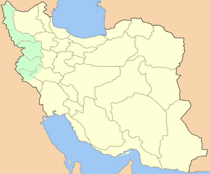
The factual accuracy of this map or the file name is disputed.
Reason: The northern and eastern part of West Azerbaijan province is known to be dominated by Azeri majority. There is no source for the boundaries inside Lorestan and Ilam provinces. |  |
Summary
| DescriptionMap of Iranian Kurdistan.png |
English: Blank locator map (orthographic projection) of Iranian Kurdistan. |
| Date | |
| Source | Own work; self-made from File:Iran locator.png. |
| Author | Persia2099. |
Licensing
I, Persia2099, the copyright holder of this work, hereby publishes it under the following licenses:

|
Permission is granted to copy, distribute and/or modify this document under the terms of the GNU Free Documentation License, Version 1.2 or any later version published by the Free Software Foundation; with no Invariant Sections, no Front-Cover Texts, and no Back-Cover Texts. A copy of the license is included in the section entitled GNU Free Documentation License.http://www.gnu.org/copyleft/fdl.htmlGFDLGNU Free Documentation Licensetruetrue |
| This file is licensed under the Creative Commons Attribution-Share Alike 3.0 Unported license. | ||
| Attribution: I, Persia2099 | ||
| ||
| This licensing tag was added to this file as part of the GFDL licensing update.http://creativecommons.org/licenses/by-sa/3.0/CC BY-SA 3.0Creative Commons Attribution-Share Alike 3.0truetrue |
This file is licensed under the Creative Commons Attribution-Share Alike 2.5 Generic license.
Attribution: I, Persia2099
- You are free:
- to share – to copy, distribute and transmit the work
- to remix – to adapt the work
- Under the following conditions:
- attribution – You must give appropriate credit, provide a link to the license, and indicate if changes were made. You may do so in any reasonable manner, but not in any way that suggests the licensor endorses you or your use.
- share alike – If you remix, transform, or build upon the material, you must distribute your contributions under the same or compatible license as the original.
You may select the license of your choice.
Captions
Add a one-line explanation of what this file represents
Le Kurdistan iranien, en vert
11 February 2010
image/png
File history
Click on a date/time to view the file as it appeared at that time.
| Date/Time | Thumbnail | Dimensions | User | Comment | |
|---|---|---|---|---|---|
| current | 16:15, 4 May 2023 | | 723 × 599 (130 KB) | HistoryofIran | rv, disruption |
| 05:32, 3 May 2023 |  | 869 × 720 (197 KB) | Benturk ato | Reverted to version as of 07:41, 25 April 2021 (UTC) | |
| 18:18, 28 April 2021 |  | 723 × 599 (130 KB) | HistoryofIran | rv, disruptive | |
| 07:41, 25 April 2021 |  | 869 × 720 (197 KB) | Mahammad tt | ||
| 19:03, 11 February 2010 |  | 723 × 599 (130 KB) | Bahramm 2 | Reverted to version as of 18:34, 11 February 2010 | |
| 18:53, 11 February 2010 |  | 1,024 × 849 (97 KB) | Elmju | == {{int:filedesc}} == {{Information |Description=Kurdistan |Source={{Own}} |Date= |Author=Elmju }} == {{int:license}} == {{self|GFDL|cc-by-sa-3.0}} Category:Maps of Iran <!--{{ImageUpload|basic}}--> | |
| 18:34, 11 February 2010 |  | 723 × 599 (130 KB) | Persia2099 | {{Information |Description={{en|1=Blank locator map (orthographic projection) of Iran (Region of Kurdistan)<br/> '''Iranian Kurdistan'''}} |Source=self-made from [http://upload.wikimedia.org/wikipedia/commons/8/89/Iran_locator.png] |Author=[[User:Persia20 |
File usage
The following pages on the English Wikipedia use this file (pages on other projects are not listed):
Global file usage
The following other wikis use this file:
- Usage on ar.wikipedia.org
- Usage on bg.wikipedia.org
- Usage on ckb.wikipedia.org
- Usage on de.wikipedia.org
- Usage on eu.wikipedia.org
- Usage on fa.wikipedia.org
- Usage on fr.wikipedia.org
- Usage on hu.wikipedia.org
- Usage on ku.wikipedia.org
- Usage on pt.wikipedia.org
- Usage on tr.wikipedia.org
- Usage on www.wikidata.org
Metadata
This file contains additional information, probably added from the digital camera or scanner used to create or digitize it.
If the file has been modified from its original state, some details may not fully reflect the modified file.
| Horizontal resolution | 28.35 dpc |
|---|---|
| Vertical resolution | 28.35 dpc |
Retrieved from "https://en.wikipedia.org/wiki/File:Map_of_Iranian_Kurdistan.png"