File:Map_de-be_friedrichstadt.png
From Wikipedia, the free encyclopedia
Size of this preview: 549 × 599 pixels. Other resolutions: 220 × 240 pixels | 440 × 480 pixels | 985 × 1,075 pixels.
Original file (985 × 1,075 pixels, file size: 353 KB, MIME type: image/png)
| This is a file from the Wikimedia Commons. Information from its description page there is shown below. Commons is a freely licensed media file repository. You can help. |
| DescriptionMap de-be friedrichstadt.png | |||
| Source | Own work | ||
| Author | Jwnabd | ||
| Permission (Reusing this file) |
This file is licensed under the Creative Commons Attribution-Share Alike 3.0 Unported license.
|

| Camera location | 52° 30′ 37.4″ N, 13° 23′ 23.7″ E | View this and other nearby images on: OpenStreetMap |
|---|
Captions
Add a one-line explanation of what this file represents
Items portrayed in this file
depicts
52°30'37.400"N, 13°23'23.701"E
File history
Click on a date/time to view the file as it appeared at that time.
| Date/Time | Thumbnail | Dimensions | User | Comment | |
|---|---|---|---|---|---|
| current | 09:57, 2 November 2005 | | 985 × 1,075 (353 KB) | Jwnabd | |
| 18:26, 28 October 2005 |  | 985 × 1,075 (353 KB) | Jwnabd | ||
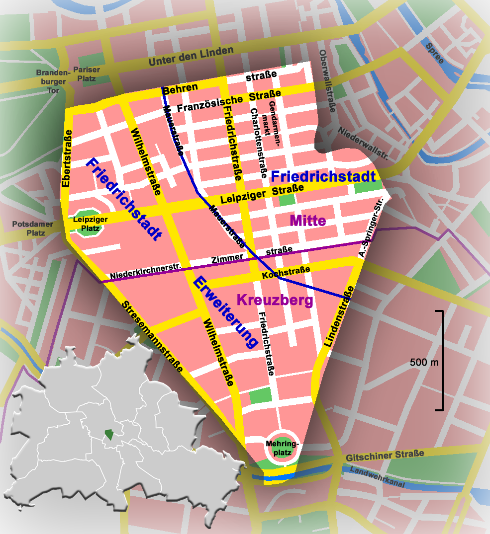
| 16:39, 28 October 2005 |  | 985 × 1,075 (351 KB) | Jwnabd | '''Deutsch:''' *'''Beschreibung :''' das Gebiet der historischen Friedrichstadt im heutigen Berlin, Deutschland *'''Quelle :''' selbst erstellt *'''Zeichner :''' Jwnabd *'''Datum :''' 28. Oktober 2005 '''English:''' *'' |
File usage
The following pages on the English Wikipedia use this file (pages on other projects are not listed):
Global file usage
The following other wikis use this file:
- Usage on da.wikipedia.org
- Usage on de.wikipedia.org
- Usage on de.wikinews.org
- Usage on it.wikipedia.org
- Usage on la.wikipedia.org
- Usage on no.wikipedia.org
- Usage on ru.wikipedia.org
- Usage on uk.wikipedia.org
Metadata
This file contains additional information, probably added from the digital camera or scanner used to create or digitize it.
If the file has been modified from its original state, some details may not fully reflect the modified file.
| Horizontal resolution | 28.35 dpc |
|---|---|
| Vertical resolution | 28.35 dpc |
Retrieved from "https://en.wikipedia.org/wiki/File:Map_de-be_friedrichstadt.png"