File:Madeira_location_(PT_and_EU).jpg
From Wikipedia, the free encyclopedia
Size of this preview: 714 × 600 pixels. Other resolutions: 286 × 240 pixels | 572 × 480 pixels | 915 × 768 pixels | 1,219 × 1,024 pixels | 2,048 × 1,720 pixels.
Original file (2,048 × 1,720 pixels, file size: 226 KB, MIME type: image/jpeg)
| This is a file from the Wikimedia Commons. Information from its description page there is shown below. Commons is a freely licensed media file repository. You can help. |

|
File:EU-Portugal with Madeira circled.svg is a vector version of this file. It should be used in place of this JPG file when not inferior.
File:Madeira location (PT and EU).jpg → File:EU-Portugal with Madeira circled.svg
For more information, see Help:SVG.
|
 |
Summary
| DescriptionMadeira location (PT and EU).jpg |
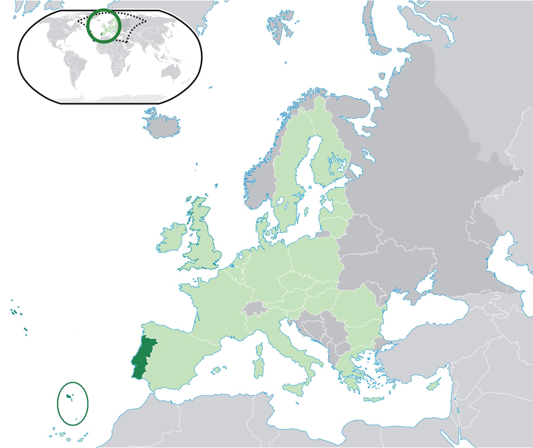
English: Location of Madeira Islands - Madeira Autonomous Region - (red), in Portugal (green) and in the European Union (blue).
Português: Localização da Madeira - Região Autónoma da Madeira - (vermelho), em Portugal (verde) e na União Europeia (azul)
Español: Localización de Madeira - Región Autónoma de Madeira - (rojo), en Portugal (verde) y en la Unión Europea |
| Date | |
| Source | Derivate from Location Portugal EU Europe.png |
| Author | It's a new modified file derivate from Location Portugal EU Europe.png |
Licensing

|
Permission is granted to copy, distribute and/or modify this document under the terms of the GNU Free Documentation License, Version 1.2 or any later version published by the Free Software Foundation; with no Invariant Sections, no Front-Cover Texts, and no Back-Cover Texts. A copy of the license is included in the section entitled GNU Free Documentation License.http://www.gnu.org/copyleft/fdl.htmlGFDLGNU Free Documentation Licensetruetrue |
| This file is licensed under the Creative Commons Attribution-Share Alike 3.0 Unported license. | ||
| ||
| This licensing tag was added to this file as part of the GFDL licensing update.http://creativecommons.org/licenses/by-sa/3.0/CC BY-SA 3.0Creative Commons Attribution-Share Alike 3.0truetrue |
Captions
Add a one-line explanation of what this file represents
Items portrayed in this file
depicts
28 January 2009
File history
Click on a date/time to view the file as it appeared at that time.
| Date/Time | Thumbnail | Dimensions | User | Comment | |
|---|---|---|---|---|---|
| current | 16:35, 3 April 2011 | | 2,048 × 1,720 (226 KB) | The Ogre | Correc t location of Madeira, since it must include the Savage islands |
| 16:26, 28 January 2009 |  | 1,736 × 1,478 (150 KB) | Maycoll F. Vieira | {{Information |Description={{en|1=Location of Madeira Islands - Madeira Autonomous Region - (red), in Portugal (green) and in the European Union (blue).}} {{pt|1=Localização da Madeira - Região Autónoma da Madeira - (vermelho), em Portugal (verde) e n |
File usage
The following pages on the English Wikipedia use this file (pages on other projects are not listed):
Global file usage
The following other wikis use this file:
- Usage on ta.wikinews.org
- Usage on uk.wikipedia.org
- Usage on yo.wikipedia.org
Metadata
This file contains additional information, probably added from the digital camera or scanner used to create or digitize it.
If the file has been modified from its original state, some details may not fully reflect the modified file.
| _error | 0 |
|---|
Retrieved from "https://en.wikipedia.org/wiki/File:Madeira_location_(PT_and_EU).jpg"
.jpg)