File:M-185_mile_0_on_Mackinac_Island_August_2004.jpg
From Wikipedia, the free encyclopedia
Size of this preview: 800 × 545 pixels. Other resolutions: 320 × 218 pixels | 640 × 436 pixels | 907 × 618 pixels.
Original file (907 × 618 pixels, file size: 597 KB, MIME type: image/jpeg)
| This is a file from the Wikimedia Commons. Information from its description page there is shown below. Commons is a freely licensed media file repository. You can help. |
Summary
|
This is an image of a place or building that is listed on the National Register of Historic Places in the United States of America. Its reference number is 66000397. |
| DescriptionM-185 mile 0 on Mackinac Island August 2004.jpg | |
| Date | 23 August 2004 (original upload date) |
| Source | Transferred from en.wikipedia |
| Author | Original uploader was Gsgeorge at en.wikipedia |
| Permission (Reusing this file) |
GFDL-WITH-DISCLAIMERS; Released under the GNU Free Documentation License. |
| Object location | 45° 51′ 51.06″ N, 84° 37′ 46.5″ W | View this and other nearby images on: OpenStreetMap |
|---|
Licensing
| This file is licensed under the Creative Commons Attribution-Share Alike 3.0 Unported license. Subject to disclaimers. | ||
| ||
| This licensing tag was added to this file as part of the GFDL licensing update.http://creativecommons.org/licenses/by-sa/3.0/CC BY-SA 3.0Creative Commons Attribution-Share Alike 3.0truetrue |

|
Permission is granted to copy, distribute and/or modify this document under the terms of the GNU Free Documentation License, Version 1.2 or any later version published by the Free Software Foundation; with no Invariant Sections, no Front-Cover Texts, and no Back-Cover Texts. A copy of the license is included in the section entitled GNU Free Documentation License. Subject to disclaimers.http://www.gnu.org/copyleft/fdl.htmlGFDLGNU Free Documentation Licensetruetrue |
Original upload log
The original description page was here. All following user names refer to en.wikipedia.
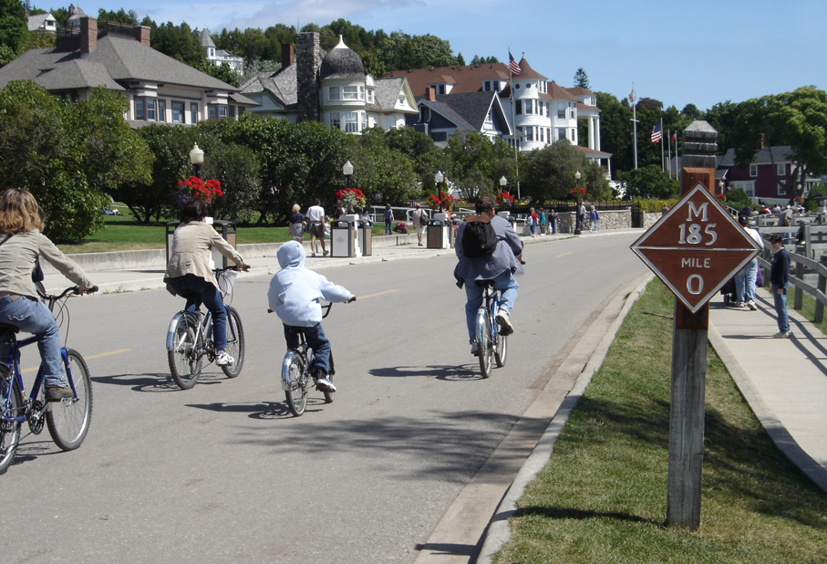
- 2004-08-23 18:29 Gsgeorge 907×618×8 (611197 bytes) Mile marker 0 on Michigan State Highway M-185, Mackinac Island, Michigan. Taken by me in August 2004.
Captions
Add a one-line explanation of what this file represents
Items portrayed in this file
depicts
23 August 2004
45°51'51.059"N, 84°37'46.499"W
File history
Click on a date/time to view the file as it appeared at that time.
| Date/Time | Thumbnail | Dimensions | User | Comment | |
|---|---|---|---|---|---|
| current | 18:24, 11 January 2008 | | 907 × 618 (597 KB) | TwinsMetsFan | {{Information |Description={{en|Mile marker 0 on Michigan State Highway M-185, Mackinac Island, Michigan. Taken by me in August 2004.}} |Source=Transferred from [http://en.wikipedia.org en.wikipedia] |Date=2004-08-23 (original upload date) |Author=Origin |
File usage
The following pages on the English Wikipedia use this file (pages on other projects are not listed):
- Healthy community design
- M-185 (Michigan highway)
- Mackinac Island
- Pedestrian zone
- User:Imzadi1979/Books/MISH
- User:Mr.Z-man.sock/testcase
- User talk:Imzadi1979/Archive 5
- Wikipedia:Today's featured article/July 12, 2014
- Wikipedia:Today's featured article/July 2014
- File talk:M185mackinac.jpg
- Portal:Michigan highways/Articles
- Portal:Michigan highways/Selected article/June 2012
- Portal:U.S. roads/Selected article
- Portal:U.S. roads/Selected article/April 1 2012
Global file usage
The following other wikis use this file:
- Usage on fr.wikipedia.org
- Discussion:Île Mackinac
- M-185
- Wikipédia:Statistiques des anecdotes de la page d'accueil/Visibilité des anecdotes (2018)
- Wikipédia:Statistiques des anecdotes de la page d'accueil/Visibilité des anecdotes (2018)/2018 12
- Projet:Aide et accueil/Twitter/Tweets/archives/décembre 2018
- Wikipédia:Le saviez-vous ?/Archives/2018
- Usage on kk.wikipedia.org
- Usage on nl.wikipedia.org
- Usage on ru.wikipedia.org
- Usage on sr.wikipedia.org
- Usage on ta.wikipedia.org
Metadata
This file contains additional information, probably added from the digital camera or scanner used to create or digitize it.
If the file has been modified from its original state, some details may not fully reflect the modified file.
| Camera manufacturer | SONY |
|---|---|
| Camera model | DSC-P93 |
| Exposure time | 1/320 sec (0.003125) |
| F-number | f/7.1 |
| ISO speed rating | 100 |
| Date and time of data generation | 13:17, 21 August 2004 |
| Lens focal length | 13.6 mm |
| Orientation | Normal |
| Horizontal resolution | 72 dpi |
| Vertical resolution | 72 dpi |
| Software used | Adobe Photoshop CS Macintosh |
| File change date and time | 14:27, 23 August 2004 |
| Y and C positioning | Co-sited |
| Exposure Program | Normal program |
| Exif version | 2.2 |
| Date and time of digitizing | 13:17, 21 August 2004 |
| Image compression mode | 8 |
| Exposure bias | 0 |
| Maximum land aperture | 3 APEX (f/2.83) |
| Metering mode | Pattern |
| Light source | Unknown |
| Flash | Flash did not fire, compulsory flash suppression |
| Color space | sRGB |
| Custom image processing | Normal process |
| Exposure mode | Auto exposure |
| White balance | Auto white balance |
| Scene capture type | Standard |
| Contrast | Normal |
| Saturation | Normal |
| Sharpness | Normal |