File:Locator_map_Iran_Khuzestan_Province.png
From Wikipedia, the free encyclopedia
No higher resolution available.
Locator_map_Iran_Khuzestan_Province.png (672 × 600 pixels, file size: 131 KB, MIME type: image/png)
| This is a file from the Wikimedia Commons. Information from its description page there is shown below. Commons is a freely licensed media file repository. You can help. |
Summary
| DescriptionLocator map Iran Khuzestan Province.png | |
| Date | |
| Source | Based on File:Iran location map.svg |
| Author | Original work by Uwe Dering. Highlighted by Dr. Blofeld |
Licensing
I, the copyright holder of this work, hereby publish it under the following licenses:
This file is licensed under the Creative Commons Attribution-Share Alike 3.0 Unported license.
- You are free:
- to share – to copy, distribute and transmit the work
- to remix – to adapt the work
- Under the following conditions:
- attribution – You must give appropriate credit, provide a link to the license, and indicate if changes were made. You may do so in any reasonable manner, but not in any way that suggests the licensor endorses you or your use.
- share alike – If you remix, transform, or build upon the material, you must distribute your contributions under the same or compatible license as the original.

|
Permission is granted to copy, distribute and/or modify this document under the terms of the GNU Free Documentation License, Version 1.2 or any later version published by the Free Software Foundation; with no Invariant Sections, no Front-Cover Texts, and no Back-Cover Texts. A copy of the license is included in the section entitled GNU Free Documentation License.http://www.gnu.org/copyleft/fdl.htmlGFDLGNU Free Documentation Licensetruetrue |
You may select the license of your choice.
Captions
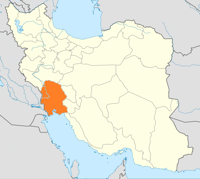
Map of Khuzestan province
نقشه استان خوزستان
Items portrayed in this file
depicts
9 July 2010
File history
Click on a date/time to view the file as it appeared at that time.
| Date/Time | Thumbnail | Dimensions | User | Comment | |
|---|---|---|---|---|---|
| current | 13:59, 23 June 2013 | | 672 × 600 (131 KB) | BasilLeaf | بروزرسانی مرزها |
| 19:25, 24 January 2011 |  | 672 × 600 (143 KB) | WikiDaisy | New version with Alborz province added. | |
| 10:49, 9 July 2010 |  | 672 × 600 (133 KB) | Dr. Blofeld~commonswiki | {{Information |Description={{en|1=k}} |Source=k |Author=k |Date=k |Permission= |other_versions= }} |
File usage
The following pages on the English Wikipedia use this file (pages on other projects are not listed):
Global file usage
The following other wikis use this file:
- Usage on ar.wikipedia.org
- الأهواز
- عبادان
- إقليم الأهواز
- دزفول
- المحمرة (مدينة)
- مسجد سليمان
- بهبهان
- السوس (مدينة)
- شوشان
- الفلاحية
- محافظة خوزستان
- الحويزة (مدينة)
- ميناء الإمام الخميني
- نهر الكرخة
- سد الكرخة
- رامهرمز
- قالب:محافظة خوزستان
- تستر
- العميدية
- يعقوب بن الليث الصفار
- مدرسة جنديسابور
- صالحية (إيران)
- أغاجارى
- قلعة خواجة
- أروندكنار
- إيذة
- شعيطة (رامشير)
- أبو شكر (مينوبار)
- مقاطعة الفلاحية
- الناحية المركزية لمقاطعة الفلاحية
- قسم خنافره، الفلاحية
- قرمه خروسي (خنافره)
- قيداري (خنافره)
- غياضي (خنافره)
- خروسي الشمالية (خنافره)
- ناصري (خنافره)
- رقبة (خنافره)
- شهرك المنتظري (خنافره)
- عبودي، الفلاحية
- البوجنام (الفلاحية)
- فية الشاوردي، الفلاحية
- الحدبه (الفلاحية)
- خروسي الجنوبية، الفلاحية
- المنصوري (الفلاحية)
- السراخية (الفلاحية)
- انتفاضة الأهواز 1979
- معشور
- باغ ملك
- قلعة تل
- صيدون (إيران)
View more global usage of this file.
Metadata
This file contains additional information, probably added from the digital camera or scanner used to create or digitize it.
If the file has been modified from its original state, some details may not fully reflect the modified file.
| Horizontal resolution | 37.8 dpc |
|---|---|
| Vertical resolution | 37.8 dpc |