File:Llandrillo_station_site_geograph-3755499-by-Ben-Brooksbank.jpg
From Wikipedia, the free encyclopedia
Size of this preview: 800 × 430 pixels. Other resolutions: 320 × 172 pixels | 640 × 344 pixels | 1,024 × 550 pixels | 1,280 × 687 pixels | 2,346 × 1,260 pixels.
Original file (2,346 × 1,260 pixels, file size: 2.28 MB, MIME type: image/jpeg)
| This is a file from the Wikimedia Commons. Information from its description page there is shown below. Commons is a freely licensed media file repository. You can help. |
Summary
| DescriptionLlandrillo station site geograph-3755499-by-Ben-Brooksbank.jpg |
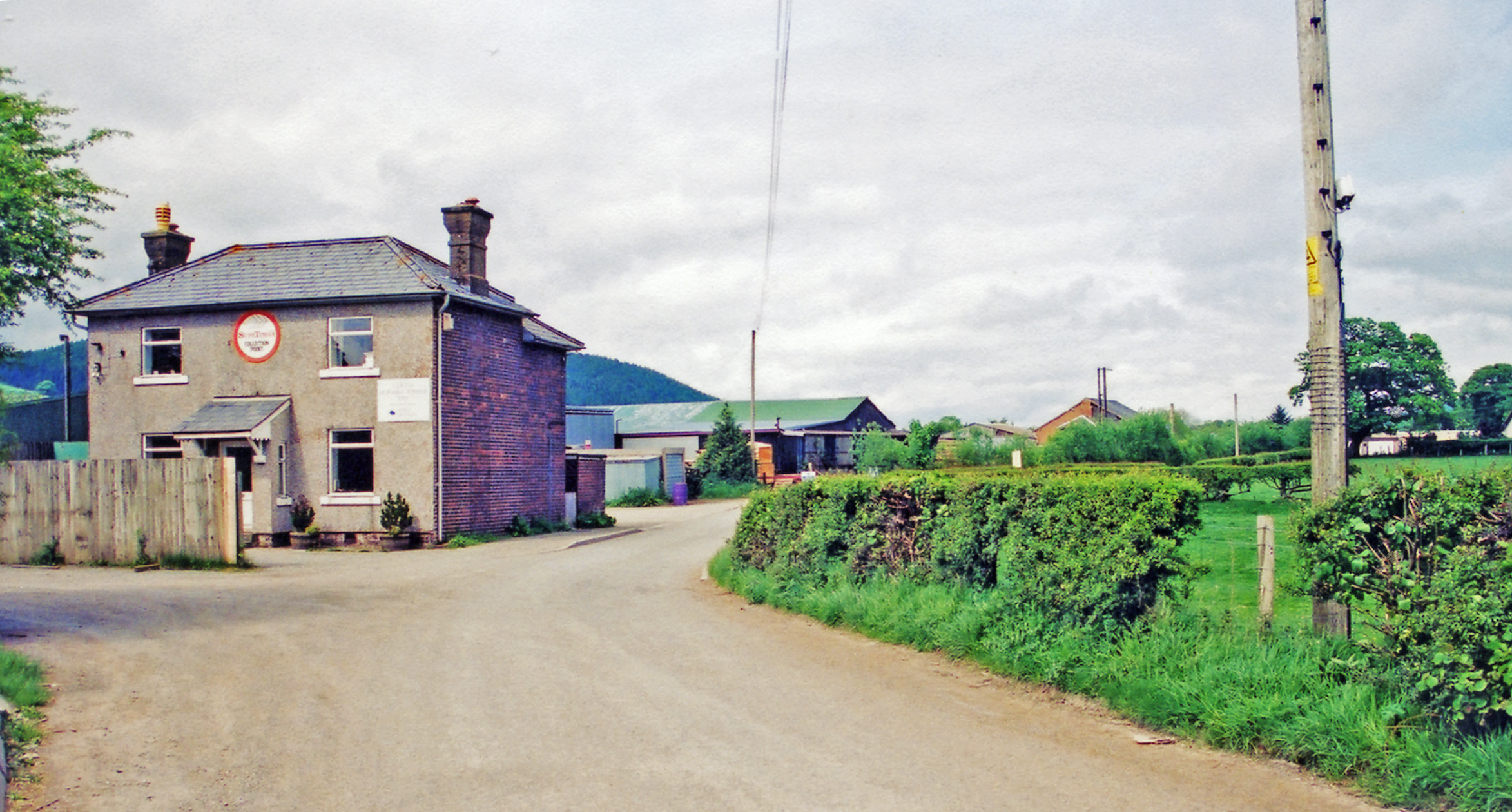
English: Llandrillo: site/remains of station, 2001. View northward, towards Corwen, Llangollen and Ruabon, where until closed by floods 14/12/64 and officially 18/1/65, the ex-GWR Ruabon - Llangollen - Corwen - Dolgellau - (Barmouth) line crossed, the station being on the left. |
| Date | |
| Source | From geograph.org.uk |
| Author | Ben Brooksbank |
| Permission (Reusing this file) |
Creative Commons Attribution Share-alike license 2.0 |
| Attribution (required by the license) InfoField | Ben Brooksbank / Llandrillo: site/remains of station, 2001 / |
InfoField | Ben Brooksbank / Llandrillo: site/remains of station, 2001 |
| Camera location | 52° 55′ 41.3″ N, 3° 26′ 53.88″ W | View this and other nearby images on: OpenStreetMap |
|---|
Licensing

|
This image was taken from the Geograph project collection. See this photograph's page on the Geograph website for the photographer's contact details. The copyright on this image is owned by Ben Brooksbank and is licensed for reuse under the Creative Commons Attribution-ShareAlike 2.0 license.
|
This file is licensed under the Creative Commons Attribution-Share Alike 2.0 Generic license.
Attribution: Ben Brooksbank
- You are free:
- to share – to copy, distribute and transmit the work
- to remix – to adapt the work
- Under the following conditions:
- attribution – You must give appropriate credit, provide a link to the license, and indicate if changes were made. You may do so in any reasonable manner, but not in any way that suggests the licensor endorses you or your use.
- share alike – If you remix, transform, or build upon the material, you must distribute your contributions under the same or compatible license as the original.
Captions
Add a one-line explanation of what this file represents
Items portrayed in this file
depicts
some value
26 May 2001
52°55'41.297"N, 3°26'53.876"W
File history
Click on a date/time to view the file as it appeared at that time.
| Date/Time | Thumbnail | Dimensions | User | Comment | |
|---|---|---|---|---|---|
| current | 14:07, 29 December 2013 | | 2,346 × 1,260 (2.28 MB) | Chevin | == {{int:filedesc}} == {{Information |Description={{en|1='''Llandrillo: site/remains of station, 2001.'''<br/> View northward, towards Corwen, Llangollen and Ruabon, where until closed by floods 14/12/64 and officially 18/1/65, the ex-GWR Ruabon - Llan... |
File usage
The following pages on the English Wikipedia use this file (pages on other projects are not listed):
Global file usage
The following other wikis use this file:
- Usage on arz.wikipedia.org
- Usage on www.wikidata.org
Metadata
This file contains additional information, probably added from the digital camera or scanner used to create or digitize it.
If the file has been modified from its original state, some details may not fully reflect the modified file.
| Orientation | Normal |
|---|---|
| Horizontal resolution | 157 dpc |
| Vertical resolution | 157 dpc |
| Software used | Adobe Photoshop Elements 3.0 Windows |
| File change date and time | 18:45, 24 November 2013 |
| Color space | sRGB |
| Image width | 2,346 px |
| Image height | 1,260 px |
| Date and time of digitizing | 18:45, 24 November 2013 |
| Date metadata was last modified | 18:45, 24 November 2013 |