File:Lake_sakakawea.jpg
From Wikipedia, the free encyclopedia
Size of this preview: 607 × 600 pixels. Other resolutions: 243 × 240 pixels | 486 × 480 pixels | 778 × 768 pixels | 1,037 × 1,024 pixels | 2,073 × 2,048 pixels | 3,904 × 3,856 pixels.
Original file (3,904 × 3,856 pixels, file size: 6.91 MB, MIME type: image/jpeg)
| This is a file from the Wikimedia Commons. Information from its description page there is shown below. Commons is a freely licensed media file repository. You can help. |
Summary
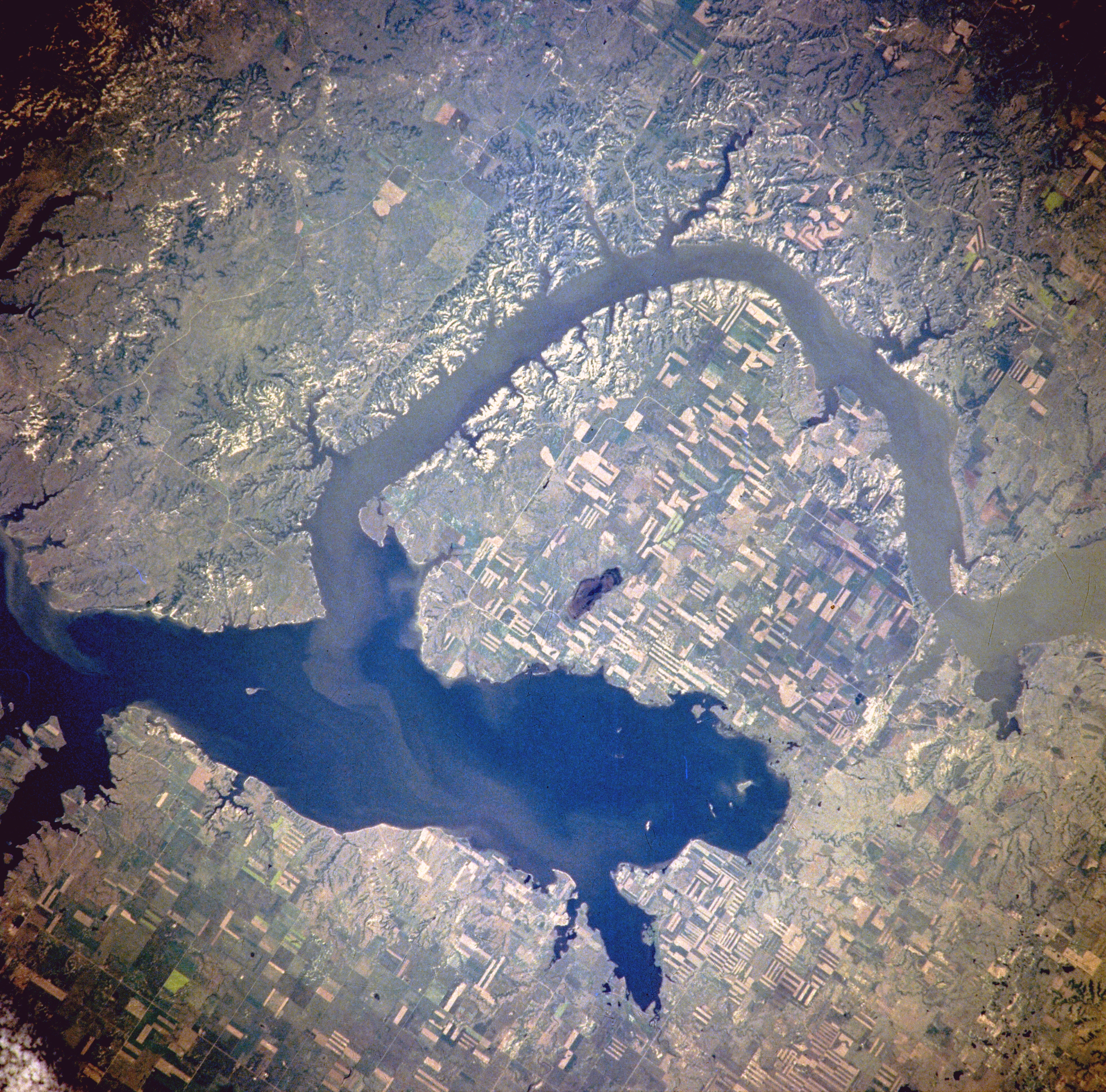
| DescriptionLake sakakawea.jpg |
Van Hook Arm of Lake Sakakawea, North Dakota, United States - Satellite image, July 1996 The image description can be found here. The bridge on the right holds North Dakota Highway 23. North is to the right side of the image.[1] |
| Date | |
| Source | http://eol.jsc.nasa.gov/sseop/EFS/photoinfo.pl?PHOTO=NM21-765-97 |
| Author | NASA |
| Permission (Reusing this file) |
PD-LAYOUT; PD-USGOV-NASA. |
Licensing
| Public domainPublic domainfalsefalse |
| This file is in the public domain in the United States because it was solely created by NASA. NASA copyright policy states that "NASA material is not protected by copyright unless noted". (See Template:PD-USGov, NASA copyright policy page or JPL Image Use Policy.) | ||
 |
Warnings:
|
Original upload log
(All user names refer to en.wikipedia)
- 2005-08-06 21:16 Darwinek 639×632×8 (196210 bytes)
Originally from en.wikipedia; description page is/was here.
Captions
Add a one-line explanation of what this file represents
Items portrayed in this file
depicts
3 July 1996
File history
Click on a date/time to view the file as it appeared at that time.
| Date/Time | Thumbnail | Dimensions | User | Comment | |
|---|---|---|---|---|---|
| current | 18:31, 27 February 2012 | | 3,904 × 3,856 (6.91 MB) | Ras67 | high resolution |
| 13:41, 4 August 2007 |  | 639 × 632 (192 KB) | Matthiasb | {{Information |Description=Van Hook Arm of Lake Sakakawea, North Dakota, United States - July 1996 The image description can be found [http://eol.jsc.nasa.gov/sseop/EFS/photoinfo.pl?PHOTO=NM21-765-97 here]. North is to the right side of the image.[http: |
File usage
The following pages on the English Wikipedia use this file (pages on other projects are not listed):
Global file usage
The following other wikis use this file:
- Usage on azb.wikipedia.org
- Usage on ceb.wikipedia.org
- Usage on de.wikipedia.org
- Usage on es.wikipedia.org
- Usage on fa.wikipedia.org
- Usage on fr.wikipedia.org
- Usage on it.wikipedia.org
- Usage on ru.wikipedia.org
- Usage on sr.wikipedia.org
- Usage on te.wikipedia.org
- Usage on www.wikidata.org
- Usage on zh.wikipedia.org
Metadata
This file contains additional information, probably added from the digital camera or scanner used to create or digitize it.
If the file has been modified from its original state, some details may not fully reflect the modified file.
| Image title | Van Hook Arm of Lake Sakakawea, North Dakota, U.S.A. Winter 1995-1996. The Van Hook Arm of Lake Sakakawea, within the Fort Berthold Indian Reservation, is featured in this spectacular, west-southwest-looking, low-oblique photograph. The Missouri River waters impounded by Garrison Dam, completed in 1956, (not in photograph) formed Lake Sakakawea [200 miles (322 kilometers) long] in western North Dakota. |
|---|---|
| Camera manufacturer | Lake Sakakawea |
| Camera model | NASA |
| Author | NASA |
| Copyright holder | http://eol.jsc.nasa.gov/sseop/EFS/photoinfo.pl?PHOTO=NM21-765-97 |
| Date and time of data generation | Winter 1995-1996 |
| User comments | NM21-765-097 |
| Orientation | Normal |
| Horizontal resolution | 72 dpi |
| Vertical resolution | 72 dpi |
| Software used | Adobe Photoshop |
| File change date and time | 19:08, 27 February 2012 |
| Color space | sRGB |
Retrieved from "https://en.wikipedia.org/wiki/File:Lake_sakakawea.jpg"