File:Lake_Superior_National_Estuarine_Research_Reserve_map.gif
From Wikipedia, the free encyclopedia
No higher resolution available.
Lake_Superior_National_Estuarine_Research_Reserve_map.gif (450 × 312 pixels, file size: 96 KB, MIME type: image/gif)
| This is a file from the Wikimedia Commons. Information from its description page there is shown below. Commons is a freely licensed media file repository. You can help. |
Summary
| DescriptionLake Superior National Estuarine Research Reserve map.gif |
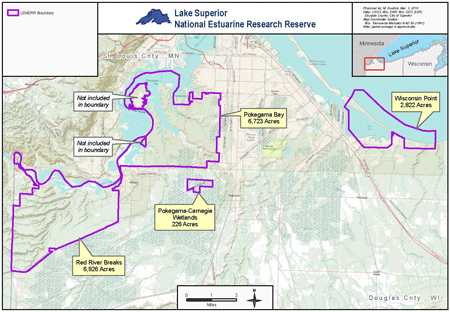
English: Lake Superior National Estuarine Research Reserve map |
| Date | |
| Source | http://www.nerrs.noaa.gov/Reserve.aspx?ResID=LKS |
| Author | NOAA |
Licensing
| Public domainPublic domainfalsefalse |
This image is in the public domain because it contains materials that originally came from the U.S. National Oceanic and Atmospheric Administration, taken or made as part of an employee's official duties.
العربية ∙ čeština ∙ Deutsch ∙ Zazaki ∙ English ∙ español ∙ eesti ∙ suomi ∙ français ∙ hrvatski ∙ magyar ∙ italiano ∙ 日本語 ∙ 한국어 ∙ македонски ∙ മലയാളം ∙ Plattdüütsch ∙ Nederlands ∙ polski ∙ português ∙ română ∙ русский ∙ sicilianu ∙ slovenščina ∙ Türkçe ∙ Tiếng Việt ∙ 简体中文 ∙ 繁體中文 ∙ +/− |
Captions
Add a one-line explanation of what this file represents
Items portrayed in this file
depicts
10 August 2014
File history
Click on a date/time to view the file as it appeared at that time.
| Date/Time | Thumbnail | Dimensions | User | Comment | |
|---|---|---|---|---|---|
| current | 00:23, 10 August 2014 | | 450 × 312 (96 KB) | Anna Frodesiak | User created page with UploadWizard |
File usage
The following pages on the English Wikipedia use this file (pages on other projects are not listed):