File:Lake_District_National_Park_UK_relief_location_map.png
From Wikipedia, the free encyclopedia
Original file (2,001 × 2,430 pixels, file size: 3.62 MB, MIME type: image/png)
| This is a file from the Wikimedia Commons. Information from its description page there is shown below. Commons is a freely licensed media file repository. You can help. |
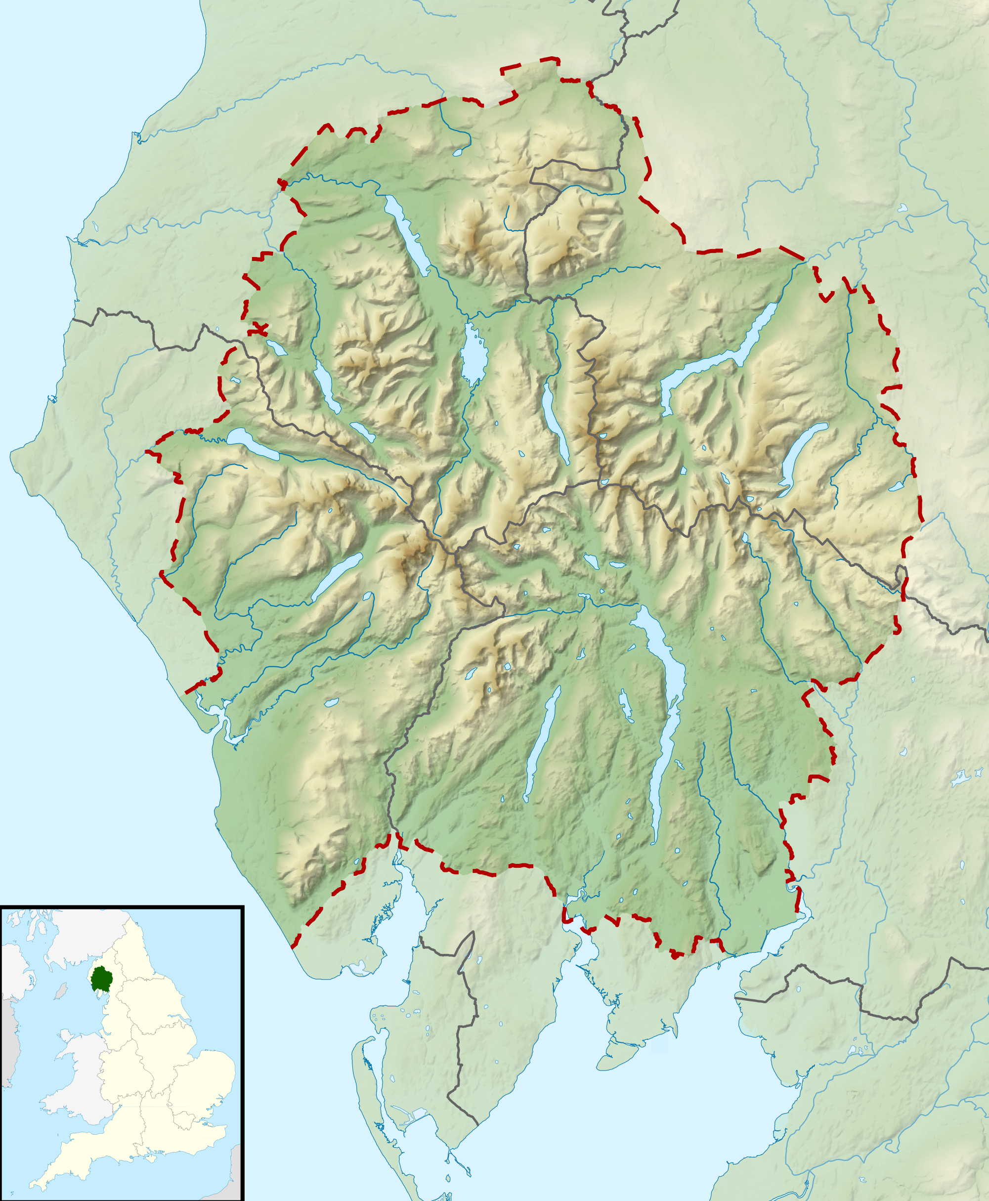
| DescriptionLake District National Park UK relief location map.png |
Relief map of the Lake District National Park, UK Equirectangular map projection on WGS 84 datum, with N/S stretched 170% Geographic limits:
|
| Date | |
| Source |
Office of National Statistics Geography
|
| Author | Nilfanion, created using Ordnance Survey data |
| Permission (Reusing this file) |
This file is licensed under the Creative Commons Attribution-Share Alike 3.0 Unported license. Attribution: Contains Ordnance Survey data © Crown copyright and database right
|
Captions
Items portrayed in this file
depicts
17 March 2012
File history
Click on a date/time to view the file as it appeared at that time.
| Date/Time | Thumbnail | Dimensions | User | Comment | |
|---|---|---|---|---|---|
| current | 10:51, 17 March 2012 | | 2,001 × 2,430 (3.62 MB) | Nilfanion | {{Information |Description=Relief map of the Lake District National Park, UK Equirectangular map projection on WGS 84 datum, with N/S stretched 170% Geographic limits: *West: 3.65W *East: 2.60W *North: 54.80N *South: 54.05N |Sourc... |
File usage
More than 100 pages use this file. The following list shows the first 100 pages that use this file only. A full list is available.
- Barf (Lake District)
- Bassenthwaite Lake
- Binsey
- Black Combe
- Blake Fell
- Blencathra
- Bowfell
- Branstree
- Broad Crag
- Brown Pike
- Buckbarrow
- Buttermere
- Carl Side
- Castle Crag
- Castlerigg stone circle
- Cat Bells
- Catstye Cam
- Causey Pike
- Clough Head
- Cold Pike
- Coniston Water
- Crag Hill
- Crinkle Crags
- Crummock Water
- Dale Head
- Dent (fell)
- Derwentwater
- Dollywaggon Pike
- Elter Water
- Ennerdale Water
- Esk Pike
- Fairfield (Lake District)
- Fleetwith Pike
- Grasmoor
- Grayrigg Forest
- Great Dodd
- Great End
- Great Gable
- Great Mell Fell
- Gummer's How
- Hallin Fell
- Hard Knott
- Harrison Stickle
- Harter Fell (Eskdale)
- Harter Fell (Mardale)
- Haweswater Reservoir
- Haystacks (Lake District)
- Helvellyn
- High Raise (Langdale)
- High Rigg
- High Seat (Lake District)
- High Stile
- High Street (Lake District)
- Hindscarth
- Holme Fell
- Ill Crag
- Kirk Fell
- Kirkby Moor
- Knott, Caldbeck
- Lake District
- List of lakes of the Lake District
- Little Mell Fell
- Loft Crag
- Loughrigg Fell
- Loweswater
- Mellbreak
- Mungrisdale Common
- Nethermost Pike
- Old Man of Coniston
- Pavey Ark
- Pike o' Blisco
- Pike of Stickle
- Pillar (Lake District)
- Place Fell
- Raise (Lake District)
- Red Screes
- Rest Dodd
- Robinson (Lake District)
- Scafell
- Scafell Pike
- Seatallan
- Skiddaw
- Skiddaw Little Man
- St Sunday Crag
- Stony Cove Pike
- Stybarrow Dodd
- Swinside (Derwent Water)
- Tarn Hows
- The Nab
- Thirlmere
- Thunacar Knott
- Troutbeck Tongue
- Ullswater
- Walla Crag
- Wast Water
- Watch Hill (Cockermouth)
- Watch Hill (Whitehaven)
- Whitbarrow
- White Side
- Whitfell
View more links to this file.
Global file usage
The following other wikis use this file:
- Usage on ar.wikipedia.org
- Usage on ceb.wikipedia.org
- Usage on de.wikivoyage.org
- Usage on hr.wikipedia.org
- Usage on it.wikipedia.org
- Usage on ja.wikipedia.org
- Usage on kn.wikipedia.org
- Usage on ml.wikipedia.org
- Usage on simple.wikipedia.org
- Usage on si.wikipedia.org
- Usage on tr.wikipedia.org
- Usage on war.wikipedia.org
- Usage on www.wikidata.org
- Usage on zh.wikipedia.org
Metadata
This file contains additional information, probably added from the digital camera or scanner used to create or digitize it.
If the file has been modified from its original state, some details may not fully reflect the modified file.
| Horizontal resolution | 180.71 dpc |
|---|---|
| Vertical resolution | 180.71 dpc |
| File change date and time | 21:43, 11 March 2012 |