File:Légende_(français)_carte_de_commune_française.PNG
From Wikipedia, the free encyclopedia
No higher resolution available.
Légende_(français)_carte_de_commune_française.PNG (169 × 195 pixels, file size: 9 KB, MIME type: image/png)
| This is a file from the Wikimedia Commons. Information from its description page there is shown below. Commons is a freely licensed media file repository. You can help. |
Summary
| DescriptionLégende (français) carte de commune française.PNG |
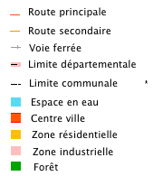
Français : Légende |
| Date |
traduction française |
| Source |
This file was derived from: Legend (English) French municipality map.PNG: _French_municipality_map.PNG) |
| Author |
|
| This is a retouched picture, which means that it has been digitally altered from its original version. Modifications: Traduction. The original can be viewed here: Legend (English) French municipality map.PNG:
|
Licensing
I, the copyright holder of this work, hereby publish it under the following license:
This file is licensed under the Creative Commons Attribution-Share Alike 3.0 Unported license.
- You are free:
- to share – to copy, distribute and transmit the work
- to remix – to adapt the work
- Under the following conditions:
- attribution – You must give appropriate credit, provide a link to the license, and indicate if changes were made. You may do so in any reasonable manner, but not in any way that suggests the licensor endorses you or your use.
- share alike – If you remix, transform, or build upon the material, you must distribute your contributions under the same or compatible license as the original.
Original upload log
This image is a derivative work of the following images:
- File:Legend_(English)_French_municipality_map.PNG licensed with Cc-by-sa-3.0
- 2012-06-09T21:13:45Z Michiel1972 169x195 (3429 Bytes)
Uploaded with derivativeFX
Captions
Add a one-line explanation of what this file represents
Items portrayed in this file
depicts
9 June 2012
image/png
File history
Click on a date/time to view the file as it appeared at that time.
| Date/Time | Thumbnail | Dimensions | User | Comment | |
|---|---|---|---|---|---|
| current | 11:30, 17 July 2012 | | 169 × 195 (9 KB) | K800i | == {{int:filedesc}} == {{Information |Description={{fr|1=Légende}} |date=2012-06-09 traduction française |Source={{Derived from|Legend_(English)_French_municipality_map.PNG|display=50}} |Date=2012-07-17 11:27 (UTC) |Author=*[[:File:Legend_(English)_F... |
File usage
No pages on the English Wikipedia use this file (pages on other projects are not listed).
Global file usage
The following other wikis use this file:
- Usage on fr.wikipedia.org
- Basse-sur-le-Rupt
- Bonsecours (Seine-Maritime)
- Cornimont (Vosges)
- La Bresse (Vosges)
- La Seyne-sur-Mer
- Apt
- Mailly-la-Ville
- Anould
- Bruyères
- Les Ableuvenettes
- Ahéville
- Allarmont
- Faucompierre
- Saint-Martin-de-Lansuscle
- Bazegney
- Bouzemont
- Fays (Vosges)
- Chartrettes
- Archettes
- Aroffe
- Autrey (Vosges)
- Avrainville (Vosges)
- Aydoilles
- Badménil-aux-Bois
- La Baffe
- Bainville-aux-Saules
- Ban-sur-Meurthe-Clefcy
- Nompatelize
- Frapelle
- Battexey
- Beauménil
- Bellefontaine (Vosges)
- Bettegney-Saint-Brice
- Bettoncourt
- Bocquegney
- Bouxurulles
- Brantigny
- Brû
- Bult
- Bussang
- Chamagne
- Champdray
- Champ-le-Duc
- Chantraine
- La Chapelle-aux-Bois
- Cheniménil
- Chavelot
- Chaumousey
- Châtel-sur-Moselle
- Charmois-l'Orgueilleux
View more global usage of this file.
_carte_de_commune_fran%C3%A7aise.PNG)
Metadata
This file contains additional information, probably added from the digital camera or scanner used to create or digitize it.
If the file has been modified from its original state, some details may not fully reflect the modified file.
| PNG file comment |
|
|---|---|
| Software used |
_carte_de_commune_française.PNG)