File:Klimagürtel-der-erde-eisklima.png
From Wikipedia, the free encyclopedia
Original file (3,600 × 1,800 pixels, file size: 664 KB, MIME type: image/png)
| This is a file from the Wikimedia Commons. Information from its description page there is shown below. Commons is a freely licensed media file repository. You can help. |
Summary
| DescriptionKlimagürtel-der-erde-eisklima.png |
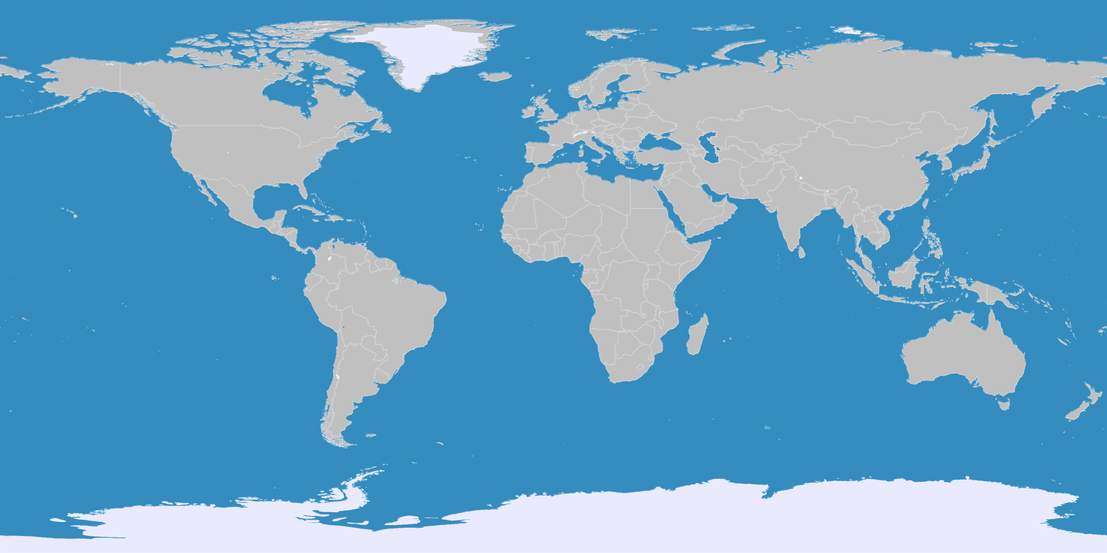
English: This map shows the Earth zones with an ice cap polar climate. Deutsch: Diese Karte stellt die polare Eisklimazone der Erde dar.
. |
||
| Date | |||
| Source |
English: Own work on the basis of the following data: Deutsch: Selbst erstellt auf Basis dieser Geodaten:
|
||
| Author | LordToran | ||
| Permission (Reusing this file) |
boe
|
||
| Other versions |
 |
Licensing
- You are free:
- to share – to copy, distribute and transmit the work
- to remix – to adapt the work
- Under the following conditions:
- attribution – You must give appropriate credit, provide a link to the license, and indicate if changes were made. You may do so in any reasonable manner, but not in any way that suggests the licensor endorses you or your use.
- share alike – If you remix, transform, or build upon the material, you must distribute your contributions under the same or compatible license as the original.
Captions
Items portrayed in this file
depicts
15 October 2007
File history
Click on a date/time to view the file as it appeared at that time.
| Date/Time | Thumbnail | Dimensions | User | Comment | |
|---|---|---|---|---|---|
| current | 21:05, 11 October 2016 | | 3,600 × 1,800 (664 KB) | Maphobbyist | The Caspian Sea was omitted. The Köppen system is based on the concept that climate types are correlated with the natural vegetation. |
| 15:12, 15 October 2007 |  | 3,600 × 1,800 (562 KB) | Lortordermur | ||
| 20:41, 5 June 2007 |  | 3,445 × 1,731 (603 KB) | Lortordermur | == Beschreibung == {{Information |Description=Diese Karte stellt die polare Eisklimazone der Erde dar. |Source=Selbst erstellt auf Basis [http://www.copernicus.org/EGU/hess/hessd/4/439/hessd-4-439.htm dieser Karte], welche unter einer Creative-Commons-Li |
File usage
Global file usage
The following other wikis use this file:
- Usage on be.wikipedia.org
- Usage on fa.wikipedia.org
- Usage on frr.wikipedia.org
- Usage on nl.wikipedia.org
Metadata
This file contains additional information, probably added from the digital camera or scanner used to create or digitize it.
If the file has been modified from its original state, some details may not fully reflect the modified file.
| Horizontal resolution | 37.79 dpc |
|---|---|
| Vertical resolution | 37.79 dpc |