File:Karte_Böhmen_unter_Ottokar_II.png
From Wikipedia, the free encyclopedia
Size of this preview: 601 × 600 pixels. Other resolutions: 241 × 240 pixels | 481 × 480 pixels | 823 × 821 pixels.
Original file (823 × 821 pixels, file size: 187 KB, MIME type: image/png)
| This is a file from the Wikimedia Commons. Information from its description page there is shown below. Commons is a freely licensed media file repository. You can help. |

|
This map image could be re-created using vector graphics as an SVG file. This has several advantages; see Commons:Media for cleanup for more information. If an SVG form of this image is available, please upload it and afterwards replace this template with
{{vector version available|new image name}}.
It is recommended to name the SVG file “Karte Böhmen unter Ottokar II.svg”—then the template Vector version available (or Vva) does not need the new image name parameter. |
Summary
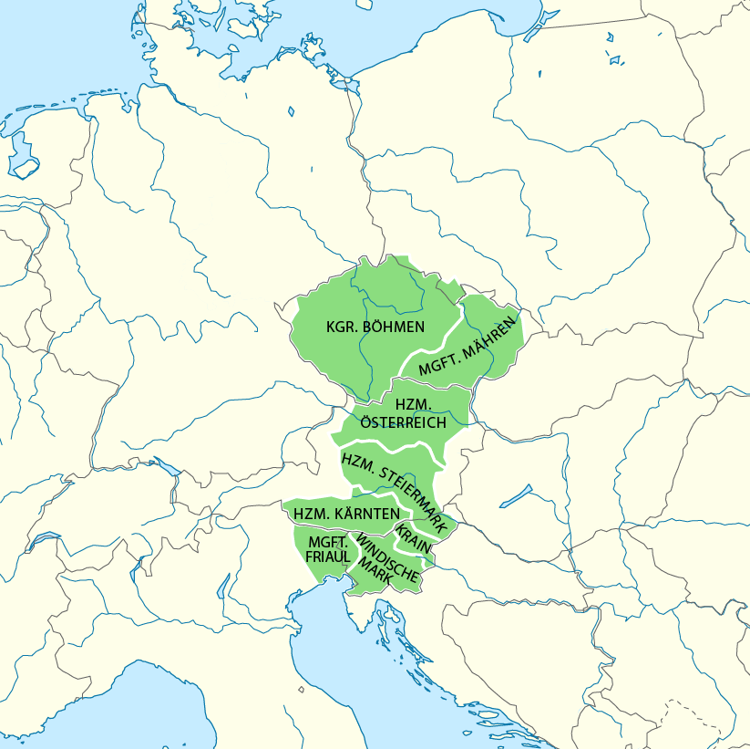
| DescriptionKarte Böhmen unter Ottokar II.png |
Deutsch: Böhmen unter Ottokar II |
| Date | see file history |
| Source |
Own work, using
|
| Author | Maximilian Dörrbecker (Chumwa) |
| Permission (Reusing this file) |
This file is licensed under the Creative Commons Attribution-Share Alike 2.0 Generic license.
|
| Other versions |
|


Captions
Add a one-line explanation of what this file represents
Items portrayed in this file
depicts
image/png
File history
Click on a date/time to view the file as it appeared at that time.
| Date/Time | Thumbnail | Dimensions | User | Comment | |
|---|---|---|---|---|---|
| current | 17:47, 21 August 2019 | | 823 × 821 (187 KB) | Valdemar | colors |
| 17:44, 21 August 2019 |  | 823 × 821 (187 KB) | Valdemar | fix borders between Bohemia ana Moravia | |
| 10:58, 13 May 2015 |  | 823 × 821 (109 KB) | RokerHRO | optipng -o7 -i0 → 39.57% decrease | |
| 19:08, 7 January 2014 |  | 823 × 821 (181 KB) | Chumwa | ||
| 20:46, 3 January 2014 |  | 823 × 821 (187 KB) | Chumwa | ||
| 20:01, 3 January 2014 |  | 823 × 821 (188 KB) | Chumwa | ||
| 21:58, 16 December 2013 |  | 823 × 821 (186 KB) | Chumwa | == {{int:filedesc}} == {{Information |Description= {{de|Böhmen unter Ottokar II}} |Author=Maximilian Dörrbecker (Chumwa) |Source={{own}}, using * this background map by {... |
File usage
The following pages on the English Wikipedia use this file (pages on other projects are not listed):
Global file usage
The following other wikis use this file:
- Usage on ar.wikipedia.org
- Usage on azb.wikipedia.org
- Usage on ba.wikipedia.org
- Usage on bn.wikipedia.org
- Usage on ca.wikipedia.org
- Usage on cs.wikipedia.org
- Usage on cy.wikipedia.org
- Usage on de.wikipedia.org
- Usage on el.wikipedia.org
- Usage on eo.wikipedia.org
- Usage on es.wikipedia.org
- Usage on et.wikipedia.org
- Usage on eu.wikipedia.org
- Usage on fr.wikipedia.org
- Usage on hu.wikipedia.org
- Usage on it.wikipedia.org
- Usage on ja.wikipedia.org
- Usage on ka.wikipedia.org
- Usage on lv.wikipedia.org
- Usage on oc.wikipedia.org
- Usage on ro.wikipedia.org
- Usage on ru.wikipedia.org
- Usage on sk.wikipedia.org
- Usage on sl.wikipedia.org
- Usage on sr.wikipedia.org
- Usage on uk.wikipedia.org
- Usage on ur.wikipedia.org
- Usage on vi.wikipedia.org
- Usage on zh.wikipedia.org
Metadata
This file contains additional information, probably added from the digital camera or scanner used to create or digitize it.
If the file has been modified from its original state, some details may not fully reflect the modified file.
| Horizontal resolution | 37.8 dpc |
|---|---|
| Vertical resolution | 37.8 dpc |
| Software used |
Retrieved from "https://en.wikipedia.org/wiki/File:Karte_Böhmen_unter_Ottokar_II.png"