File:Israel_outline_ashkelon.png
From Wikipedia, the free encyclopedia
No higher resolution available.
Israel_outline_ashkelon.png (692 × 430 pixels, file size: 77 KB, MIME type: image/png)
| This is a file from the Wikimedia Commons. Information from its description page there is shown below. Commons is a freely licensed media file repository. You can help. |

|
This map image could be re-created using vector graphics as an SVG file. This has several advantages; see Commons:Media for cleanup for more information. If an SVG form of this image is available, please upload it and afterwards replace this template with
{{vector version available|new image name}}.
It is recommended to name the SVG file “Israel outline ashkelon.svg”—then the template Vector version available (or Vva) does not need the new image name parameter. |
Summary
| DescriptionIsrael outline ashkelon.png |
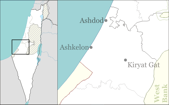
English: Ashkelon sub-district of the South District of Israel, for pushpin maps. |
| Date | |
| Source | Own work |
| Author | Ynhockey |
Licensing
I, the copyright holder of this work, hereby publish it under the following licenses:
This file is licensed under the Creative Commons Attribution-Share Alike 3.0 Unported license.
- You are free:
- to share – to copy, distribute and transmit the work
- to remix – to adapt the work
- Under the following conditions:
- attribution – You must give appropriate credit, provide a link to the license, and indicate if changes were made. You may do so in any reasonable manner, but not in any way that suggests the licensor endorses you or your use.
- share alike – If you remix, transform, or build upon the material, you must distribute your contributions under the same or compatible license as the original.

|
Permission is granted to copy, distribute and/or modify this document under the terms of the GNU Free Documentation License, Version 1.2 or any later version published by the Free Software Foundation; with no Invariant Sections, no Front-Cover Texts, and no Back-Cover Texts. A copy of the license is included in the section entitled GNU Free Documentation License.http://www.gnu.org/copyleft/fdl.htmlGFDLGNU Free Documentation Licensetruetrue |
You may select the license of your choice.
Captions
Add a one-line explanation of what this file represents
Items portrayed in this file
depicts
25 December 2008
File history
Click on a date/time to view the file as it appeared at that time.
| Date/Time | Thumbnail | Dimensions | User | Comment | |
|---|---|---|---|---|---|
| current | 17:23, 1 September 2016 | | 692 × 430 (77 KB) | Number 57 | Updated Israel map |
| 12:50, 25 December 2008 |  | 692 × 430 (74 KB) | Ynhockey | {{Information |Description={{en|1=Ashkelon sub-district of the South District of Israel, for pushpin maps.}} |Source=Own work by uploader |Author=Ynhockey |Date=2008-12-25 |Permission= |other_versions= }} <!--{{ImageUpload|full}}--> [[C |
File usage
More than 100 pages use this file. The following list shows the first 100 pages that use this file only. A full list is available.
- Ahuzam
- Ahva, Israel
- Al-'Azi
- Aluma
- Amatzia, Israel
- Arugot
- Ashdod
- Ashdod-Yam
- Ashdod Sand Dune
- Ashkelon
- Avigdor
- Azrikam
- Bat Hadar
- Be'er Tuvia
- Beit Ezra
- Beit Guvrin, Israel
- Beit Nir
- Beit Shikma
- Berekhya
- Bitzaron
- Bnei Darom
- Bnei Re'em
- Ein Tzurim
- Eitan, Israel
- Eliav, Israel
- Emunim
- Erez
- Even Shmuel
- Ezer
- Gal On
- Gan Yavne
- Gat, Israel
- Ge'a
- Gevim
- Giv'ati
- Gvar'am
- Hatzav
- Hatzor
- Hatzor Airbase
- Heletz
- Hodiya
- Kannot
- Karmei Yosef
- Karmia
- Kedma, Israel
- Kfar Ahim
- Kfar HaRif
- Kfar Menahem
- Kfar Silver
- Kfar Warburg
- Kiryat Gat
- Kiryat Malakhi
- Kokhav Michael
- Komemiyut
- Lakhish, Israel
- Mash'en
- Masu'ot Yitzhak
- Mavki'im
- Menuha
- Merkaz Shapira
- Nahala, Israel
- Negba
- Nehora
- Netiv HaAsara
- Neve Mivtah
- Nir Banim
- Nir Hen
- Nir Yisrael
- Nitzan
- Nitzan Bet
- Nitzanim
- No'am
- Noga, Israel
- Orot
- Otzem
- Revadim
- Revaha
- Ruhama
- Sde David
- Sde Moshe
- Sde Uziyahu
- Sde Yoav
- Sgula
- Shafir
- Shahar, Israel
- Shalva
- Shekef
- Shomria
- Shtulim
- Talmei Yaffe
- Talmei Yehiel
- Timorim
- Tlamim
- Uza, Israel
- Vardon
- Yad Mordechai
- Yad Natan
- Yinon
- Zavdiel
- Zikim
View more links to this file.
Global file usage
The following other wikis use this file:
- Usage on arz.wikipedia.org
- Usage on cy.wikipedia.org
- Usage on el.wikipedia.org
- Usage on en.wiktionary.org
- Usage on fa.wikipedia.org
- Usage on hr.wikipedia.org
- Usage on id.wikipedia.org
- Usage on it.wikipedia.org
- Usage on ja.wikipedia.org
- Usage on mn.wikipedia.org
- Usage on si.wikipedia.org
- Usage on th.wikipedia.org
- Usage on tr.wikipedia.org
- Usage on uz.wikipedia.org
- Usage on zh.wikipedia.org
Metadata
This file contains additional information, probably added from the digital camera or scanner used to create or digitize it.
If the file has been modified from its original state, some details may not fully reflect the modified file.
| Horizontal resolution | 37.8 dpc |
|---|---|
| Vertical resolution | 37.8 dpc |
Retrieved from "https://en.wikipedia.org/wiki/File:Israel_outline_ashkelon.png"