File:Hudson_bay_explorer.png
From Wikipedia, the free encyclopedia
Hudson_bay_explorer.png (550 × 442 pixels, file size: 449 KB, MIME type: image/png)
| This is a file from the Wikimedia Commons. Information from its description page there is shown below. Commons is a freely licensed media file repository. You can help. |
| DescriptionHudson bay explorer.png |
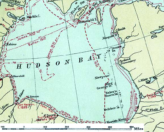
English: Map of the routes of the main European explorers in Hudson Bay, Canada. |
|||||||
| Date | ||||||||
| Source | Excerpted from 1st Edition, 1906, Atlas of Canada - Routes of Explorers,1497 to 1905. | |||||||
| Author | Department of the Interior, Ottawa | |||||||
| Permission (Reusing this file) |
Crown copyright expired.
|

Original upload log
- 2007-01-26 22:28 CyclePat 550×442×8 (459278 bytes) ==Description== This map shows the routes followed by the principal explorers of what is now Canada, from 1497 up to 1905. The map also shows the location of forts with the date of their establishment. It was created using [[:image:Canada, Routes of Explo
Captions
Items portrayed in this file
depicts
1906
image/png
File history
Click on a date/time to view the file as it appeared at that time.
| Date/Time | Thumbnail | Dimensions | User | Comment | |
|---|---|---|---|---|---|
| current | 11:41, 10 July 2008 | | 550 × 442 (449 KB) | Urdangaray | {{Information |Description={{en|thumb|400px|right|Canada, Routes of Explorers,1497 to 1905 This map shows the routes followed by the principal explorers of what is now Canada, from 1497 up to 190 |
File usage
Global file usage
The following other wikis use this file:
- Usage on arz.wikipedia.org
- Usage on ast.wikipedia.org
- Usage on az.wikipedia.org
- Usage on bg.wikipedia.org
- Usage on ca.wikipedia.org
- Usage on cv.wikipedia.org
- Usage on de.wikipedia.org
- Usage on es.wikipedia.org
- Usage on hi.wikipedia.org
- Usage on nn.wikipedia.org
- Usage on ru.wikipedia.org
- Usage on zh.wikipedia.org