File:Hadrians_Wall_map.png
From Wikipedia, the free encyclopedia
Size of this preview: 482 × 599 pixels. Other resolutions: 193 × 240 pixels | 386 × 480 pixels.
Original file (800 × 995 pixels, file size: 215 KB, MIME type: image/png)
| This is a file from the Wikimedia Commons. Information from its description page there is shown below. Commons is a freely licensed media file repository. You can help. |

|
File:Hadrians Wall map.svg is a vector version of this file. It should be used in place of this PNG file when not inferior.
File:Hadrians Wall map.png → File:Hadrians Wall map.svg
For more information, see Help:SVG.
|
 |
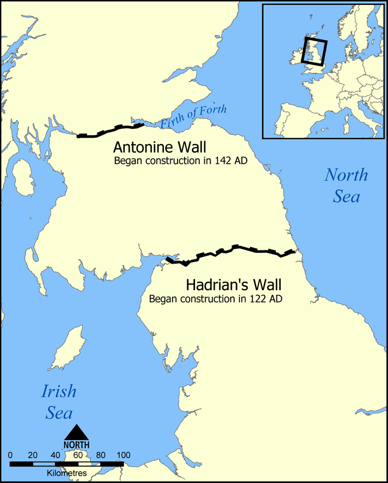
This map shows the location of Hadrian's Wall and the Antonine Wall in Scotland and Northern England.
Created by NormanEinstein, September 20, 2005.
I, the copyright holder of this work, hereby publish it under the following licenses:

|
Permission is granted to copy, distribute and/or modify this document under the terms of the GNU Free Documentation License, Version 1.2 or any later version published by the Free Software Foundation; with no Invariant Sections, no Front-Cover Texts, and no Back-Cover Texts. A copy of the license is included in the section entitled GNU Free Documentation License.http://www.gnu.org/copyleft/fdl.htmlGFDLGNU Free Documentation Licensetruetrue |
| This file is licensed under the Creative Commons Attribution-Share Alike 3.0 Unported license. | ||
| ||
| This licensing tag was added to this file as part of the GFDL licensing update.http://creativecommons.org/licenses/by-sa/3.0/CC BY-SA 3.0Creative Commons Attribution-Share Alike 3.0truetrue |
You may select the license of your choice.
derivative works
Derivative works of this file:
- Hadrians Wall map Swedish.png
- Hadrians Wall map mak.png
- Hadrians Wall map-ru.svg
- Hadrians Wall map.svg
- Hadrians Wall map hr.svg
Captions
Add a one-line explanation of what this file represents
Items portrayed in this file
depicts
File history
Click on a date/time to view the file as it appeared at that time.
| Date/Time | Thumbnail | Dimensions | User | Comment | |
|---|---|---|---|---|---|
| current | 22:03, 1 January 2009 | | 800 × 995 (215 KB) | Mahahahaneapneap | Compressed |
| 21:00, 20 September 2005 |  | 800 × 995 (288 KB) | NormanEinstein | This map shows the location of Hadrian's Wall and the Antonine Wall in Scotland and Northern England. Created by NormanEinstein, September 20, 2005. {{GFDL-self}} |
File usage
The following pages on the English Wikipedia use this file (pages on other projects are not listed):
Global file usage
The following other wikis use this file:
- Usage on an.wikipedia.org
- Usage on ast.wikipedia.org
- Usage on bar.wikipedia.org
- Usage on bg.wikipedia.org
- Usage on br.wikipedia.org
- Usage on ca.wikipedia.org
- Usage on cs.wikipedia.org
- Usage on cy.wikipedia.org
- Usage on da.wikipedia.org
- Usage on de.wikivoyage.org
- Usage on eu.wikipedia.org
- Usage on fi.wikipedia.org
- Usage on fy.wikipedia.org
- Usage on gl.wikipedia.org
- Usage on ja.wikipedia.org
- Usage on ka.wikipedia.org
- Usage on lt.wikipedia.org
- Usage on ml.wikipedia.org
- Usage on mn.wikipedia.org
- Usage on ms.wikipedia.org
- Usage on nds-nl.wikipedia.org
- Usage on nl.wikipedia.org
- Usage on nn.wikipedia.org
- Usage on no.wikipedia.org
- Usage on pl.wikipedia.org
- Usage on pt.wikipedia.org
- Usage on ro.wikipedia.org
View more global usage of this file.
Retrieved from "https://en.wikipedia.org/wiki/File:Hadrians_Wall_map.png"