File:Guyana_Venezuela_Locator.png
From Wikipedia, the free encyclopedia
No higher resolution available.
Guyana_Venezuela_Locator.png (496 × 400 pixels, file size: 4 KB, MIME type: image/png)
| This is a file from the Wikimedia Commons. Information from its description page there is shown below. Commons is a freely licensed media file repository. You can help. |
Summary
| DescriptionGuyana Venezuela Locator.png |
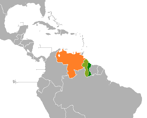
English: Map showing locations of both Guyana and Venezuela. Light green is the disputed Guayana Esequiba |
| Date | |
| Source | Own work |
| Author | Aquintero82 |
Licensing
I, the copyright holder of this work, hereby publish it under the following license:
This file is licensed under the Creative Commons Attribution-Share Alike 4.0 International license.
- You are free:
- to share – to copy, distribute and transmit the work
- to remix – to adapt the work
- Under the following conditions:
- attribution – You must give appropriate credit, provide a link to the license, and indicate if changes were made. You may do so in any reasonable manner, but not in any way that suggests the licensor endorses you or your use.
- share alike – If you remix, transform, or build upon the material, you must distribute your contributions under the same or compatible license as the original.
Captions
Add a one-line explanation of what this file represents
Items portrayed in this file
depicts
some value
8 August 2015
image/png
File history
Click on a date/time to view the file as it appeared at that time.
| Date/Time | Thumbnail | Dimensions | User | Comment | |
|---|---|---|---|---|---|
| current | 22:00, 8 December 2023 | | 496 × 400 (4 KB) | Spesh531 | Minor correction to the Guayana Esequiba-Guyana border |
| 01:00, 4 June 2023 |  | 496 × 400 (8 KB) | Usedbook | Reverting to Fobos92 (12 Aug 2017). Original image is particular to the Venezuela and Guyana dispute only. Please create a new comprehensive image to include Brazil, Suriname, Venezuela, etc. | |
| 17:48, 1 April 2023 |  | 496 × 400 (10 KB) | SurinameCentral | Disputed Area Suriname-Venezuela added in light Blue Color | |
| 01:13, 12 August 2017 |  | 496 × 400 (8 KB) | Fobos92 | . | |
| 03:34, 9 August 2015 |  | 403 × 605 (18 KB) | Aquintero82 | User created page with UploadWizard |
File usage
The following pages on the English Wikipedia use this file (pages on other projects are not listed):
Global file usage
The following other wikis use this file:
- Usage on ar.wikipedia.org
- Usage on eo.wikipedia.org
- Usage on es.wikipedia.org
- Usage on fa.wikipedia.org
- Usage on fr.wikipedia.org
- Usage on he.wikipedia.org
- Usage on hr.wikipedia.org
- Usage on hu.wikipedia.org
- Usage on id.wikipedia.org
- Usage on it.wikipedia.org
- Usage on ja.wikipedia.org
- Usage on ko.wikipedia.org
- Usage on pt.wikipedia.org
- Usage on ro.wikipedia.org
- Usage on ru.wikipedia.org
- Usage on sh.wikipedia.org
- Usage on uk.wikipedia.org
- Usage on vi.wikipedia.org
- Usage on www.wikidata.org
- Usage on zh.wikipedia.org
Metadata
This file contains additional information, probably added from the digital camera or scanner used to create or digitize it.
If the file has been modified from its original state, some details may not fully reflect the modified file.
| Horizontal resolution | 37.8 dpc |
|---|---|
| Vertical resolution | 37.8 dpc |
Retrieved from "https://en.wikipedia.org/wiki/File:Guyana_Venezuela_Locator.png"