File:Genovesa.topographic_map-en.png
From Wikipedia, the free encyclopedia
Original file (3,543 × 3,208 pixels, file size: 858 KB, MIME type: image/png)
| This is a file from the Wikimedia Commons. Information from its description page there is shown below. Commons is a freely licensed media file repository. You can help. |
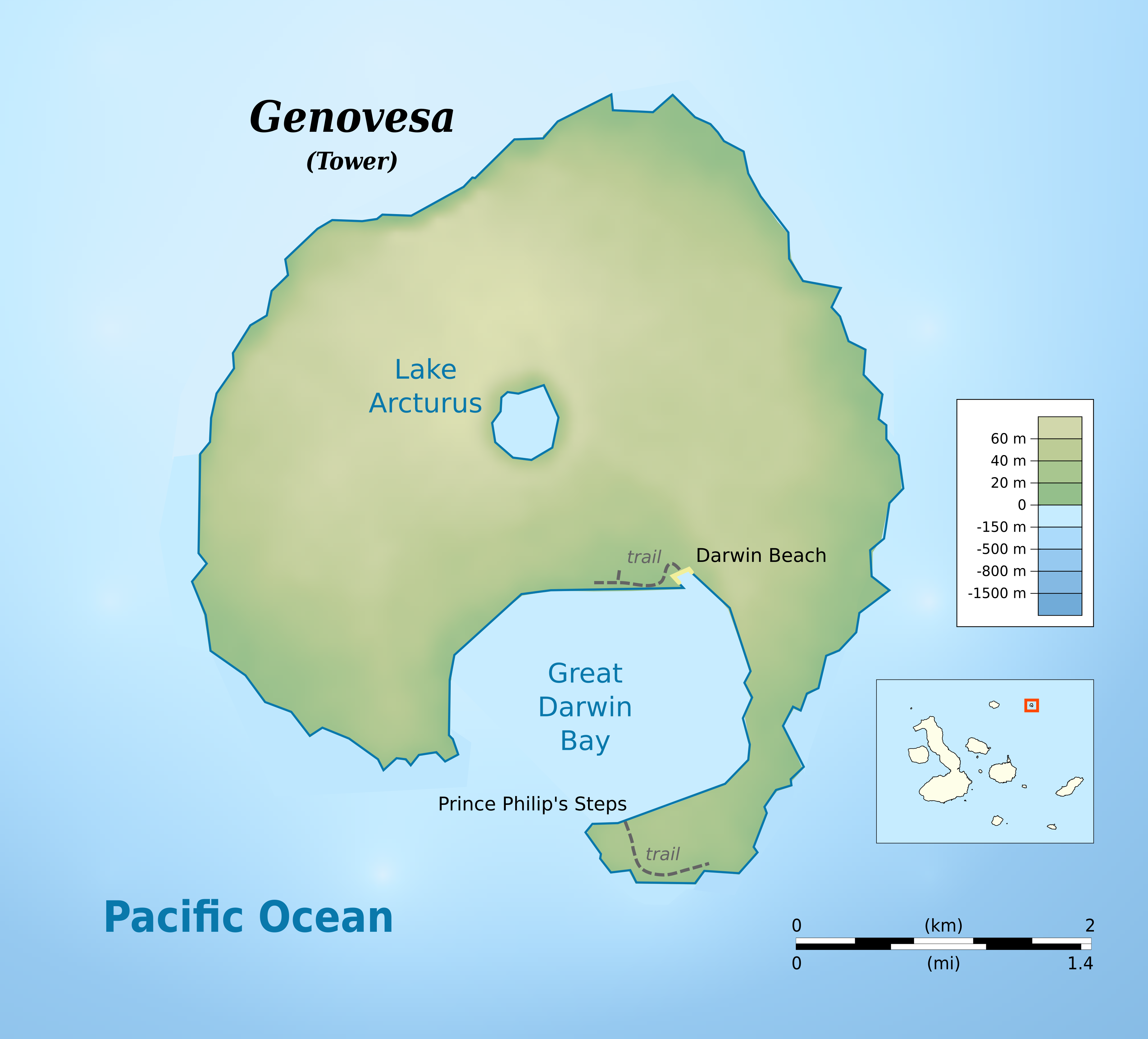
| DescriptionGenovesa.topographic map-en.png | cylindrical equidistant projection, central meridian -90°, standard parallel 0° | |||||||
| Date | ||||||||
| Source |
own work, using: |
|||||||
| Author | Bamse | |||||||
| Permission (Reusing this file) |
|
|||||||
| Other versions |
|


Captions
Items portrayed in this file
depicts
23 May 2016
File history
Click on a date/time to view the file as it appeared at that time.
| Date/Time | Thumbnail | Dimensions | User | Comment | |
|---|---|---|---|---|---|
| current | 20:48, 24 May 2016 | | 3,543 × 3,208 (858 KB) | Bamse | added darwin beach |
| 20:40, 24 May 2016 |  | 3,543 × 3,208 (849 KB) | Bamse | {{Information |Description ={{en|1=Topographic map of Genovesa Island, Galápagos Islands}} cylindrical equidistant projection, central meridian -90°, standard parallel 0° |Source =own wor... |
File usage
Global file usage
The following other wikis use this file:
- Usage on ar.wikipedia.org
- Usage on ca.wikipedia.org
- Usage on ja.wikipedia.org
- Usage on lij.wikipedia.org
- Usage on nl.wikipedia.org
- Usage on pt.wikipedia.org
- Usage on www.wikidata.org
- Usage on zh.wikipedia.org
Metadata
This file contains additional information, probably added from the digital camera or scanner used to create or digitize it.
If the file has been modified from its original state, some details may not fully reflect the modified file.
| Horizontal resolution | 118.11 dpc |
|---|---|
| Vertical resolution | 118.11 dpc |
| Software used |