File:Fuller_projection_with_largest_islands.svg
From Wikipedia, the free encyclopedia

Size of this PNG preview of this SVG file: 512 × 288 pixels. Other resolutions: 320 × 180 pixels | 640 × 360 pixels | 1,024 × 576 pixels | 1,280 × 720 pixels | 2,560 × 1,440 pixels.
Original file (SVG file, nominally 512 × 288 pixels, file size: 554 KB)
| This is a file from the Wikimedia Commons. Information from its description page there is shown below. Commons is a freely licensed media file repository. You can help. |
Summary
| DescriptionFuller projection with largest islands.svg |
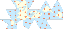
English: Dymaxion map of the world with the continental landmasses (Roman numerals) and 30 largest islands (Hindu-Arabic numerals) highlighted. (The list stops at 30 as the next few islands are north of Canada, and space is insufficient for their labels.) |
|||
| Date | ||||
| Source |
|
|||
| Author | cmglee, Justin Kunimune | |||
| Other versions |
|


Licensing
This file is licensed under the Creative Commons Attribution-Share Alike 4.0 International license.
- You are free:
- to share – to copy, distribute and transmit the work
- to remix – to adapt the work
- Under the following conditions:
- attribution – You must give appropriate credit, provide a link to the license, and indicate if changes were made. You may do so in any reasonable manner, but not in any way that suggests the licensor endorses you or your use.
- share alike – If you remix, transform, or build upon the material, you must distribute your contributions under the same or compatible license as the original.
Captions
Dymaxion Map of the world with the continental landmasses (Roman numerals) and 30 largest islands (Hindu-Arabic numerals) highlighted.
15 February 2018
image/svg+xml
File history
Click on a date/time to view the file as it appeared at that time.
| Date/Time | Thumbnail | Dimensions | User | Comment | |
|---|---|---|---|---|---|
| current | 00:15, 25 October 2020 | | 512 × 288 (554 KB) | Cmglee | Uploaded a work by cmglee, Justin Kunimune from {{source thumb|Dymaxion_with_Tissot's_Indicatrices_of_Distortion.svg}} with UploadWizard |
File usage
The following pages on the English Wikipedia use this file (pages on other projects are not listed):
Global file usage
The following other wikis use this file:
- Usage on fa.wikipedia.org
- Usage on hi.wikipedia.org
- Usage on kk.wikipedia.org
- Usage on si.wikipedia.org
- Usage on zh.wikipedia.org
Metadata
This file contains additional information, probably added from the digital camera or scanner used to create or digitize it.
If the file has been modified from its original state, some details may not fully reflect the modified file.
| Short title | Dymaxion map of the world with the continental landmasses (Roman numerals) and 30 largest islands (Arabic numerals) highlighted. |
|---|---|
| Image title | A map of the world, showing all landmasses with 10° graticule and Tissot's indicatrices of diameter 1,000 km and spacing 30°. Coastlines precise to 110 km. |
| Width | 100% |
| Height | 100% |