File:Footpath_and_fields_-_geograph.org.uk_-_652151.jpg
From Wikipedia, the free encyclopedia
No higher resolution available.
Footpath_and_fields_-_geograph.org.uk_-_652151.jpg (640 × 480 pixels, file size: 190 KB, MIME type: image/jpeg)
| This is a file from the Wikimedia Commons. Information from its description page there is shown below. Commons is a freely licensed media file repository. You can help. |
Summary
| DescriptionFootpath and fields - geograph.org.uk - 652151.jpg |
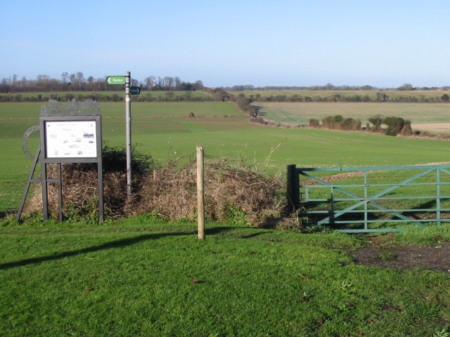
English: Footpath and fields The fields to the NW of Elvington and the footpath is part of The Miner's Way, which is a new walking and cycling trail exploring the rich heritage and landscape of the former East Kent Coalfield. The route uses existing footpaths and bridleways to link together the former mining communities, colliery sites and stretches of the East Kent Light Railway. http://www.dover.gov.uk/kentcoal/minerstrail/home.asp |
| Date | |
| Source | From geograph.org.uk |
| Author | Nick Smith |
| Attribution (required by the license) InfoField | Nick Smith / Footpath and fields / |
InfoField | Nick Smith / Footpath and fields |
| Camera location | 51° 12′ 32″ N, 1° 15′ 23″ E | View this and other nearby images on: OpenStreetMap |
|---|
| Object location | 51° 12′ 39″ N, 1° 15′ 09″ E | View this and other nearby images on: OpenStreetMap |
|---|
Licensing

|
This image was taken from the Geograph project collection. See this photograph's page on the Geograph website for the photographer's contact details. The copyright on this image is owned by Nick Smith and is licensed for reuse under the Creative Commons Attribution-ShareAlike 2.0 license.
|
This file is licensed under the Creative Commons Attribution-Share Alike 2.0 Generic license.
Attribution: Nick Smith
- You are free:
- to share – to copy, distribute and transmit the work
- to remix – to adapt the work
- Under the following conditions:
- attribution – You must give appropriate credit, provide a link to the license, and indicate if changes were made. You may do so in any reasonable manner, but not in any way that suggests the licensor endorses you or your use.
- share alike – If you remix, transform, or build upon the material, you must distribute your contributions under the same or compatible license as the original.
- Remove redundant categories and try to put this image in the most specific category/categories
- Remove this template
- The location categories are based on information from this geonames tool and this OpenStreetMap tool combined with a database. You can also have a look at this tool from mysociety.
- The topic category from Geograph was Footpath (find similar images at Geograph)
English | suomi | français | galego | עברית | magyar | македонски | മലയാളം | português | português do Brasil | Türkçe | +/−
Captions
Add a one-line explanation of what this file represents
Items portrayed in this file
depicts
some value
6 January 2008
51°12'32.47"N, 1°15'23.40"E
51°12'38.70"N, 1°15'9.00"E
File history
Click on a date/time to view the file as it appeared at that time.
| Date/Time | Thumbnail | Dimensions | User | Comment | |
|---|---|---|---|---|---|
| current | 14:50, 7 February 2011 | | 640 × 480 (190 KB) | GeographBot | == {{int:filedesc}} == {{Information |description={{en|1=Footpath and fields The fields to the NW of Elvington and the footpath is part of The Miner's Way, which is a new walking and cycling trail exploring the rich heritage and landscape of the former Ea |
File usage
The following pages on the English Wikipedia use this file (pages on other projects are not listed):
Global file usage
The following other wikis use this file:
- Usage on www.wikidata.org
Metadata
This file contains additional information, probably added from the digital camera or scanner used to create or digitize it.
If the file has been modified from its original state, some details may not fully reflect the modified file.
| Camera manufacturer | Canon |
|---|---|
| Camera model | Canon PowerShot A20 |
| Exposure time | 1/160 sec (0.00625) |
| F-number | f/10 |
| Date and time of data generation | 12:36, 6 January 2008 |
| Lens focal length | 9.40625 mm |
| Orientation | Normal |
| Horizontal resolution | 180 dpi |
| Vertical resolution | 180 dpi |
| File change date and time | 12:36, 6 January 2008 |
| Y and C positioning | Centered |
| Exif version | 2.1 |
| Date and time of digitizing | 12:36, 6 January 2008 |
| Image compression mode | 5 |
| Shutter speed | 7.3125 |
| APEX aperture | 6.65625 |
| Maximum land aperture | 2.9708557128906 APEX (f/2.8) |
| Subject distance | 1.612 meters |
| Metering mode | Pattern |
| Flash | Flash did not fire |
| Color space | sRGB |
| Focal plane X resolution | 3,106.7961165049 |
| Focal plane Y resolution | 3,096.7741935484 |
| Focal plane resolution unit | inches |
| Sensing method | One-chip color area sensor |