File:Eruptions_in_the_Lassen_area_in_the_last_50,000_years-map.jpg
From Wikipedia, the free encyclopedia
No higher resolution available.
Eruptions_in_the_Lassen_area_in_the_last_50,000_years-map.jpg (335 × 378 pixels, file size: 34 KB, MIME type: image/jpeg)
| This is a file from the Wikimedia Commons. Information from its description page there is shown below. Commons is a freely licensed media file repository. You can help. |
Summary
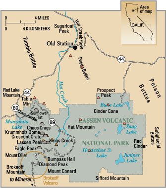
| DescriptionEruptions in the Lassen area in the last 50,000 years-map.jpg |
English: Map — Eruptions in the Lassen area in the last 50,000 years. |
||||
| Source | PD USGS image from http://pubs.usgs.gov/fs/2000/fs022-00/ | ||||
| Author |
|
Captions
The Map
Items portrayed in this file
depicts
File history
Click on a date/time to view the file as it appeared at that time.
| Date/Time | Thumbnail | Dimensions | User | Comment | |
|---|---|---|---|---|---|
| current | 01:44, 25 September 2006 | | 335 × 378 (34 KB) | Mav | PD USGS image from http://pubs.usgs.gov/fs/2000/fs022-00/ {{PD-USGov-USGS}} Category:Lassen Volcanic National Park |
File usage
The following pages on the English Wikipedia use this file (pages on other projects are not listed):
Global file usage
The following other wikis use this file:
- Usage on bn.wikipedia.org
- Usage on fr.wikipedia.org
- Usage on it.wikipedia.org
Metadata
This file contains additional information, probably added from the digital camera or scanner used to create or digitize it.
If the file has been modified from its original state, some details may not fully reflect the modified file.
| _error | 0 |
|---|