File:Distington_(Joint)_station,_with_train_1951_(geograph_5325623).jpg
From Wikipedia, the free encyclopedia
Size of this preview: 800 × 484 pixels. Other resolutions: 320 × 193 pixels | 640 × 387 pixels | 1,024 × 619 pixels | 1,280 × 774 pixels | 2,399 × 1,450 pixels.
Original file (2,399 × 1,450 pixels, file size: 1.74 MB, MIME type: image/jpeg)
| This is a file from the Wikimedia Commons. Information from its description page there is shown below. Commons is a freely licensed media file repository. You can help. |
Summary
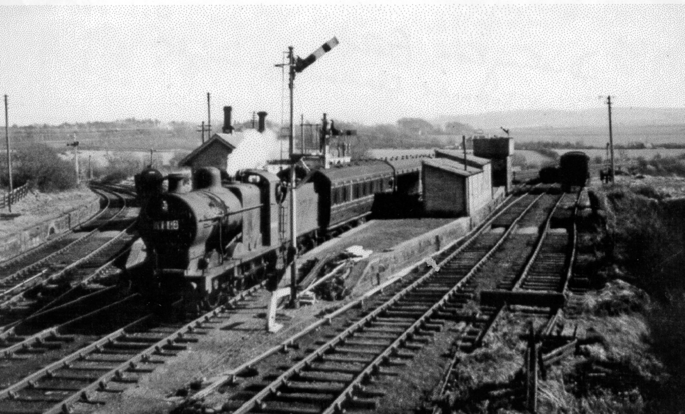
| DescriptionDistington (Joint) station, with train 1951 (geograph 5325623).jpg |
English: Distington (Joint) station, with train 1951 View SW, towards Cleator Moor (Cleator & Workington Junction Railway, with excursion train returning to Carlisle from Egremont headed by LMS 4F 0-6-0 No. 44461 (built 5/28, withdrawn 9/64). The line to the left is to Rowrah and Kelton Fell. |
| Date | |
| Source | From geograph.org.uk |
| Author | Walter Dendy, deceased |
| Permission (Reusing this file) |
Creative Commons Attribution Share-alike license 2.0 |
| Attribution (required by the license) InfoField | Walter Dendy, deceased / Distington (Joint) station, with train 1951 / |
InfoField | Walter Dendy, deceased / Distington (Joint) station, with train 1951 |
| Camera location | 54° 36′ 06.58″ N, 3° 31′ 54.14″ W | View this and other nearby images on: OpenStreetMap |
|---|
| Object location | 54° 36′ 07″ N, 3° 31′ 54″ W | View this and other nearby images on: OpenStreetMap |
|---|
Licensing

|
This image was taken from the Geograph project collection. See this photograph's page on the Geograph website for the photographer's contact details. The copyright on this image is owned by Walter Dendy, deceased and is licensed for reuse under the Creative Commons Attribution-ShareAlike 2.0 license.
|
This file is licensed under the Creative Commons Attribution-Share Alike 2.0 Generic license.
Attribution: Walter Dendy, deceased
- You are free:
- to share – to copy, distribute and transmit the work
- to remix – to adapt the work
- Under the following conditions:
- attribution – You must give appropriate credit, provide a link to the license, and indicate if changes were made. You may do so in any reasonable manner, but not in any way that suggests the licensor endorses you or your use.
- share alike – If you remix, transform, or build upon the material, you must distribute your contributions under the same or compatible license as the original.
Captions
Add a one-line explanation of what this file represents
Items portrayed in this file
depicts
18 April 1951
54°36'6.577"N, 3°31'54.138"W
54°36'6.73"N, 3°31'53.76"W
image/jpeg
File history
Click on a date/time to view the file as it appeared at that time.
| Date/Time | Thumbnail | Dimensions | User | Comment | |
|---|---|---|---|---|---|
| current | 09:01, 30 July 2017 | | 2,399 × 1,450 (1.74 MB) | Das48 | Transferred from geograph.co.uk using [https://tools.wmflabs.org/geograph2commons/ geograph2commons] |
File usage
The following pages on the English Wikipedia use this file (pages on other projects are not listed):
Global file usage
The following other wikis use this file:
- Usage on www.wikidata.org
Metadata
This file contains additional information, probably added from the digital camera or scanner used to create or digitize it.
If the file has been modified from its original state, some details may not fully reflect the modified file.
| Width | 2,399 px |
|---|---|
| Height | 1,450 px |
| Bits per component |
|
| Pixel composition | RGB |
| Orientation | Normal |
| Number of components | 3 |
| Horizontal resolution | 400 dpi |
| Vertical resolution | 400 dpi |
| Software used | Adobe Photoshop Elements 12.0 Windows |
| File change date and time | 17:56, 27 March 2017 |
| Exif version | 2.21 |
| Color space | Uncalibrated |
| Unique ID of original document | 09D1307292AE96C945D9E11BD262A6BA |
| Date and time of digitizing | 18:48, 27 March 2017 |
| Date metadata was last modified | 18:56, 27 March 2017 |
_station,_with_train_1951_(geograph_5325623).jpg)