File:Digital-elevation-map-washington.gif
From Wikipedia, the free encyclopedia
Size of this preview: 800 × 539 pixels. Other resolutions: 320 × 216 pixels | 640 × 431 pixels | 980 × 660 pixels.
Original file (980 × 660 pixels, file size: 409 KB, MIME type: image/gif)
| This is a file from the Wikimedia Commons. Information from its description page there is shown below. Commons is a freely licensed media file repository. You can help. |
Summary
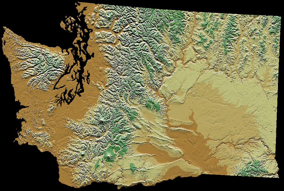
| DescriptionDigital-elevation-map-washington.gif |
English: Digital Elevation map of Washington state. |
| Date | 22 January 2005 (original upload date) |
| Source |
Media:SOURCE: http://wwwflag.wr.usgs.gov/USGSFlag/Data/maps/
|
| Author |
USGS |
| Other versions | Derivative works of this file: Lake Lewis Basin.jpg |
Licensing
| Public domainPublic domainfalsefalse |
This image is in the public domain in the United States because it only contains materials that originally came from the United States Geological Survey, an agency of the United States Department of the Interior. For more information, see the official USGS copyright policy.
Bahasa Indonesia ∙ català ∙ čeština ∙ Deutsch ∙ eesti ∙ English ∙ español ∙ français ∙ galego ∙ italiano ∙ Nederlands ∙ português ∙ polski ∙ sicilianu ∙ suomi ∙ Tiếng Việt ∙ Türkçe ∙ български ∙ македонски ∙ русский ∙ മലയാളം ∙ 한국어 ∙ 日本語 ∙ 中文 ∙ 中文(简体) ∙ 中文(繁體) ∙ العربية ∙ فارسی ∙ +/− |
Original upload log
The original description page was here. All following user names refer to en.wikipedia.
Upload date | User | Bytes | Dimensions | Comment
- 2008-03-30 01:10 (UTC) | Koavf | 418509 (bytes) | 980×660 | Deleted blackspace
- 2005-01-22 00:28 (UTC) | Jengod | 425546 (bytes) | 1335×1032 | {{PD-USGov-Interior-USGS}} SOURCE: http://wwwflag.wr.usgs.gov/USGSFlag/Data/maps/ [[Category:Washington maps]]
Captions
Add a one-line explanation of what this file represents
Items portrayed in this file
depicts
22 January 2005
File history
Click on a date/time to view the file as it appeared at that time.
| Date/Time | Thumbnail | Dimensions | User | Comment | |
|---|---|---|---|---|---|
| current | 19:26, 2 October 2011 | | 980 × 660 (409 KB) | SreeBot | (Original text) : Deleted blackspace |
| 19:25, 2 October 2011 |  | 1,335 × 1,032 (416 KB) | SreeBot | (Original text) : {{PD-USGov-Interior-USGS}} SOURCE: http://wwwflag.wr.usgs.gov/USGSFlag/Data/maps/ Category:Washington maps |
File usage
The following pages on the English Wikipedia use this file (pages on other projects are not listed):
Global file usage
The following other wikis use this file:
- Usage on ro.wikipedia.org