File:Craigieburn_1_aerial.jpg
From Wikipedia, the free encyclopedia
Size of this preview: 800 × 212 pixels. Other resolutions: 320 × 85 pixels | 640 × 169 pixels | 2,265 × 599 pixels.
Original file (2,265 × 599 pixels, file size: 1.39 MB, MIME type: image/jpeg)
| This is a file from the Wikimedia Commons. Information from its description page there is shown below. Commons is a freely licensed media file repository. You can help. |
Summary
| DescriptionCraigieburn 1 aerial.jpg |
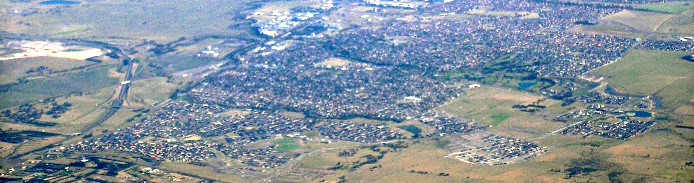
English: Craigiburn Victoria from north west, Hume highway is on the left, and curves off into the Craigieburn bypass. The Crigieburn Public golf course is prominent in the right of centre, it is on the banks of the Aitken Creek. The reserve Bank note printing factory, in Craigieburn, is the bunch of white buildings on the top, left of the midline |
| Date | |
| Source | Own work |
| Author | Graeme Bartlett |
Licensing
I, the copyright holder of this work, hereby publish it under the following license:
This file is licensed under the Creative Commons Attribution-Share Alike 3.0 Unported license.
- You are free:
- to share – to copy, distribute and transmit the work
- to remix – to adapt the work
- Under the following conditions:
- attribution – You must give appropriate credit, provide a link to the license, and indicate if changes were made. You may do so in any reasonable manner, but not in any way that suggests the licensor endorses you or your use.
- share alike – If you remix, transform, or build upon the material, you must distribute your contributions under the same or compatible license as the original.
Captions
Add a one-line explanation of what this file represents
Items portrayed in this file
depicts
12 November 2009
image/jpeg
7ce008825be9ff6c0f8c7ebcafbb5018979e2248
1,461,822 byte
599 pixel
2,265 pixel
File history
Click on a date/time to view the file as it appeared at that time.
| Date/Time | Thumbnail | Dimensions | User | Comment | |
|---|---|---|---|---|---|
| current | 02:56, 28 November 2009 | 2,265 × 599 (1.39 MB) | Graeme Bartlett | {{Information |Description={{en|1=Craigiburn Victoria from north west, Hume highway is on the left, and curves off into the Craigieburn bypass. The Crigieburn Public golf course is prominent in the right of centre, it is on the banks of the Aitken Creek. |
File usage
The following pages on the English Wikipedia use this file (pages on other projects are not listed):
Global file usage
The following other wikis use this file:
- Usage on gd.wikipedia.org
Metadata
This file contains additional information, probably added from the digital camera or scanner used to create or digitize it.
If the file has been modified from its original state, some details may not fully reflect the modified file.
| _error | 0 |
|---|
Retrieved from "https://en.wikipedia.org/wiki/File:Craigieburn_1_aerial.jpg"