File:City_of_London_Ogilby_and_Morgan's_Map_of_1677.jpg
From Wikipedia, the free encyclopedia
Size of this preview: 800 × 473 pixels. Other resolutions: 320 × 189 pixels | 640 × 379 pixels | 1,024 × 606 pixels | 1,280 × 757 pixels | 2,560 × 1,514 pixels | 4,000 × 2,366 pixels.
Original file (4,000 × 2,366 pixels, file size: 4.12 MB, MIME type: image/jpeg)
| This is a file from the Wikimedia Commons. Information from its description page there is shown below. Commons is a freely licensed media file repository. You can help. |
Summary
| DescriptionCity of London Ogilby and Morgan's Map of 1677.jpg |
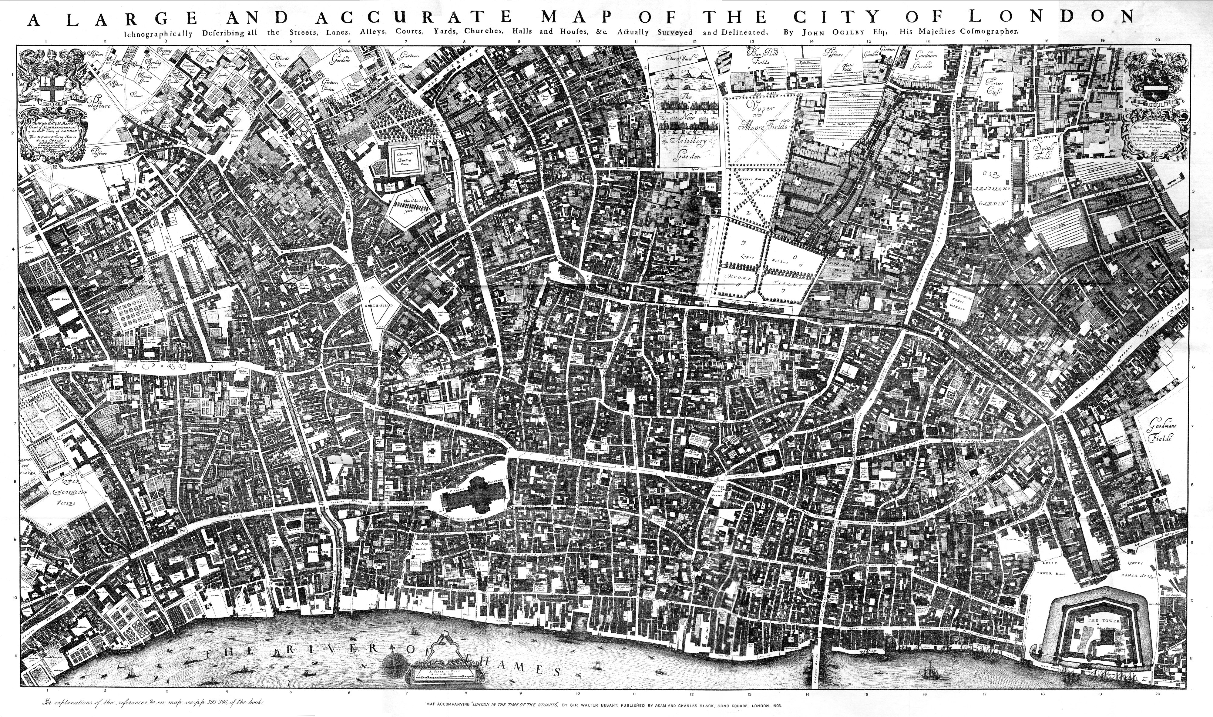
English: The original of this map is 8 feet 5 inches by 4 feet 7 inches, in 20 sheets. In 1894 the British Museum granted permission to the London and Middlesex Archaeological Society to make a reduced copy, of which the original of this scan is a copy. The L&M Society copy apparently did not match the dissected sheets perfectly, and the misjoins can be seen in places in this reproduction. |
| Date | |
| Source | Scanned copy of reproduction in "Maps of Old London" (1908) of Ogilby & Morgan's Map of London. |
| Author | Ogilby and Morgan |
Licensing
|
This is a faithful photographic reproduction of a two-dimensional, public domain work of art. The work of art itself is in the public domain for the following reason:
The official position taken by the Wikimedia Foundation is that "faithful reproductions of two-dimensional public domain works of art are public domain".
This photographic reproduction is therefore also considered to be in the public domain in the United States. In other jurisdictions, re-use of this content may be restricted; see Reuse of PD-Art photographs for details. | |||||
Captions
1894 facsimile of Ogilby and Morgan map of London 1677
Items portrayed in this file
depicts
1677
image/jpeg
6e408774c43f58ca86e4e395c75862b40ae83e22
4,317,749 byte
2,366 pixel
4,000 pixel
File history
Click on a date/time to view the file as it appeared at that time.
| Date/Time | Thumbnail | Dimensions | User | Comment | |
|---|---|---|---|---|---|
| current | 17:16, 16 August 2009 | | 4,000 × 2,366 (4.12 MB) | MikeCalder | {{Information |Description={{en|1=The original of this map is 8 feet 5 inches by 4 feet 7 inches, in 20 sheets. In 1894 the British Museum granted permission to the London and Middlesex Archaeological Society to make a reduced copy, of which the original |
File usage
The following pages on the English Wikipedia use this file (pages on other projects are not listed):
Global file usage
The following other wikis use this file:
- Usage on es.wikipedia.org
- Usage on hy.wikipedia.org
- Usage on ro.wikipedia.org
- Usage on ru.wikipedia.org
- Usage on uk.wikipedia.org
- Usage on www.wikidata.org
Metadata
This file contains additional information, probably added from the digital camera or scanner used to create or digitize it.
If the file has been modified from its original state, some details may not fully reflect the modified file.
| _error | 0 |
|---|