File:Calixa-Lavallée_Quebec_location_diagram.PNG
From Wikipedia, the free encyclopedia
No higher resolution available.
Calixa-Lavallée_Quebec_location_diagram.PNG (370 × 385 pixels, file size: 90 KB, MIME type: image/png)
| This is a file from the Wikimedia Commons. Information from its description page there is shown below. Commons is a freely licensed media file repository. You can help. |
Summary
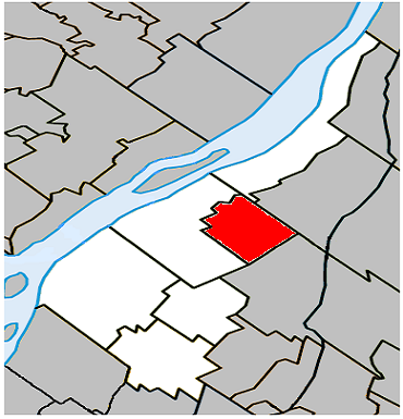
| DescriptionCalixa-Lavallée Quebec location diagram.PNG |
English: Location of Calixa-Lavallée, Quebec within Lajemmerais Regional County Municipality. |
| Date | |
| Source | Own work |
| Author | Gordalmighty |
Licensing
| Public domainPublic domainfalsefalse |
| I, the copyright holder of this work, release this work into the public domain. This applies worldwide. In some countries this may not be legally possible; if so: I grant anyone the right to use this work for any purpose, without any conditions, unless such conditions are required by law. |
Captions
Add a one-line explanation of what this file represents
Items portrayed in this file
depicts
some value
27 April 2009
image/png
66dd6207c39ae87c258e0ce566091b2b40c0dae8
92,303 byte
385 pixel
370 pixel
File history
Click on a date/time to view the file as it appeared at that time.
| Date/Time | Thumbnail | Dimensions | User | Comment | |
|---|---|---|---|---|---|
| current | 20:52, 27 April 2009 | | 370 × 385 (90 KB) | Gordalmighty | {{Information |Description={{en|1=Location of Calixa-Lavallée, Quebec within Lajemmerais Regional County Municipality.}} |Source=Own work by uploader |Author=Gordalmighty |Date=2009-04-27 |Permission= |other_versions= }} <!--{{Imag |
File usage
The following pages on the English Wikipedia use this file (pages on other projects are not listed):
Global file usage
The following other wikis use this file:
- Usage on ar.wikipedia.org
- Usage on es.wikipedia.org
- Usage on fa.wikipedia.org
- Usage on www.wikidata.org