File:Burkina_Faso_relief_location_map.jpg
From Wikipedia, the free encyclopedia
Size of this preview: 800 × 589 pixels. Other resolutions: 320 × 236 pixels | 640 × 471 pixels | 900 × 663 pixels.
Original file (900 × 663 pixels, file size: 527 KB, MIME type: image/jpeg)
| This is a file from the Wikimedia Commons. Information from its description page there is shown below. Commons is a freely licensed media file repository. You can help. |
Summary
| DescriptionBurkina Faso relief location map.jpg |
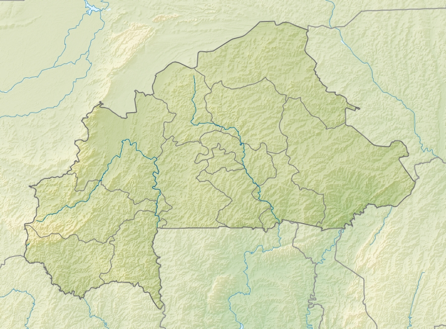
English: Location map of Burkina Faso Equirectangular projection. Strechted by 102%. Geographic limits of the map:
  * N: 15.5° N
  * S: 9° N
  * W: 6° W
  * E: 3° E
Made with Natural Earth. Free vector and raster map data @ naturalearthdata.com. |
| Date | |
| Source | Own work |
| Author | Uwe Dedering |
| Other versions |
|

Licensing
I, the copyright holder of this work, hereby publish it under the following licenses:
This file is licensed under the Creative Commons Attribution-Share Alike 3.0 Unported license.
- You are free:
- to share – to copy, distribute and transmit the work
- to remix – to adapt the work
- Under the following conditions:
- attribution – You must give appropriate credit, provide a link to the license, and indicate if changes were made. You may do so in any reasonable manner, but not in any way that suggests the licensor endorses you or your use.
- share alike – If you remix, transform, or build upon the material, you must distribute your contributions under the same or compatible license as the original.

|
Permission is granted to copy, distribute and/or modify this document under the terms of the GNU Free Documentation License, Version 1.2 or any later version published by the Free Software Foundation; with no Invariant Sections, no Front-Cover Texts, and no Back-Cover Texts. A copy of the license is included in the section entitled GNU Free Documentation License.http://www.gnu.org/copyleft/fdl.htmlGFDLGNU Free Documentation Licensetruetrue |
You may select the license of your choice.
Captions
Add a one-line explanation of what this file represents
Carte de Ramessoum
24 April 2010
image/jpeg
dd186905f399711ffb8e765f7958f9ac6c76d2f0
539,892 byte
663 pixel
900 pixel
File history
Click on a date/time to view the file as it appeared at that time.
| Date/Time | Thumbnail | Dimensions | User | Comment | |
|---|---|---|---|---|---|
| current | 11:30, 24 April 2010 | | 900 × 663 (527 KB) | Uwe Dedering | {{Information |Description={{en|1=English: Location map of Burkina Faso Equirectangular projection. Strechted by 102%. Geographic limits of the map: * N: 15.5° N * S: 9° N * W: 6° W * E: 3° E Made with Natural Earth. Free vector and rast |
File usage
The following pages on the English Wikipedia use this file (pages on other projects are not listed):
- 1987 Burkina Faso coup d'état
- Ancient Ferrous Metallurgy Sites of Burkina Faso
- Arli National Park
- Bagre Dam
- Bontioli Reserve
- Burkina Faso hostage rescue
- Deux Balés National Park
- Foulgo, Salogo
- Grand Mosque of Bobo-Dioulasso
- Kantchari
- Kirikongo
- Kissi, Burkina Faso
- Lake Bam
- Lake Dem
- Lake Higa
- Lake Kompienga
- Lake Tengrela
- Mare d'Oursi
- May 2022 Madjoari massacre
- Mount Tenakourou
- Ouagadougou
- Oumarou Kanazoé Dam
- Ruins of Loropéni
- Module:Location map/data/Burkina Faso
- Module:Location map/data/Burkina Faso/doc
Global file usage
The following other wikis use this file:
- Usage on als.wikipedia.org
- Usage on ast.wikipedia.org
- Usage on az.wikipedia.org
- Usage on bar.wikipedia.org
- Usage on ba.wikipedia.org
- Usage on be.wikipedia.org
- Usage on bg.wikipedia.org
- Usage on bn.wikipedia.org
- Usage on bs.wikipedia.org
- Usage on ca.wikipedia.org
- Usage on ceb.wikipedia.org
- Usage on ce.wikipedia.org
- Usage on ckb.wikipedia.org
- Usage on cs.wikipedia.org
- Usage on da.wikipedia.org
- Usage on de.wikipedia.org
- Burkina Faso
- Obervolta
- Tena Kourou
- Cascades de Karfiguéla
- Mare d’Oursi
- Mare aux Hippopotames
- Tengrélasee
- Bamsee
- Demsee
- Vorlage:Positionskarte Burkina Faso
- Kompienga-Stausee
- Pic de Nahouri
- Bagré-Stausee
- Ziga-Stausee
- Wikipedia:Kartenwerkstatt/Positionskarten/Afrika
- Benutzer:Uwe Dedering
- Benutzer:Uwe Dedering/Länderliste
- Goldtagebau Essakane
- Usage on de.wikivoyage.org
View more global usage of this file.
Metadata
This file contains additional information, probably added from the digital camera or scanner used to create or digitize it.
If the file has been modified from its original state, some details may not fully reflect the modified file.
| _error | 0 |
|---|